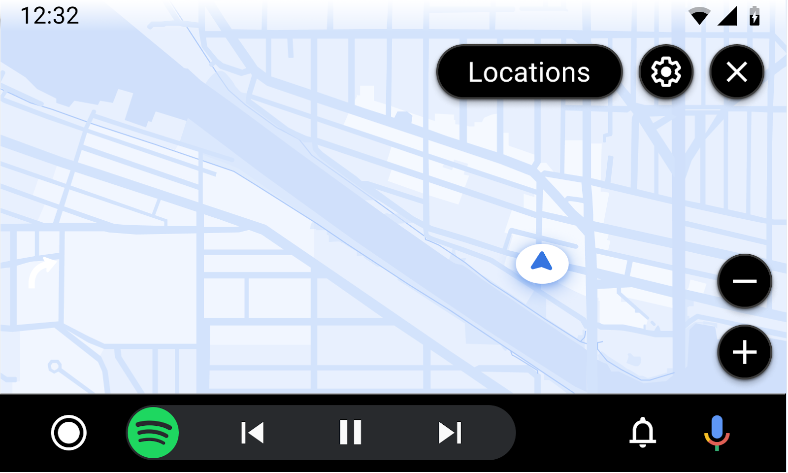
导航模板会显示底图和可选的路线信息。
当用户驾车时,如果不显示基于文本的精细导航路线,应用可以显示实时更新的全屏地图。在有效导航期间,应用可以显示包含车道转换和 Surface 详细信息的可选卡片,以及导航提醒。
此模板可嵌入标签页模板中,以提供标签页导航。
包含:
仪表板中的地图显示
在导航期间,应用可以使用 Navigation 模板在仪表板中显示地图。仪表板是指位于方向盘后面的仪表板区域。
集群中的地图应具有以下特点:
- 独立渲染,但可以根据需要复制主显示屏。
- 非交互式。移除按钮等交互元素。
- 深色主题。强烈建议绘制深色主题版仪表板地图,以减少可能导致驾驶员注意力分散的情况。
仪表板中应用的地图仅在特定时间显示,具体取决于导航状态、车辆 OEM 偏好设置(在 AAOS 中)以及主显示屏上显示的内容(在 AAP 中)。
如需查看涉及集群的用户体验流程示例,请参阅在集群中查看地图。
仪表板和中央屏幕示例
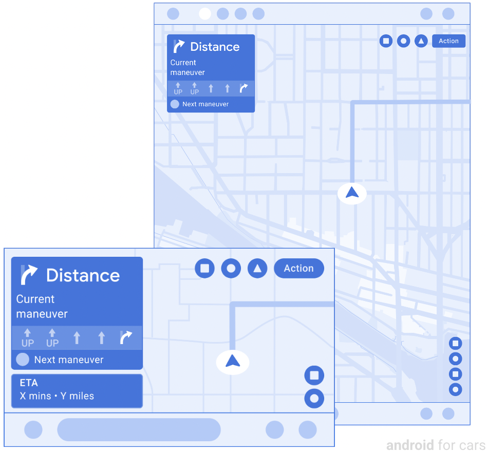
路由卡片详情
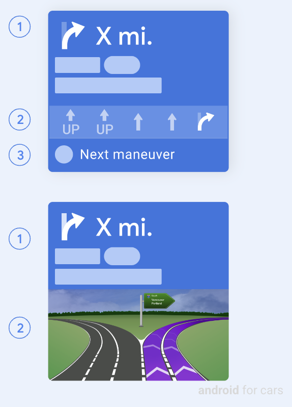
当路由卡片处于路由状态(而非消息状态)时,它会显示以下信息:
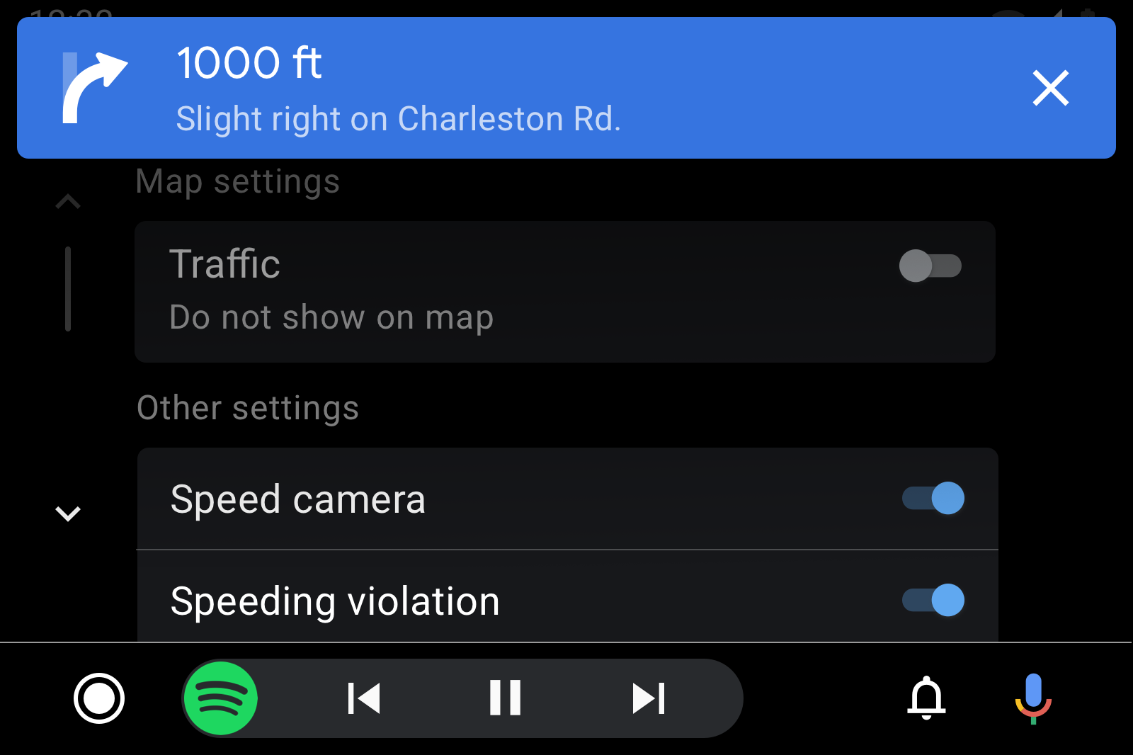
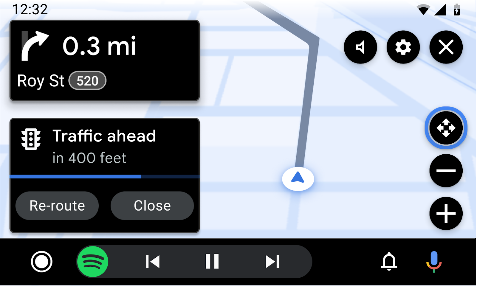
- 当前步骤:包括图标(通常是方向箭头)、距离和提示文本(可能包括路线标记等图片跨度)
- 车道引导(可选):显示为简单的车道辅助图片或较大的路口图片(大小可灵活调整,高度上限为 200dp)
- 后续步骤(可选):包含图标和提示,只能显示在不包含交叉路口图片的路线卡底部
在路线规划状态下,另一种方法是让路线规划卡显示旋转图标动画(此处未显示),以指示加载、计算或重新路线规划等瞬时状态。
在某些情况下,路线信息可能会改为显示在浮动导航栏中,如在驾车时添加经停点中所示。
路由卡片的消息状态
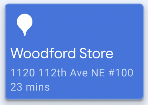
当路线卡片处于消息状态时,它会显示消息,而不是路线指示。该消息可用于传达到达目的地或路线故障等情况。
在消息状态下,转送卡片可以包含:
- 一条不为空的路线相关消息,长度不超过 2 行
- 图片或图标(可选)
导航通知:精细导航 (TBT) 和常规导航
TBT 通知:当应用提供基于文本的 TBT 路线时,还必须触发 TBT 通知。 这些通知用于在导航模板之外显示精细导航路线。应用可以自定义 TBT 通知背景颜色,以提高可见度。
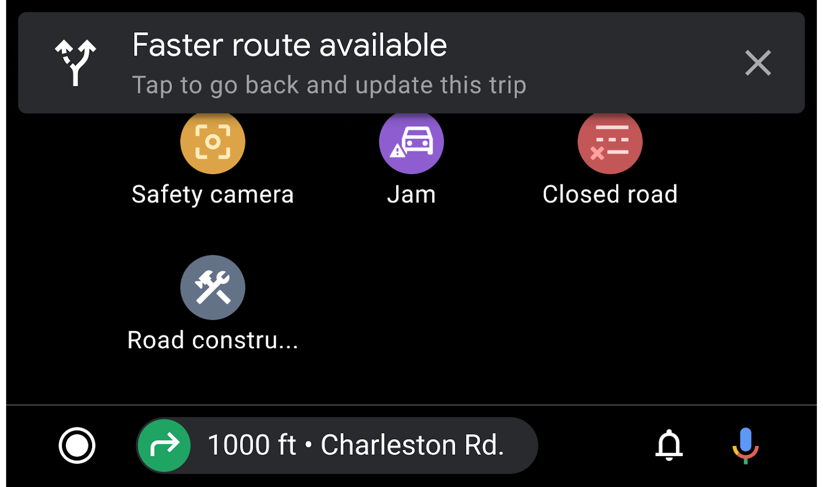
常规通知:如需传达与导航相关的其他消息(例如路线设置的更改),导航应用还可以发送常规(非 TBT)通知(如图所示)或使用导航提醒。即使显示路线卡片,这些信息也可能会显示。
导航提醒
导航提醒会以不会遮挡导航路线的格式提供简短的临时消息和可选操作。内容应简单明了,且与导航任务相关。例如,提醒可能描述交通状况的变化,或者询问司机是否可以接客。
每条提醒都包含以下内容:
您可以通过以下任一方式关闭提醒:
- 用户选择任意操作
X秒后超时(可配置)- 无需用户操作即可关闭应用
导航模板示例

导航模板用户体验要求
应用开发者:
| 必须 | 在路线卡片上显示至少 1 个转弯。 |
| 必须 | 在操作条上添加至少一个操作按钮,以启用用户流程。 |
| 必须 | 如果应用支持平移手势,请在地图操作栏中添加平移按钮。 |
| 应当 | 在仪表板中显示地图时使用深色主题。 |
| 应当 | 在地图操作栏中仅添加与地图互动相关的按钮(例如罗盘、重新居中或 3D 模式)。 |
| 应当 | 提供精细导航路线时,应添加用于结束导航的按钮。 |
| 应当 | 使用标准化符号或与国际符号或特定国家/地区符号一致的符号。 |
| 应当 | 仅使用交叉点图片显示与导航相关的内容,并使用图片填充整个卡片宽度。 |
| 应当 | 提供采用透明背景的车道图片,以便与路线卡背景融为一体。 |
| 应当 | 仅针对与当前导航任务相关且不会造成干扰的信息使用提醒。 |
| 可以 | 在车道下方显示简短的辅助文本(建议使用 Roboto 24),并降低非突出显示车道的对比度。 |
| 可以 | 当 2 个相邻的车道转换发生在短时间内时,在路线卡片上显示这 2 个车道转换。 |
| 可以 | 在路线卡片文本(当前步骤和后续步骤)中添加路线标记等图片。 |
| 可以 | 当用户驾车时,如果不显示基于文本的精细导航路线或处于自由驾驶模式,则显示完整地图。 |
| 可以 | 根据需要选择显示或隐藏路线卡片和行程预估组件。 |
| 可以 | 在地图上绘制与驾驶相关的详细信息和提醒,例如当前速度、限速和前方摄像头。 |
| 可以 | 自定义路线卡背景颜色,并在导航会话期间更改该颜色,以反映道路类型或其他相关条件。 |