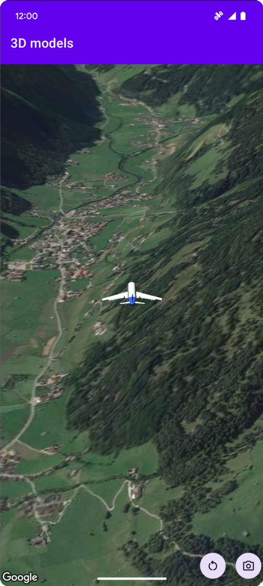
The following code sample demonstrates how to add a 3D model and position it
in 3D space by calling the
addModel
method. To use this code sample, follow the instructions in
Setup and Add a 3D map to your
app to set up your
Android Studio project with a basic 3D map. Then, add the following code to the
MainActivity.kt file:
// Add imports and define constants
import com.google.android.gms.maps3d.model.latLngAltitude
val PLANE_URL = "https://storage.googleapis.com/gmp-maps-demos/p3d-map/assets/Airplane.glb"
val PLANE_SCALE = 0.05

// Add to the onMap3DViewReady method, after the googleMap3D object has been initialized
googleMap3D.setCamera(
   camera {
        center = latLngAltitude {
            latitude = 47.133971
            longitude = 11.333161
            altitude = 2200.0
        }
        heading = 221.0
        tilt = 65.0
        range = 1_200.0
    }
)

googleMap3D.addModel(
    modelOptions {
        id = "plane_model"
        position = latLngAltitude {
            latitude = 47.133971
            longitude = 11.333161
            altitude = 2200.0
        }
        altitudeMode = AltitudeMode.ABSOLUTE
        orientation = orientation {
            heading = 41.5
            tilt = -90.0
            roll = 0.0
        }
        url = PLANE_URL
        scale = vector3D {
            x = PLANE_SCALE
            y = PLANE_SCALE
            z = PLANE_SCALE
        }
    }
)
Listen for 3D model click events
To listen for click events on a 3D model, call
setClickListener on the model object. The following example shows
how to set a click listener on a 3D model:
model.setClickListener {
    lifecycleScope.launch(Dispatchers.Main) {
        Toast.makeText(this@ModelsActivity, "Model clicked", Toast.LENGTH_SHORT).show()
    }
}
Note that the click handler does not run on the Main (or UI) thread. If you
want to make changes to the UI (such as showing a Toast message), you must
switch to the Main thread. For Kotlin, you can do this using
lifecycleScope.launch(Dispatchers.Main).