- 数据集可用时间
- 2000-01-01T00:00:00Z–2020-01-01T00:00:00Z
- 数据集生产者
- 国际地球科学信息网络中心下属的 NASA SEDAC
- 标签
说明
此数据集会根据普查文档中提供的信息,对估计人口为零的像素进行分类。
世界网格化人口第 4 版 (GPWv4) 修订版本 11 模拟了 2000 年、2005 年、2010 年、2015 年和 2020 年全球人口在 30 角秒(约 1 公里)网格单元中的分布情况。人口会根据普查和行政单位的人口比例分配到各个单元格。人口输入数据是根据 2005 年至 2014 年间进行的 2010 年人口普查结果,以最详细的空间分辨率收集的。对输入数据进行外推,以生成每个建模年份的人口估计值。
频段
波段
像素大小:927.67 米(所有波段)
| 名称 | 最小值 | 最大值 | 像素大小 | 说明 |
|---|---|---|---|---|
data_context |
0* | 207* | 927.67 米 | 根据人口普查文件中提供的信息,将估计人口为零的像素归类。 |
data_context 类表
| 值 | 颜色 | 说明 |
|---|---|---|
| 0 | #ffffff | 不适用 |
| 201 | #099506 | 公园或保护区 |
| 202 | #f04923 | 军事区、机场区或其他基础设施 |
| 203 | #e62440 | 未在人口普查中列出或报告 |
| 204 | #706984 | 无家庭 |
| 205 | #a5a5a5 | 无人居住 |
| 206 | #d4cc11 | 未网格化的人口 |
| 207 | #000000 | 缺少年龄或性别数据 |
使用条款
使用条款
引用
引用:
Center for International Earth Science Information Network - CIESIN - Columbia University. 2018 年。Gridded Population of the World, Version 4 (GPWv4): Data Context, Revision 11. Palisades, NY:NASA Socioeconomic Data and Applications Center (SEDAC)。doi:10.7927/H42Z13KG。访问日期:DAY MONTH YEAR。
DOI
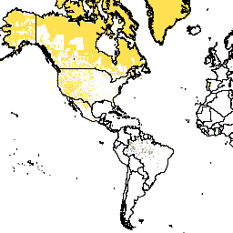
通过 Earth Engine 探索
代码编辑器 (JavaScript)
var dataset = ee.ImageCollection('CIESIN/GPWv411/GPW_Data_Context');
var raster = dataset.select('data_context');
var raster_vis = {
  'min': 200.0,
  'palette': [
    'ffffff',
    '099506',
    'f04923',
    'e62440',
    '706984',
    'a5a5a5',
    'ffe152',
    'd4cc11',
    '000000'
  ],
  'max': 207.0
};
Map.setCenter(-88.6, 26.4, 1);
Map.addLayer(raster, raster_vis, 'data_context');