- 数据集可用时间
- 2023-08-01T00:00:00Z–2025-09-16T21:03:09Z
- 数据集生产者
- NASA ASDC
- 标签
说明
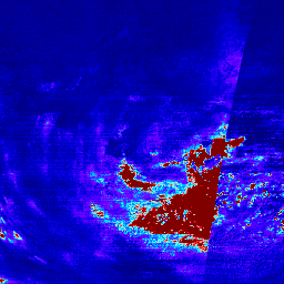
二氧化氮 Level 3 文件在覆盖 TEMPO 观测名义视场的规则网格上提供微量气体信息。3 级文件是通过合并构成 TEMPO 东西向扫描周期的所有 2 级文件中的信息得出的。栅格包含有关对流层、平流层和总二氧化氮垂直柱的信息、用于气团因子和平流层/对流层分离计算的辅助数据,以及检索质量标志。重新网格化算法使用面积加权方法。
- 应用了 QA 过滤条件的相应版本的数据集为 NASA/TEMPO/NO2_L3_QA
- 常规文档
频段
波段
像素大小:2226 米(所有波段)
| 名称 | 单位 | 像元大小 | 说明 |
|---|---|---|---|
weight |
平方公里 | 2226 米 | 2 级像素重叠区域的总和。表示每个网格单元的权重系数,用于指示具有有效数据的网格单元面积所占的比例。 |
vertical_column_troposphere |
分子/平方厘米 | 2226 米 | NO2 对流层垂直柱浓度 |
vertical_column_troposphere_uncertainty |
分子/平方厘米 | 2226 米 | NO2 对流层垂直柱不确定性 |
vertical_column_stratosphere |
分子/平方厘米 | 2226 米 | NO2 平流层垂直柱不确定性 |
main_data_quality_flag |
无量纲 | 2226 米 | 主要数据质量标志。提供数据质量的总体评估 |
num_vertical_column_troposphere_samples |
无量纲 | 2226 米 | 促成对流层垂直列的 3 级网格的 2 级像素值数量。 |
min_vertical_column_troposphere_sample |
分子/平方厘米 | 2226 米 | 对对流层垂直柱的 3 级网格有贡献的最小 2 级像素值。 |
max_vertical_column_troposphere_sample |
分子/平方厘米 | 2226 米 | 对流层垂直柱浓度对 3 级网格有贡献的最大 2 级像素值。 |
num_vertical_column_troposphere_uncertainty_samples |
无量纲 | 2226 米 | 促成对流层垂直柱不确定性的 2 级像素值数量,用于 3 级网格。 |
min_vertical_column_troposphere_uncertainty_sample |
分子/平方厘米 | 2226 米 | 促成对流层垂直柱不确定性的 Level 3 网格的最小 Level 2 像素值。 |
max_vertical_column_troposphere_uncertainty_sample |
分子/平方厘米 | 2226 米 | 促成对流层垂直柱不确定性的 Level 3 网格的最大 Level 2 像素值。 |
num_vertical_column_stratosphere_samples |
无量纲 | 2226 米 | 促成平流层垂直柱的 3 级网格的 2 级像素值数量。 |
min_vertical_column_stratosphere_sample |
分子/平方厘米 | 2226 米 | 促成平流层垂直列的最小 2 级像素值。 |
max_vertical_column_stratosphere_sample |
分子/平方厘米 | 2226 米 | 促成平流层垂直柱浓度 Level 3 网格的最大 Level 2 像素值。 |
num_vertical_column_total_samples |
无量纲 | 2226 米 | 对于整个垂直列,促成 3 级网格的 2 级像素值数量。 |
min_vertical_column_total_sample |
分子/平方厘米 | 2226 米 | 有助于形成总垂直列的最小 Level 2 像素值,以用于 Level 3 网格。 |
max_vertical_column_total_sample |
分子/平方厘米 | 2226 米 | 有助于形成总垂直列的第 3 级网格的最大第 2 级像素值。 |
solar_zenith_angle |
度 | 2226 米 | 像素中心的太阳天顶角 |
viewing_zenith_angle |
度 | 2226 米 | 像元中心处的观测天顶角 |
relative_azimuth_angle |
度 | 2226 米 | 像素中心处的相对方位角 |
vertical_column_total |
分子/平方厘米 | 2226 米 | NO2 垂直柱浓度 |
vertical_column_total_uncertainty |
分子/平方厘米 | 2226 米 | NO2 垂直柱不确定性 |
surface_pressure |
hPa | 2226 米 | 地表气压 |
terrain_height |
米 | 2226 米 | 地形高度 |
snow_ice_fraction |
无量纲 | 2226 米 | 被雪和/或冰覆盖的像元面积所占的比例 |
fitted_slant_column |
分子/平方厘米 | 2226 米 | 拟合的 NO2 斜柱 |
fitted_slant_column_uncertainty |
分子/平方厘米 | 2226 米 | NO2 拟合斜柱不确定性 |
albedo |
无量纲 | 2226 米 | 地表反照率 |
tropopause_pressure |
hPa | 2226 米 | 对流层顶气压 |
amf_total |
无量纲 | 2226 米 | NO2 空气质量因子 |
eff_cloud_fraction |
无量纲 | 2226 米 | 有效云量 |
amf_cloud_fraction |
无量纲 | 2226 米 | 用于计算 AMF 的云辐射分数 |
amf_cloud_pressure |
hPa | 2226 米 | 用于计算 AMF 的云压力 |
amf_troposphere |
无量纲 | 2226 米 | NO2 对流层空气质量因子 |
amf_stratosphere |
无量纲 | 2226 米 | NO2 平流层空气质量因子 |
main_data_quality_flag 类表
| 值 | 颜色 | 说明 |
|---|---|---|
| 0 | 无 | 好 |
| 1 | 无 | 可疑 |
| 2 | 无 | 较差 |
使用条款
使用条款
本数据集属于公共领域,使用和分发不受限制。如需更多信息,请参见 NASA 地球科学数据和信息政策。
引用
NASA/LARC/SD/ASDC。(日期不详)。TEMPO 网格化 NO2 对流层和平流层柱浓度 V03(临时)[数据集]。NASA Langley Atmospheric Science Data Center DAAC. 检索自 https://doi.org/10.5067/IS-40e/TEMPO/NO2_L3.003
DOI
通过 Earth Engine 探索
代码编辑器 (JavaScript)
var collection = ee.ImageCollection('NASA/TEMPO/NO2_L3')
    .filterDate('2024-04-01', '2024-04-05')

var visParams = {
  min: 0,
  max: 1.5e16,
  bands: ['vertical_column_troposphere'],
  palette: [
    '000080', '0000D9', '4000FF', '8000FF', '0080FF',
    '00D9FF', '80FFFF', 'FF8080', 'D90000', '800000'
  ]
};
Map.setCenter(-95.06, 42.02, 3)
Map.addLayer(collection, visParams, 'Tropospheric NO2')