Google uses AI technology to translate content into your preferred language. AI translations can contain errors.
United Nations Geospatial Data: BNDA_simplified
使用集合让一切井井有条
根据您的偏好保存内容并对其进行分类。
数据集可用时间
2023-02-11T00:00:00Z–2023-02-12T00:00:00Z
数据集生产者
联合国地理空间信息
Earth Engine 代码段
FeatureCollection
ee.FeatureCollection("UN/Geodata/BNDA_simplified/current")
open_in_new
FeatureView
ui.Map.FeatureViewLayer("UN/Geodata/BNDA_simplified/current_FeatureView")
标签
边界
国家/地区
基础设施边界
表格
说明
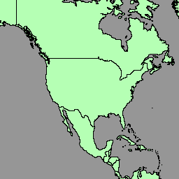
联合国地理空间数据(简称“地理数据”)是联合国提供的全球地理空间数据集。
联合国地理位置数据旨在帮助联合国准备地图资料,其中包含几何图形、属性和标签,以便根据联合国政策和实践充分描绘地理要素并为其命名,从而准备地图。
地理空间数据集包含国家/地区的多边形/面积 (BNDA_simplified)。如需了解详情,请参阅此页面 。
表格结构
表格结构
名称
类型
说明
admiso
STRING
相应区域管理员的 ISO-3166 alpha-3 代码。
geo_cd
INT
联合国 M49 地理区域代码
georeg
STRING
联合国 M49 地理区域
globalid
STRING
GlobalID
globalid_1
STRING
GlobalID_1
int_cd
STRING
联合国 M49 中间区域代码;如果未设置,则为 0
intreg
STRING
联合国 M49 中间区域;如果“int_cd”为 0,则为空
iso2cd
STRING
ISO-3166 alpha-2 代码
iso3cd
STRING
ISO-3166 alpha-3 代码
lbl_en
STRING
地图标签(英文)
lbl_fr
STRING
地图标签(法语)
m49_cd
STRING
联合国 M49 国家/地区代码
nam_en
STRING
名称(英文)
name_fr
STRING
名称(法语)
objectid
STRING
内部对象 ID 号
st_area_sh
双精度
几何图形的总面积
stscod
INT
主权状态代码:
0:南极洲
1:州
2:巴勒斯坦被占领土
3:非自治领土
4:地区
5:特别行政区或省/直辖市/自治区
99:未确定
sub_cd
INT
联合国 M49 子区域代码
subreg
STRING
联合国 M49 子区域
使用条款
使用条款
联合国地理空间数据是全球地理空间数据库,可供联合国秘书处和外部用户使用。该数据集可用于各种用途,但不得用于商业用途。联合国保留对数据的所有权,用户必须在自己的作品中注明联合国为数据来源。数据“按原样”提供,不提供任何保证,联合国对因使用数据而造成的任何损害或损失不承担任何责任。如需了解详情,请参阅此页面 。
注意 :
不受管理指令约束的数据用户(“外部用户”)只能将数据用于适合的用途,具体用途由地理空间信息部分在传输数据或授予数据访问权限时确定。数据的所有知识产权应始终归联合国所有。使用数据创建的产品的知识产权应归外部用户所有。除非外部用户更改数据或将数据与其他数据集组合,否则在外部用户使用数据创建的任何产品中,联合国应被确认为数据来源。如果您对将联合国列为数据源有任何疑问,请发送电子邮件至 geospatial@un.org 与我们联系。外部用户确认,任何访问和使用数据的权利均可撤消且不可转让。在任何情况下,不得将数据用于商业目的。
通过 Earth Engine 探索
重要提示: Earth Engine 是一个平台,可用于对地理空间数据集进行 PB 级科学分析和可视化,既可用于公益用途,也可供企业和政府用户使用。Earth Engine 可免费用于研究、教育和公益用途。如需开始使用,请注册以获取 Earth Engine 访问权限 。
代码编辑器 (JavaScript)
var dataset = ee . FeatureCollection ( 'UN/Geodata/BNDA_simplified/current' );
var styleParams = {
fillColor : 'b5ffb4' ,
color : '00909F' ,
width : 1.0 ,
};
dataset = dataset . style ( styleParams );
Map . centerObject ( dataset );
Map . addLayer ( dataset , {}, 'BNDA simplified' );
在代码编辑器中打开
[null,null,[],[],["The United Nations Geospatial Data (Geodata) dataset, provided by the United Nations Geospatial, is available from February 11-12, 2023. It includes global geospatial data with polygons/areas of countries (BNDA_simplified), geometry, attributes, and labels for map creation. The dataset, accessible via Google Earth Engine, has a defined table schema, includes ISO, M49 and GlobalID codes, and is free for research, education, and nonprofit use, but commercial use is prohibited. The UN must be credited as the data source.\n"]]