- 数据集可用时间
- 2000-02-11T00:00:00Z–2000-02-22T00:00:00Z
- 数据集生产者
- NASA / USGS / JPL-Caltech Google Earth Engine
- 标签
说明
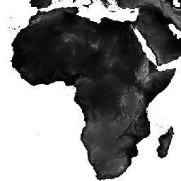
航天飞机雷达地形测绘任务 (SRTM,参见 Farr 等人,2007 年) 数字高程数据是一项国际研究工作,旨在获取近乎全球范围的数字高程模型。此 SRTM V3 产品 (SRTM Plus) 由 NASA JPL 提供,分辨率为 1 角秒(约 30 米)。
此数据集已使用开源数据(ASTER GDEM2、GMTED2010 和 NED)进行空白填充处理,而其他版本包含空白或已使用商业来源进行空白填充处理。如需详细了解不同版本,请参阅 SRTM 快速指南。
文档:
频段
波段
| 名称 | 单位 | 最小值 | 最大值 | 像元大小 | 说明 |
|---|---|---|---|---|---|
elevation |
米 | -10* | 6500* | 30 米 | 海拔 |
使用条款
使用条款
除非另有说明,否则 JPL 公共网站(以 jpl.nasa.gov 地址结尾的公共网站)上的图片和视频均可用于任何用途,无需事先获得许可。如需了解详情和例外情况,请访问 JPL 图片使用政策网站。
引用
引用:
Farr, T.G.、Rosen, P.A.、Caro, E.、Crippen, R.、Duren, R.、Hensley, S.、Kobrick, M.、Paller, M.、Rodriguez, E.、Roth, L.、Seal, D.、Shaffer, S.、Shimada, J.、Umland, J.、Werner, M.、Oskin, M.、Burbank, D. 和 Alsdorf, D.E.,2007 年,航天飞机雷达地形测绘任务:《地球物理学评论》,第 45 卷第 2 期,RG2004,网址:https://doi.org/10.1029/2005RG000183。
通过 Earth Engine 探索
代码编辑器 (JavaScript)
var dataset = ee.Image('USGS/SRTMGL1_003');
var elevation = dataset.select('elevation');
var slope = ee.Terrain.slope(elevation);
Map.setCenter(-112.8598, 36.2841, 10);
Map.addLayer(slope, {min: 0, max: 60}, 'slope');