- 目录所有者
- National Ecological Observatory Network
- 数据集可用时间
- 2013-01-01T00:00:00Z–2026-05-14T14:26:01Z
- 数据集生产者
- NEON
- 标签
说明
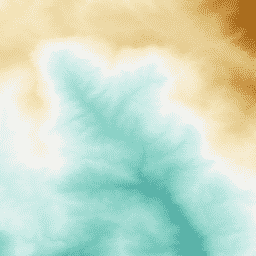
从 NEON LiDAR 数据派生的表面 (DSM) 和地形 (DTM) 数字模型。DSM:表面特征(包含植被和人造结构的地形信息)。DTM:裸露地面高程(不包含植被和人造结构的地形信息)。图像以高于平均海平面的米为单位给出,并以 1 米分辨率镶嵌到空间均匀的网格上。GEE 中的可用性可能无法完全代表 NEON 数据门户(链接如下)中的可用性。如需在 GEE 中添加其他地点和年份,请发送电子邮件至 listaopgee@battelleecology.org 提出请求。
如需了解详情,请参阅 NEON 数据产品 DP3.30024.001。
文档:高程 - LiDAR (DP3.30024.001) 快速入门指南
首先探索 Google Earth Engine 教程系列中的 AOP 数据简介
在 NEON AOP GEE 数据查看器应用 中浏览 AOP 数据并与之互动
频段
频段
像素大小:1 米(所有频段)
| 名称 | 单位 | 最小值 | 最大值 | 像素大小 | 说明 |
|---|---|---|---|---|---|
DTM |
米 | 0 | 3500 | 1 米 | 数字地形模型 |
DSM |
米 | 0 | 3500 | 1 米 | 数字表面模型 |
图像属性
图像属性
| 名称 | 类型 | 说明 |
|---|---|---|
| AOP_VISIT_NUMBER | INT | NEON 站点的唯一访问次数。 |
| 引用 | STRING | 数据引用。请参阅 NEON 数据政策和引用指南。 |
| 数字对象标识符 (DOI) | STRING | 数字对象标识符。已发布的 NEON 数据会分配有 DOI。 |
| FLIGHT_YEAR | INT | 数据收集年份。 |
| NEON_DOMAIN | STRING | NEON 生态气候域代码,范围为“D01”到“D20”。请参阅 NEON 现场站点和域。 |
| NEON_SITE | STRING | NEON 四位数站点代码。请参阅 NEON 现场站点。 |
| NEON_SITE_NAME | STRING | NEON 站点的全名。请参阅 NEON 现场站点。 |
| NEON_DATA_PROD_URL | STRING | NEON 数据产品网址。始终设置为:https://data.neonscience.org/data-products/DP3.30024.001。 |
| SENSOR_NAME | STRING | LiDAR 传感器的制造商和型号:“Optech Galaxy Prime”“Optech Gemini”“Riegl Q780”。 |
| SENSOR_SERIAL | STRING | LiDAR 传感器的序列号:“11SEN287”“12SEN311”“5060445”“220855”。 |
| PROVISIONAL_RELEASED | STRING | 数据是临时数据还是已发布数据。请参阅 https://www.neonscience.org/data-samples/data-management/data-revisions-releases。 |
| RELEASE_YEAR | INT | 如果数据已发布,则为 NEON 发布标记的年份。 |
使用条款
使用条款
NEON 收集的所有数据(与稀有、受威胁或濒危 (RTE) 物种相关的数据除外)均根据 知识共享 CC0 1.0“不保留任何权利”许可发布到公有领域。NEON 数据未应用版权;任何人均可出于商业或非商业目的复制、修改或分发数据,而无需征求许可。NEON 数据可能仍受其他法律或权利(例如隐私权)的约束,NEON 对数据不做任何保证,并免除所有责任。使用或引用 NEON 数据时,不应暗示 NEON 的认可。在大多数国家/地区,数据和事实不受版权保护。 通过将 NEON 数据放入公有领域,我们鼓励广泛使用,尤其是在科学分析和数据聚合方面。不过,请注意以下学术规范:使用 NEON 数据时应注意数据的限制,并使用与数据包关联的文档作为指南。 如需详细了解如何正确使用和引用 NEON 数据,以及发布使用 NEON 数据的研究的最佳实践,请参阅 NEON 数据指南和政策 。
引用
请参阅 NEON 引用指南
通过 Earth Engine 探索
代码编辑器 (JavaScript)
// Read in the NEON AOP DEM Image Collection
var dem = ee.ImageCollection(
  'projects/neon-prod-earthengine/assets/DEM/001');

// Display available images in the DEM/001 Image Collection
print('NEON DEM Images:')
print( dem.aggregate_array('system:index'))

// Specify the start and end dates and filter by date range
var startDate = ee.Date('2021-01-01');
var endDate = startDate.advance(1, 'year');
var dem2021 = dem.filterDate(startDate, endDate);

// Filter by NEON site name (see https://www.neonscience.org/field-sites/explore-field-sites)
var demSOAP_2021 = dem2021.filter('NEON_SITE == "SOAP"');

// Select the DTM and DSM bands in order to display each layer
var soapDTM = demSOAP_2021.select('DTM');
var soapDSM = demSOAP_2021.select('DSM');

// Define the color palette and visualization parameters
var palettes = require('users/gena/packages:palettes');
var dem_palette = palettes.colorbrewer.BrBG[9].reverse();
var demVis = {min: 700, max: 2300, palette: dem_palette};

// Add the DTM and DSM layers and center on the site
Map.addLayer(soapDTM, demVis, 'SOAP 2021 Digital Terrain Model (m)');
Map.addLayer(soapDSM, demVis, 'SOAP 2021 Digital Surface Model (m)');
Map.centerObject(soapDSM, 12);