Planet 提供每日卫星数据,帮助企业、政府、研究人员和记者了解现实世界并采取行动。通过挪威国际气候与森林倡议 (NICFI),用户现在可以访问 Planet 的高分辨率、可直接用于分析的全球热带地区镶嵌影像,以帮助减少和扭转热带森林的损失、应对气候变化、保护生物多样性,并促进非商业用途的可持续发展。
-
NICFI 卫星数据计划 - 热带森林监测底图 - 非洲
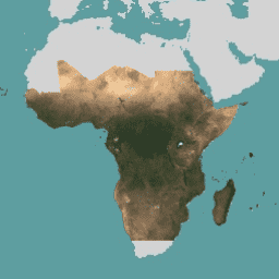
此图片集提供对热带地区的高分辨率卫星监测数据,主要目的是减少和扭转热带森林的损失,从而有助于应对气候变化、保护生物多样性、促进森林再生、恢复和增强,以及推动可持续发展,所有这些都… 基础地图 forest nicfi planet planet-nicfi publisher-dataset -
NICFI 卫星数据计划热带森林监测基本地图 - 美洲
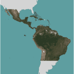
此图片集提供对热带地区的高分辨率卫星监测数据,主要目的是减少和扭转热带森林的损失,从而有助于应对气候变化、保护生物多样性、促进森林再生、恢复和增强,以及推动可持续发展,所有这些都… 基础地图 forest nicfi planet planet-nicfi publisher-dataset -
NICFI 卫星数据计划热带森林监测基本地图 - 亚洲
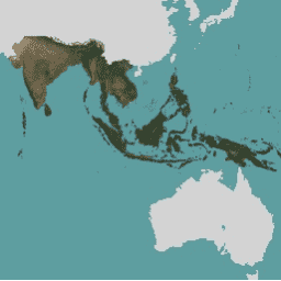
此图片集提供对热带地区的高分辨率卫星监测数据,主要目的是减少和扭转热带森林的损失,从而有助于应对气候变化、保护生物多样性、促进森林再生、恢复和增强,以及推动可持续发展,所有这些都… 基础地图 forest nicfi planet planet-nicfi publisher-dataset