-
全球 2020 年森林分类(IPCC 地上生物量第 1 级估计值),版本 1

此数据集提供 2020 年按状态/条件划分的全球森林类别,分辨率约为 30 米。这些数据有助于根据 2019 年修订版《2006 年 IPCC 国家温室气体清单指南》生成天然林地上干木质生物质密度 (AGBD) 的 1 级估计值。 地上 生物质 碳 分类 森林 森林生物质 -
全球地上和地下生物质碳密度地图

此数据集提供 2010 年地上和地下生物质碳密度的时态一致且协调的全球地图,空间分辨率为 300 米。地上生物量地图整合了森林、草地、农田和苔原生物量的特定地表覆盖遥感地图。输入映射是… 地上 生物质 碳 密度 森林 森林生物质 -
MERRA-2 M2T1NXAER:气溶胶诊断 V5.12.4

M2T1NXAER(或 tavg1_2d_aer_Nx)是现代研究和应用回顾性分析版本 2 (MERRA-2) 中的每小时时间平均二维数据集合。此集合包含同化气溶胶诊断数据,例如气溶胶组分(黑碳、沙尘、海盐、硫酸盐和有机碳)的柱质量密度、地表… 气溶胶 大气 碳 尘埃 质量 merra -
OpenLandMap 土壤有机碳含量

土壤有机碳含量(单位:x 5 g / kg),分辨率为 250 米,在 6 个标准深度(0、10、30、60、100 和 200 厘米)下,根据全球土壤点汇编数据预测得出。此处详细介绍了处理步骤。不包括南极洲。… carbon envirometrix opengeohub openlandmap soil -
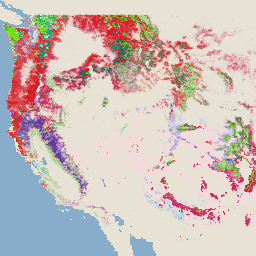
美国林务局 TreeMap v2016(美国本土)

此产品是 TreeMap 数据套件的一部分。该数据集提供了 2016 年美国大陆整个森林覆盖范围内的森林特征(包括活树和死树的数量、生物量和碳)的详细空间信息。TreeMap v2016 包含一张图片,即… 生物质 碳 气候变化 美国本土 森林 森林生物质 -
USFS TreeMap v2020
此产品是 TreeMap 数据套件的一部分。该数据集提供了 2020 年美国整个森林覆盖范围内的森林特征(包括活树和死树的数量、生物量和碳)的详细空间信息。TreeMap v2020 包含 22 个波段,分辨率为 30 x 30 米… 地上 生物质 碳 气候变化 美国本土 森林 -
USFS TreeMap v2022

此产品是 TreeMap 数据套件的一部分。该数据集提供了 2022 年美国整个森林覆盖范围内的森林特征(包括活树和死树的数量、生物量和碳)的详细空间信息。TreeMap v2022 包含 22 个波段的 30 x 30 米… 地上 生物质 碳 气候变化 美国本土 森林 -
WCMC 地上和地下生物质碳密度

此数据集表示 2010 年左右的地上和地下陆地碳储存量(每公顷 (ha) 的碳含量,以吨 (t) 为单位)。该数据集是通过合并最可靠的公开数据集,并将其与 2010 年的 ESA CCI 地表覆盖地图叠加而构建的(ESA,… 生物质 碳 森林生物质 wcmc -
WHRC 泛热带国家级碳储量数据集

热带国家/地区 500 米分辨率的地上活体木质生物量密度国家级地图。此数据集由实地测量数据、LiDAR 观测数据和中等分辨率成像光谱辐射计 (MODIS) 记录的图像组合而成。 地上 生物质 碳 森林生物质 地球物理 umd -
iSDAsoil 有机碳

0-20 厘米和 20-50 厘米土壤深度的有机碳,预测的平均值和标准差。像素值必须使用 exp(x/10)-1 进行反向转换。在茂密丛林地区(通常位于非洲中部),模型准确度较低,因此可能会出现条带状伪影(条纹),… 非洲 碳 ISDA 土壤
Datasets tagged carbon in Earth Engine
[null,null,[],[],[]]