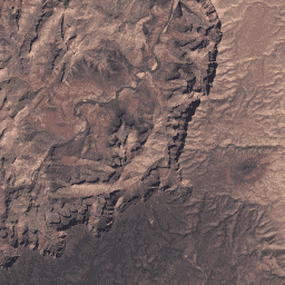
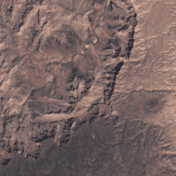
USGS Landsat 4 লেভেল 2, কালেকশন 2, টায়ার 1 এই ডেটাসেটে ল্যান্ডস্যাট টিএম সেন্সর দ্বারা উত্পাদিত ডেটা থেকে প্রাপ্ত বায়ুমণ্ডলীয়ভাবে সংশোধন করা পৃষ্ঠের প্রতিফলন এবং ভূমি পৃষ্ঠের তাপমাত্রা রয়েছে। এই চিত্রগুলিতে 4টি দৃশ্যমান এবং কাছাকাছি-ইনফ্রারেড (VNIR) ব্যান্ড এবং 2টি শর্ট-ওয়েভ ইনফ্রারেড (SWIR) ব্যান্ড রয়েছে যা অর্থোরেক্টিফায়েড পৃষ্ঠের প্রতিফলনের জন্য প্রক্রিয়া করা হয় এবং একটি তাপীয় ইনফ্রারেড … সিএফমাস্ক ক্লাউড এফমাস্ক গ্লোবাল ল্যান্ডস্যাট ল্যাএসআরসি USGS Landsat 4 লেভেল 2, কালেকশন 2, টায়ার 2 এই ডেটাসেটে ল্যান্ডস্যাট টিএম সেন্সর দ্বারা উত্পাদিত ডেটা থেকে প্রাপ্ত বায়ুমণ্ডলীয়ভাবে সংশোধন করা পৃষ্ঠের প্রতিফলন এবং ভূমি পৃষ্ঠের তাপমাত্রা রয়েছে। এই চিত্রগুলিতে 4টি দৃশ্যমান এবং কাছাকাছি-ইনফ্রারেড (VNIR) ব্যান্ড এবং 2টি শর্ট-ওয়েভ ইনফ্রারেড (SWIR) ব্যান্ড রয়েছে যা অর্থোরেক্টিফায়েড পৃষ্ঠের প্রতিফলনের জন্য প্রক্রিয়া করা হয় এবং একটি তাপীয় ইনফ্রারেড … সিএফমাস্ক ক্লাউড এফমাস্ক গ্লোবাল ল্যান্ডস্যাট ল্যাএসআরসি
Datasets tagged lt04 in Earth Engine
[null,null,[],[[["\u003cp\u003eThe datasets provide atmospherically corrected surface reflectance and land surface temperature data from the Landsat 4 TM sensor.\u003c/p\u003e\n"],["\u003cp\u003eData includes visible, near-infrared, short-wave infrared, and thermal infrared bands.\u003c/p\u003e\n"],["\u003cp\u003eBoth Tier 1 and Tier 2 datasets are available in Collection 2.\u003c/p\u003e\n"],["\u003cp\u003eImages are orthorectified for surface reflectance.\u003c/p\u003e\n"],["\u003cp\u003eCommon quality assessment tags include cfmask, cloud, fmask, and lasrc, indicating the global coverage and Landsat program source.\u003c/p\u003e\n"]]],["The datasets provide atmospherically corrected surface reflectance and land surface temperature from the Landsat TM sensor. Each contains imagery with four visible and near-infrared (VNIR) bands, two short-wave infrared (SWIR) bands, and one thermal infrared band. The data is orthorectified and available in two tiers, Collection 2, Tier 1 and Tier 2. They both use cloud masking techniques cfmask and fmask.\n"],null,["# Datasets tagged lt04 in Earth Engine\n\n-\n\n |----------------------------------------------------------------------------------------------------------------------------------------------------------------------------------------------------------------------------------------------------------------------------------------------------------------------------------------------|\n | [### USGS Landsat 4 Level 2, Collection 2, Tier 1](/earth-engine/datasets/catalog/LANDSAT_LT04_C02_T1_L2) |\n | This dataset contains atmospherically corrected surface reflectance and land surface temperature derived from the data produced by the Landsat TM sensor. These images contain 4 visible and near-infrared (VNIR) bands and 2 short-wave infrared (SWIR) bands processed to orthorectified surface reflectance, and one thermal infrared ... |\n | [cfmask](/earth-engine/datasets/tags/cfmask) [cloud](/earth-engine/datasets/tags/cloud) [fmask](/earth-engine/datasets/tags/fmask) [global](/earth-engine/datasets/tags/global) [landsat](/earth-engine/datasets/tags/landsat) [lasrc](/earth-engine/datasets/tags/lasrc) |\n\n-\n\n |----------------------------------------------------------------------------------------------------------------------------------------------------------------------------------------------------------------------------------------------------------------------------------------------------------------------------------------------|\n | [### USGS Landsat 4 Level 2, Collection 2, Tier 2](/earth-engine/datasets/catalog/LANDSAT_LT04_C02_T2_L2) |\n | This dataset contains atmospherically corrected surface reflectance and land surface temperature derived from the data produced by the Landsat TM sensor. These images contain 4 visible and near-infrared (VNIR) bands and 2 short-wave infrared (SWIR) bands processed to orthorectified surface reflectance, and one thermal infrared ... |\n | [cfmask](/earth-engine/datasets/tags/cfmask) [cloud](/earth-engine/datasets/tags/cloud) [fmask](/earth-engine/datasets/tags/fmask) [global](/earth-engine/datasets/tags/global) [landsat](/earth-engine/datasets/tags/landsat) [lasrc](/earth-engine/datasets/tags/lasrc) |"]]