ইউএসজিএস ল্যান্ডস্যাট ৫ লেভেল ২, কালেকশন ২, টিয়ার ১ 
এই ডেটাসেটে ল্যান্ডস্যাট টিএম সেন্সর দ্বারা উত্পাদিত ডেটা থেকে প্রাপ্ত বায়ুমণ্ডলীয়ভাবে সংশোধিত পৃষ্ঠের প্রতিফলন এবং ভূমি পৃষ্ঠের তাপমাত্রা রয়েছে। এই চিত্রগুলিতে 4টি দৃশ্যমান এবং কাছাকাছি-ইনফ্রারেড (VNIR) ব্যান্ড এবং 2টি শর্ট-ওয়েভ ইনফ্রারেড (SWIR) ব্যান্ড রয়েছে যা অর্থোরেক্টিফাইড পৃষ্ঠের প্রতিফলনে প্রক্রিয়াজাত করা হয়েছে, এবং একটি তাপীয় ইনফ্রারেড … cfmask ক্লাউড fmask গ্লোবাল ল্যান্ডস্যাট lasrc ইউএসজিএস ল্যান্ডস্যাট ৫ লেভেল ২, কালেকশন ২, টিয়ার ২ 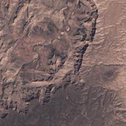
এই ডেটাসেটে ল্যান্ডস্যাট টিএম সেন্সর দ্বারা উত্পাদিত ডেটা থেকে প্রাপ্ত বায়ুমণ্ডলীয়ভাবে সংশোধিত পৃষ্ঠের প্রতিফলন এবং ভূমি পৃষ্ঠের তাপমাত্রা রয়েছে। এই চিত্রগুলিতে 4টি দৃশ্যমান এবং কাছাকাছি-ইনফ্রারেড (VNIR) ব্যান্ড এবং 2টি শর্ট-ওয়েভ ইনফ্রারেড (SWIR) ব্যান্ড রয়েছে যা অর্থোরেক্টিফাইড পৃষ্ঠের প্রতিফলনে প্রক্রিয়াজাত করা হয়েছে, এবং একটি তাপীয় ইনফ্রারেড … cfmask ক্লাউড fmask গ্লোবাল ল্যান্ডস্যাট lasrc
Datasets tagged lt05 in Earth Engine
[null,null,[],[],[]]