Page Summary
-
The Global Administrative Unit Layers (GAUL) dataset from FAO provides comprehensive information on administrative units for countries worldwide to help standardize spatial data.
-
Simplified 500m versions of the FAO GAUL dataset are available, providing data for country boundaries, first-level administrative units, and second-level administrative units.
-
The standard FAO GAUL dataset also offers global layers for country boundaries, first-level administrative units (like departments and provinces), and second-level administrative units (such as county and districts).
-
Both simplified and standard GAUL datasets are tagged with keywords like borders, countries, FAO, GAUL, infrastructure-boundaries, and table, among others specific to the administrative level.
-
FAO GAUL 500m Simplified: Global Administrative Unit Layers 2015, Country Boundaries
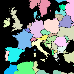
This version of GAUL dataset is simplified at 500m. The Global Administrative Unit Layers (GAUL) compiles and disseminates the best available information on administrative units for all the countries in the world, providing a contribution to the standardization of the spatial dataset representing administrative units. … borders countries fao gaul infrastructure-boundaries table -
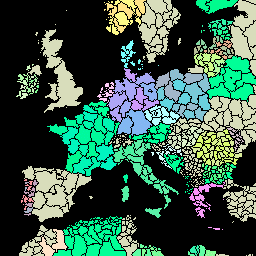
FAO GAUL 500m Simplified: Global Administrative Unit Layers 2015, First-Level Administrative Units

This version of GAUL dataset is simplified at 500m. The Global Administrative Unit Layers (GAUL) compiles and disseminates the best available information on administrative units for all the countries in the world, providing a contribution to the standardization of the spatial dataset representing administrative units. … borders departments fao gaul infrastructure-boundaries provinces -
FAO GAUL 500m Simplified: Global Administrative Unit Layers 2015, Second-Level Administrative Units
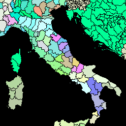
This version of GAUL dataset is simplified at 500m. The Global Administrative Unit Layers (GAUL) compiles and disseminates the best available information on administrative units for all the countries in the world, providing a contribution to the standardization of the spatial dataset representing administrative units. … borders county districts fao gaul infrastructure-boundaries -
FAO GAUL: Global Administrative Unit Layers 2015, Country Boundaries

The Global Administrative Unit Layers (GAUL) compiles and disseminates the best available information on administrative units for all the countries in the world, providing a contribution to the standardization of the spatial dataset representing administrative units. The GAUL always maintains global layers with a unified … borders countries fao gaul infrastructure-boundaries table -
FAO GAUL: Global Administrative Unit Layers 2015, First-Level Administrative Units
The Global Administrative Unit Layers (GAUL) compiles and disseminates the best available information on administrative units for all the countries in the world, providing a contribution to the standardization of the spatial dataset representing administrative units. The GAUL always maintains global layers with a unified … borders departments fao gaul infrastructure-boundaries provinces -
FAO GAUL: Global Administrative Unit Layers 2015, Second-Level Administrative Units

The Global Administrative Unit Layers (GAUL) compiles and disseminates the best available information on administrative units for all the countries in the world, providing a contribution to the standardization of the spatial dataset representing administrative units. The GAUL always maintains global layers with a unified … borders county districts fao gaul infrastructure-boundaries