-
哥白尼全球土地覆盖图层:CGLS-LC100 Collection 3

哥白尼全球土地服务 (CGLS) 被指定为土地服务的一个组件,用于运行多用途服务组件,该组件提供一系列生物地球物理产品,用于描述全球范围内陆地表面的状况和演变。动态土地覆盖地图,位于… copernicus eea esa eu landcover landuse-landcover -
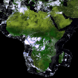
PROBA-V C1 冠层顶部每日合成 100 米

Proba-V 是一项卫星任务,旨在绘制土地覆盖和植被生长情况。它旨在为 SPOT-4 和 SPOT-5 任务中的 VGT 光学仪器提供连续性。该传感器在三个 VNIR(可见光和近红外)波段和一个 SWIR(短波… esa multispectral nir proba probav satellite-imagery -
PROBA-V C1 冠层顶部每日合成 333 米
Proba-V 是一项卫星任务,旨在绘制土地覆盖和植被生长情况。它旨在为 SPOT-4 和 SPOT-5 任务中的 VGT 光学仪器提供连续性。该传感器在三个 VNIR(可见光和近红外)波段和一个 SWIR(短波… esa multispectral nir proba probav satellite-imagery
Datasets tagged vito in Earth Engine
[null,null,[],[],[]]