Mit Sammlungen den Überblick behalten
Sie können Inhalte basierend auf Ihren Einstellungen speichern und kategorisieren.
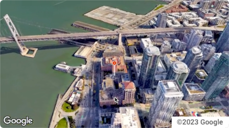
Die Aerial View API ist ein Dienst, mit dem Sie fotorealistische 3D-Videos aus der Vogelperspektive von jeder beliebigen Adresse in den USA erstellen und anzeigen können. Die Videos simulieren Aufnahmen von einer Drohne, die über dem Boden kreist.
Google hat bereits ein Dataset mit vorgerenderten Videos aus der Vogelperspektive für Sie erstellt. Sie umfassen große Gebäude und Sehenswürdigkeiten in den gesamten USA.
Wir fügen ständig weitere Luftaufnahmen hinzu. Sie können diese vorhandenen Videos einfach verwenden. Wenn es für eine Adresse noch kein Video gibt, können Sie ein neues Video von Google erstellen lassen.
Gründe für die Verwendung der Aerial View API
Hier sind einige Gründe, warum Sie die Aerial View API verwenden sollten.
Sie möchten 3D-Daten untersuchen, sind aber nicht mit der Verwendung von 3D-Kacheln oder mit der Arbeit mit einem Renderer vertraut.
Sie möchten Satellitenbilder nutzen und Gebäude anhand von Street View-Aufnahmen erkennen.
Sie haben darüber nachgedacht, einen Drohnenpiloten zu engagieren, um Ihr Objekt zu filmen.
Sie möchten innovative, hochmoderne Technologie nutzen.
Sie können Videos problemlos in Ihre Website einbetten.
Funktionen der Aerial View API
Hier finden Sie eine Liste einiger der Möglichkeiten, die die Aerial View API bietet.
Vogelperspektive eines Gebäudes mit Hervorhebung von Straßen, Parks oder Gewässern in der Nähe
Potenziellen Mietern oder Käufern einen Eindruck von einer Immobilie vermitteln
In einem Short zeigen, wo du dich gerade befindest
Sehenswürdigkeiten oder interessante Orte hervorheben, wenn Sie Nutzern bei der Urlaubsplanung helfen
Lieferfahrern oder Käufern helfen, Ihr Unternehmen zu finden
Funktionsweise der Aerial View API
Es gibt zwei Möglichkeiten, die Aerial View API zu verwenden.
Strategie
Begründung
Erstelltes Video aufrufen
Alle benötigten Luftaufnahmen wurden bereits von Google gerendert (vorgerenderter Datensatz von Google).
Neues Video generieren
Sie benötigen Luftaufnahmen, die nicht bereits von Google vorgerendert wurden.
Abgedeckte Gebiete
Die Aerial View API unterstützt nur Postadressen in den USA, für die Google 3D-Videos rendern kann.
Senden Sie eine US-Postanschrift oder videoId an den lookupVideoMetadata()-Endpunkt, um die Metadaten eines Luftbildvideos zurückzugeben.
Weitere Informationen findest du unter Metadaten eines Videos abrufen.
4
Vorhandenes Luftbildvideo abrufen
Senden Sie eine US-Postanschrift oder videoId an den lookupVideo()-Endpunkt, um ein vorgerendertes Luftbildvideo zurückzugeben.
Weitere Informationen finden Sie unter Generiertes Video abrufen.
5
Neues Luftbildvideo generieren
Senden Sie eine US-Postanschrift an den renderVideo()-Endpunkt, um die Generierung eines neuen Luftbildvideos für die angegebene Adresse anzufordern.
Weitere Informationen finden Sie unter Neues Video generieren.
[null,null,["Zuletzt aktualisiert: 2025-08-31 (UTC)."],[[["\u003cp\u003eThe Aerial View API lets you create and display photorealistic 3D aerial videos of US addresses, simulating drone footage.\u003c/p\u003e\n"],["\u003cp\u003eGoogle provides a pre-rendered video dataset for many locations, or you can request new videos to be generated.\u003c/p\u003e\n"],["\u003cp\u003eUse the API to enhance user experiences with interactive 3D aerial views for various applications, such as real estate, travel planning, and business listings.\u003c/p\u003e\n"],["\u003cp\u003eAccess and display videos through the API, but note that downloading or storing them locally is not permitted.\u003c/p\u003e\n"],["\u003cp\u003eThe API is limited to US addresses where 3D video rendering is supported by Google.\u003c/p\u003e\n"]]],[],null,["The Aerial View API is a service that lets you create and display\nphotorealistic 3D aerial videos of any physical address within the United\nStates. The videos simulate footage taken by a drone circling overhead.\n\nGoogle has already created a dataset of pre-rendered aerial view videos for you\nto use. They cover large buildings and landmarks throughout the United States.\nAnd we're adding more aerial view videos all the time. You can simply use these\nexisting videos or, if a video does not yet exist for an address, you can\nrequest that Google generate a new one for you.\n| **Note:** Google automatically pre-renders videos for addresses periodically, so some addresses will have no wait time.\n\nWhy use Aerial View API\n\nHere are some reasons why you might want to use Aerial View API.\n\n- You want to explore 3D data, but you're not comfortable using 3D Tiles, or with working with a renderer\n\n- You like the context of satellite imagery, and the ability to recognize a building facade from Street View\n\n- You've considered hiring a drone operator to film your property\n\n- You want to use cutting-edge, innovative technology\n\n- You're comfortable embedding video in your web site\n\nWhat you can do with Aerial View API\n\nHere's a list of some of the things you can do with Aerial View API.\n\n- Provide birds-eye awareness of a building by highlighting nearby roads, parks, or bodies of water\n\n- Give a prospective renter or home buyer a sense of what a property is like\n\n- Set the scene for a short-form video showing the viewer where you are\n\n- Highlight attractions or points-of-interest when helping users plan a vacation\n\n- Help delivery drivers or shoppers find your place of business\n\nHow the Aerial View API works\n\nThere are two approaches that you can take to use the Aerial View API.\n| **Tip:** Both of these approaches should begin with you checking whether the video exists using the [`lookupVideoMetadata`](/maps/documentation/aerial-view/lookup-video-metadata) endpoint.\n\n| Approach | Rationale |\n|--------------------------|--------------------------------------------------------------------------------------------------------------|\n| Lookup a generated video | All of the aerial imagery that you need has already been rendered by Google (Google's pre-rendered dataset). |\n| Generate a new video | You need aerial view imagery that hasn't already been pre-rendered by Google. |\n\nCoverage areas\n\nAerial View API only supports postal addresses in the United States where\nGoogle is able to render 3D videos.\n\nHow to use the Aerial View API\n\n|---|------------------------------------------------------|----------------------------------------------------------------------------------------------------------------------------------------------------------------------------------------------------------------------|\n| 1 | **Review the Google Maps Platform Terms of Service** | Note that you cannot download, store, or cache the aerial view videos. For more information, see the [Google Maps Platform Terms of Service](https://cloud.google.com/maps-platform/terms/). |\n| 2 | **Get set up** | Start with [Set up your Google Cloud project](/maps/documentation/aerial-view/cloud-setup) and complete the instructions that follow. |\n| 3 | **Retrieve an aerial view video's metadata** | Send a US postal address or `videoId` to the `lookupVideoMetadata()` endpoint to return an aerial view video's metadata. See [Retrieve a video's metadata.](/maps/documentation/aerial-view/lookup-video-metadata) |\n| 4 | **Fetch an existing aerial view video** | Send a US postal address or `videoId` to the `lookupVideo()` endpoint to return a pre-rendered aerial view video. See [Fetch a generated video.](/maps/documentation/aerial-view/lookup-video) |\n| 5 | **Generate a new aerial view video** | Send a US postal address to the `renderVideo()` endpoint to request the generation of a new aerial view video for the specified address. See [Generate a new video.](/maps/documentation/aerial-view/generate-video) |"]]