تستخدم واجهة برمجة التطبيقات Solar بيانات الأماكن لتحديد نوع المبنى، وتحدّد المباني استنادًا إلى صور الأقمار الصناعية. توضّح هذه الصفحة كيفية تحديد معلومات الطاقة الشمسية الخاصة بأي مبنى يتم عرضها في طلب buildingInsights.
أنواع المباني
تتيح Solar API استخدام المباني من النوع
premise. يشير هذا النوع إلى موقع جغرافي محدّد الاسم، ويكون عادةً مبنى أو مجموعة من المباني لها اسم مشترك.
لا تتوافق الخدمة مع أنواع أخرى، مثل
subpremise أو
المجمّعات، مثل المباني المنفصلة الواقعة في عقار واحد، ما لم يتم تسجيلها كـ premise،
ولا تتوافق معها.
أسقف المباني
تحدّد Solar API أفضل موضع لتركيب ألواح الطاقة الشمسية على الأسطح استنادًا إلى صور الأقمار الصناعية. يتم تحديد المباني السكنية، لا سيما تلك التي تحتوي على أسطح مائلة أو منحدرة، بدقة عالية، بينما قد تختلف دقة تحديد المباني التي تحتوي على أسطح مستوية (مثل المباني السكنية أو التجارية).
إذا لم يتضمّن الردّ على طلب buildingInsights الحقل solarPanelConfigs، يعني ذلك أنّه تمت معالجة المبنى بشكل صحيح، ولكن تعذّر علينا وضع الألواح على السطح. قد يحدث ذلك إذا كان السطح صغيرًا جدًا بحيث لا يمكن وضع الألواح عليه أو إذا كان مظللاً جدًا بحيث لا يمكن للألواح توليد طاقة كبيرة.
البحث من عنوان
يمكنك تحويل عنوان إلى إحداثيات خط العرض وخط الطول باستخدام Geocoding API أو Place Autocomplete API.
استخدِم
place_idللإشارة إلى المكان المطابِق.استخدِم إحداثيات خط العرض وخط الطول الخاصة بالمكان في طلبك إلى Solar API
buildingInsights.- إذا عثرت Solar API على مبنى مطابق، تأكَّد من أنّ قيمة
place_idفي الردّbuildingInsightsتتطابق مع قيمةplace_idمن Geocoding API أو Place Autocomplete API. - لحصر النتائج على الأماكن من النوع
premise، أضِف فلترًا لنوع المكان إلى الردود من Geocoding API أو Places API.{ "name": "buildings/ChIJh0CMPQW7j4ARLrRiVvmg6Vs", "center": { "latitude": 37.4449739, "longitude": -122.13914659999998 },... }
- إذا عثرت Solar API على مبنى مطابق، تأكَّد من أنّ قيمة
يمكنك استخدام تطبيق العيّنة المفتوح المصدر أو إرسال طلب buildingInsights للتحقّق من place_id للمباني التي تغطيها Solar API.
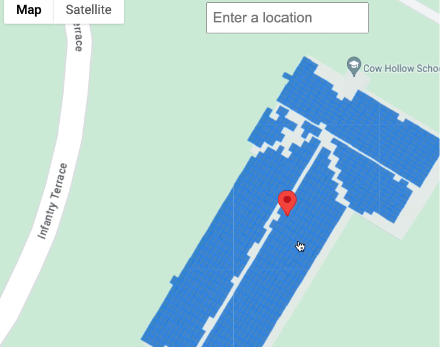
اختيار موقع جغرافي على خريطة
يمكنك أيضًا تقديم تجربة تكميلية من خلال السماح للمستخدمين باختيار المبنى على الخريطة باستخدام Maps JavaScript API. استخرِج خط العرض وخط الطول للمبنى من حدث
الماوس، ثم مرِّر هاتين الإحداثيتين في طلب buildingInsights.