Solar API 使用地点数据来确定建筑物类型,并根据卫星图像识别建筑物。本页介绍了如何确定 buildingInsights 请求中返回哪个建筑物的太阳能信息。
建筑类型
Solar API 支持类型为 premise 的建筑物。此类型表示已命名的位置,通常是具有常见名称的建筑或建筑群。
其他类型(例如 subpremise 或复合型房产,例如位于同一房产上的独立式建筑,除非注册为 premise)不受支持。
建筑物屋顶
Solar API 可根据卫星图像确定最佳的屋顶太阳能板安装位置。住宅建筑(尤其是倾斜或坡屋顶)的识别准确度较高,而平屋顶建筑(例如公寓或商业建筑)的识别准确度可能会有所不同。
如果 buildingInsights 响应中不包含 solarPanelConfigs 字段,则表示建筑物已正确处理,但我们无法在屋顶上安装太阳能板。如果屋顶太小而无法放置太阳能板,或者阴影太多而导致太阳能板无法产生足够的能量,则可能会发生这种情况。
从地址进行搜索
您可以使用 Geocoding API 或地点自动补全 API 将地址转换为经纬度坐标。
使用
place_id引用匹配的地点。在 Solar API
buildingInsights请求中使用相应地点的纬度和经度坐标。- 如果 Solar API 找到了匹配的建筑物,请检查
buildingInsights响应中的place_id是否与 Geocoding API 或 Place Autocomplete API 中的place_id相匹配。 - 如需将结果限制为类型为
premise的地点,请向 Geocoding API 或 Places API 响应添加地点类型过滤条件。{ "name": "buildings/ChIJh0CMPQW7j4ARLrRiVvmg6Vs", "center": { "latitude": 37.4449739, "longitude": -122.13914659999998 },... }
- 如果 Solar API 找到了匹配的建筑物,请检查
您可以使用开源示例应用或发出 buildingInsights 请求来检查 Solar API 涵盖的建筑物的 place_id。
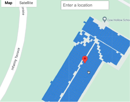
在地图上选择位置
您还可以通过 Maps JavaScript API 允许用户在地图上选择建筑物,从而提供补充体验。从鼠标事件中提取建筑物的纬度和经度,然后在 buildingInsights 请求中传入这些坐标。