Solar API は、位置情報を使用して建物の種類を特定し、衛星画像に基づいて建物を識別します。このページでは、buildingInsights リクエストでどの建物の太陽光発電情報が返されるかを判断する方法について説明します。
建物のタイプ
Solar API は、premise タイプの建物をサポートしています。このタイプは名前のある場所を示します。通常は共通の名前を持つ建物や建物の集合体です。
premise として登録されていない限り、subpremise などの他のタイプや複合施設(1 つの敷地内にある独立した建物など)はサポートされていません。
建物の屋根
Solar API は、衛星画像に基づいて屋上太陽光パネルの最適な配置を特定します。住宅用建物、特に傾斜屋根や切妻屋根は高い精度で識別されますが、平屋根の建物(アパートや商業施設など)は精度が異なる場合があります。
buildingInsights レスポンスに solarPanelConfigs フィールドが含まれていない場合、建物は正しく処理されましたが、屋根にパネルを設置できませんでした。これは、屋根が小さすぎてパネルを設置できない場合や、日陰が多すぎてパネルで十分なエネルギーを生成できない場合に発生することがあります。
住所から検索する
Geocoding API または Place Autocomplete API を使用して、住所を緯度と経度の座標に変換できます。
一致した場所を参照するには、
place_idを使用します。Solar API の
buildingInsightsリクエストで、場所の緯度と経度の座標を使用します。- Solar API で一致する建物が見つかった場合は、
buildingInsightsレスポンスのplace_idが Geocoding API または Place Autocomplete API のplace_idと一致することを確認します。 - 結果をタイプ
premiseの場所に限定するには、Geocoding API または Places API のレスポンスに場所タイプ フィルタを追加します。{ "name": "buildings/ChIJh0CMPQW7j4ARLrRiVvmg6Vs", "center": { "latitude": 37.4449739, "longitude": -122.13914659999998 },... }
- Solar API で一致する建物が見つかった場合は、
オープンソースのサンプルアプリを使用するか、buildingInsights リクエストを行って、Solar API の対象となる建物の place_id を確認できます。
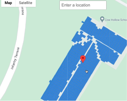
地図上で場所を選択する
Maps JavaScript API を使用して、ユーザーが地図上の建物を選択できるようにすることで、補完的なエクスペリエンスを提供することもできます。マウスイベントから建物の緯度と経度を抽出し、buildingInsights リクエストでそれらの座標を渡します。