फ़ोटोरियलिस्टिक 3D टाइलें, OGC स्टैंडर्ड glTF फ़ॉर्मैट में होती हैं. इसका मतलब है कि 3D विज़ुअलाइज़ेशन बनाने के लिए, OGC 3D टाइल स्पेसिफ़िकेशन के साथ काम करने वाले किसी भी रेंडरर का इस्तेमाल किया जा सकता है. उदाहरण के लिए, Cesium, 3D विज़ुअलाइज़ेशन रेंडर करने के लिए एक बुनियादी ओपन सोर्स लाइब्रेरी है.
CesiumJS का इस्तेमाल करना
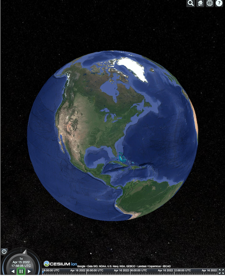
CesiumJS, वेब पर 3D विज़ुअलाइज़ेशन के लिए एक ओपन सोर्स JavaScript लाइब्रेरी है. CesiumJS का इस्तेमाल करने के बारे में ज़्यादा जानने के लिए, CesiumJS के बारे में जानें पर जाएं.
उपयोगकर्ता नियंत्रण
CesiumJS टाइल रेंडरर में, उपयोगकर्ता के कंट्रोल का स्टैंडर्ड सेट होता है.
| कार्रवाई | ब्यौरा |
|---|---|
| पैन व्यू | लेफ़्ट क्लिक करके खींचें और छोड़ें |
| ज़ूम व्यू | राइट क्लिक करके खींचें और छोड़ें या माउस व्हील को घुमाएं |
| व्यू घुमाएं | Ctrl + लेफ़्ट/राइट क्लिक करके खींचें और छोड़ें या बीच में क्लिक करके खींचें और छोड़ें |
सबसे सही तरीके
CesiumJS 3D को लोड होने में लगने वाले समय को कम करने के लिए, कई तरीके अपनाए जा सकते हैं. उदाहरण के लिए:
एक साथ कई अनुरोध करने की सुविधा चालू करने के लिए, रेंडरिंग एचटीएमएल में यह स्टेटमेंट जोड़ें:
Cesium.RequestScheduler.requestsByServer["tile.googleapis.com:443"] = <REQUEST_COUNT>REQUEST_COUNTकी वैल्यू जितनी ज़्यादा होगी, टाइलें उतनी ही तेज़ी से लोड होंगी. हालांकि, Chrome ब्राउज़र मेंREQUEST_COUNT10 से ज़्यादा फ़ाइलें लोड करने पर और कैश मेमोरी बंद होने पर, आपको Chrome से जुड़ी समस्या का सामना करना पड़ सकता है. हमारा सुझाव है कि ज़्यादातर मामलों में, बेहतर परफ़ॉर्मेंस के लिएREQUEST_COUNTकी वैल्यू 18 होनी चाहिए.ज़्यादा जानकारी वाले लेवल को स्किप करने की सुविधा चालू करें. ज़्यादा जानकारी के लिए, यह Cesium की समस्या देखें.
showCreditsOnScreen: true को चालू करके, पक्का करें कि आपने डेटा एट्रिब्यूशन को सही तरीके से दिखाया हो. ज़्यादा जानकारी के लिए, नीतियां देखें.
रेंडरिंग मेट्रिक
फ़्रेमरेट का पता लगाने के लिए, देखें कि requestAnimationFrame मेथड को हर सेकंड कितनी बार कॉल किया जाता है.
फ़्रेम लेटेंसी का हिसाब कैसे लगाया जाता है, यह जानने के लिए PerformanceDisplay क्लास देखें.
CesiumJS रेंडरर के उदाहरण
Map Tiles API के 3D टाइल के साथ CesiumJS रेंडरर का इस्तेमाल किया जा सकता है. इसके लिए, आपको सिर्फ़ रूट टाइलसेट का यूआरएल देना होगा.
सामान्य उदाहरण
यहां दिए गए उदाहरण में, CesiumJS रेंडरर को शुरू किया गया है. इसके बाद, रूट टाइलसेट लोड किया गया है.
<!DOCTYPE html>
<head>
  <meta charset="utf-8">
  <title>CesiumJS 3D Tiles Simple Demo</title>
  <script src="https://ajax.googleapis.com/ajax/libs/cesiumjs/1.105/Build/Cesium/Cesium.js"></script>
  <link href="https://ajax.googleapis.com/ajax/libs/cesiumjs/1.105/Build/Cesium/Widgets/widgets.css" rel="stylesheet">
</head>
<body>
  <div id="cesiumContainer"></div>
  <script>

    // Enable simultaneous requests.
    Cesium.RequestScheduler.requestsByServer["tile.googleapis.com:443"] = 18;

    // Create the viewer.
    const viewer = new Cesium.Viewer('cesiumContainer', {
      imageryProvider: false,
      baseLayerPicker: false,
      geocoder: false,
      globe: false,
      // https://cesium.com/blog/2018/01/24/cesium-scene-rendering-performance/#enabling-request-render-mode
      requestRenderMode: true,
    });

    // Add 3D Tiles tileset.
    const tileset = viewer.scene.primitives.add(new Cesium.Cesium3DTileset({
      url: "https://tile.googleapis.com/v1/3dtiles/root.json?key=YOUR_API_KEY",
      // This property is needed to appropriately display attributions
      // as required.
      showCreditsOnScreen: true,
    }));
  </script>
</body>
requestRenderMode के बारे में जानकारी के लिए, अनुरोध रेंडर मोड चालू करना लेख पढ़ें.
एचटीएमएल पेज, यहां दिखाए गए तरीके से रेंडर होता है.
Places API इंटिग्रेशन
ज़्यादा जानकारी पाने के लिए, Places API के साथ CesiumJS का इस्तेमाल किया जा सकता है. जगहों के व्यूपोर्ट पर जाने के लिए, ऑटोकंप्लीट विजेट का इस्तेमाल किया जा सकता है. इस उदाहरण में, Places Autocomplete API का इस्तेमाल किया गया है. इसे इन निर्देशों का पालन करके चालू किया जाता है. साथ ही, इसमें Maps JavaScript API का इस्तेमाल किया गया है. इसे इन निर्देशों का पालन करके चालू किया जाता है.
<!DOCTYPE html>
<head>
 <meta charset="utf-8" />
 <title>CesiumJS 3D Tiles Places API Integration Demo</title>
 <script src="https://ajax.googleapis.com/ajax/libs/cesiumjs/1.105/Build/Cesium/Cesium.js"></script>
 <link href="https://ajax.googleapis.com/ajax/libs/cesiumjs/1.105/Build/Cesium/Widgets/widgets.css" rel="stylesheet">
</head>
<body>
 <label for="pacViewPlace">Go to a place: </label>
 <input
   type="text"
   id="pacViewPlace"
   name="pacViewPlace"
   placeholder="Enter a location..."
   style="width: 300px"
 />
 <div id="cesiumContainer"></div>
 <script>
   // Enable simultaneous requests.
   Cesium.RequestScheduler.requestsByServer["tile.googleapis.com:443"] = 18;

   // Create the viewer.
   const viewer = new Cesium.Viewer("cesiumContainer", {
     imageryProvider: false,
     baseLayerPicker: false,
     requestRenderMode: true,
     geocoder: false,
     globe: false,
   });

   // Add 3D Tiles tileset.
   const tileset = viewer.scene.primitives.add(
     new Cesium.Cesium3DTileset({
       url: "https://tile.googleapis.com/v1/3dtiles/root.json?key=YOUR_API_KEY",
       // This property is required to display attributions as required.
       showCreditsOnScreen: true,
     })
   );

   const zoomToViewport = (viewport) => {
     viewer.entities.add({
       polyline: {
         positions: Cesium.Cartesian3.fromDegreesArray([
           viewport.getNorthEast().lng(), viewport.getNorthEast().lat(),
           viewport.getSouthWest().lng(), viewport.getNorthEast().lat(),
           viewport.getSouthWest().lng(), viewport.getSouthWest().lat(),
           viewport.getNorthEast().lng(), viewport.getSouthWest().lat(),
           viewport.getNorthEast().lng(), viewport.getNorthEast().lat(),
         ]),
         width: 10,
         clampToGround: true,
         material: Cesium.Color.RED,
       },
     });
     viewer.flyTo(viewer.entities);
   };

   function initAutocomplete() {
     const autocomplete = new google.maps.places.Autocomplete(
       document.getElementById("pacViewPlace"),
       {
         fields: [
           "geometry",
           "name",
         ],
       }
     );
     autocomplete.addListener("place_changed", () => {
       viewer.entities.removeAll();
       const place = autocomplete.getPlace();
       if (!place.geometry || !place.geometry.viewport) {
         window.alert("No viewport for input: " + place.name);
         return;
       }
       zoomToViewport(place.geometry.viewport);
     });
   }
 </script>
 <script
   async=""
   src="https://maps.googleapis.com/maps/api/js?key=YOUR_API_KEY&libraries=places&callback=initAutocomplete"
 ></script>
</body>
ड्रोन के कैमरे को घुमाकर लिया गया व्यू
टाइलों के सेट के ज़रिए ऐनिमेशन बनाने के लिए, कैमरे को कंट्रोल किया जा सकता है. Places API और Elevation API के साथ इस्तेमाल करने पर, यह ऐनिमेशन किसी भी लोकप्रिय जगह के ऊपर से ड्रोन के उड़ने का इंटरैक्टिव अनुभव देता है.
इस कोड सैंपल की मदद से, उस जगह के आस-पास की जानकारी देखी जा सकती है जिसे आपने Autocomplete विजेट में चुना है.
<!DOCTYPE html>
<head>
  <meta charset="utf-8" />
  <title>CesiumJS 3D Tiles Rotating Drone View Demo</title>
  <script src="https://ajax.googleapis.com/ajax/libs/cesiumjs/1.105/Build/Cesium/Cesium.js"></script>
  <link href="https://ajax.googleapis.com/ajax/libs/cesiumjs/1.105/Build/Cesium/Widgets/widgets.css" rel="stylesheet">
</head>
<body>
  <label for="pacViewPlace">Go to a place: </label>
  <input type="text" id="pacViewPlace" name="pacViewPlace" placeholder="Enter a location..." style="width: 300px" />
  <div id="cesiumContainer"></div>
  <script>
    // Enable simultaneous requests.
    Cesium.RequestScheduler.requestsByServer["tile.googleapis.com:443"] = 18;

    // Create the viewer and remove unneeded options.
    const viewer = new Cesium.Viewer("cesiumContainer", {
      imageryProvider: false,
      baseLayerPicker: false,
      homeButton: false,
      fullscreenButton: false,
      navigationHelpButton: false,
      vrButton: false,
      sceneModePicker: false,
      geocoder: false,
      globe: false,
      infobox: false,
      selectionIndicator: false,
      timeline: false,
      projectionPicker: false,
      clockViewModel: null,
      animation: false,
      requestRenderMode: true,
    });

    // Add 3D Tile set.
    const tileset = viewer.scene.primitives.add(
      new Cesium.Cesium3DTileset({
        url: "https://tile.googleapis.com/v1/3dtiles/root.json?key=YOUR_API_KEY",
        // This property is required to display attributions.
        showCreditsOnScreen: true,
      })
    );

    // Point the camera at a location and elevation, at a viewport-appropriate distance.
    function pointCameraAt(location, viewport, elevation) {
      const distance = Cesium.Cartesian3.distance(
        Cesium.Cartesian3.fromDegrees(
          viewport.getSouthWest().lng(), viewport.getSouthWest().lat(), elevation),
        Cesium.Cartesian3.fromDegrees(
          viewport.getNorthEast().lng(), viewport.getNorthEast().lat(), elevation)
      ) / 2;
      const target = new Cesium.Cartesian3.fromDegrees(location.lng(), location.lat(), elevation);
      const pitch = -Math.PI / 4;
      const heading = 0;
      viewer.camera.lookAt(target, new Cesium.HeadingPitchRange(heading, pitch, distance));
    }

    // Rotate the camera around a location and elevation, at a viewport-appropriate distance.
    let unsubscribe = null;
    function rotateCameraAround(location, viewport, elevation) {
      if(unsubscribe) unsubscribe();
      pointCameraAt(location, viewport, elevation);
      unsubscribe = viewer.clock.onTick.addEventListener(() => {
        viewer.camera.rotate(Cesium.Cartesian3.UNIT_Z);
      });
    }

    function initAutocomplete() {
      const autocomplete = new google.maps.places.Autocomplete(
        document.getElementById("pacViewPlace"), {
          fields: [
            "geometry",
            "name",
          ],
        }
      );

      autocomplete.addListener("place_changed", async () => {
        const place = autocomplete.getPlace();

        if (!(place.geometry && place.geometry.viewport && place.geometry.location)) {
          window.alert(`Insufficient geometry data for place: ${place.name}`);
          return;
        }
        // Get place elevation using the ElevationService.
        const elevatorService = new google.maps.ElevationService();
        const elevationResponse =  await elevatorService.getElevationForLocations({
          locations: [place.geometry.location],
        });

        if(!(elevationResponse.results && elevationResponse.results.length)){
          window.alert(`Insufficient elevation data for place: ${place.name}`);
          return;
        }
        const elevation = elevationResponse.results[0].elevation || 10;

        rotateCameraAround(
          place.geometry.location,
          place.geometry.viewport,
          elevation
        );
      });
    }
  </script>
  <script async src="https://maps.googleapis.com/maps/api/js?key=YOUR_API_KEY&libraries=places&callback=initAutocomplete"></script>
</body>
पॉलीलाइन और लेबल बनाना
इस कोड के सैंपल में, मैप में पॉलीलाइन और लेबल जोड़ने का तरीका बताया गया है. ड्राइविंग और पैदल चलने के दिशा-निर्देश दिखाने के लिए, मैप में पॉलीलाइन जोड़ी जा सकती हैं. इसके अलावा, प्रॉपर्टी की सीमाएं दिखाने या ड्राइविंग और पैदल चलने की अवधि का हिसाब लगाने के लिए भी पॉलीलाइन जोड़ी जा सकती हैं. सीन को रेंडर किए बिना भी एट्रिब्यूट पाए जा सकते हैं.
उपयोगकर्ताओं को किसी इलाके की चुनिंदा जगहों की यात्रा कराई जा सकती है. इसके अलावा, उन्हें आस-पास की ऐसी प्रॉपर्टी दिखाई जा सकती हैं जो फ़िलहाल बिक्री के लिए उपलब्ध हैं. इसके बाद, सीन में बिलबोर्ड जैसे 3D ऑब्जेक्ट जोड़े जा सकते हैं.
यात्रा की खास जानकारी दी जा सकती है. इसमें देखी गई प्रॉपर्टी की सूची बनाई जा सकती है. साथ ही, इन प्रॉपर्टी की जानकारी को वर्चुअल ऑब्जेक्ट में दिखाया जा सकता है.
<!DOCTYPE html>
<head>
  <meta charset="utf-8" />
  <title>CesiumJS 3D Tiles Polyline and Label Demo</title>
  <script src="https://ajax.googleapis.com/ajax/libs/cesiumjs/1.105/Build/Cesium/Cesium.js"></script>
  <link
    href="https://ajax.googleapis.com/ajax/libs/cesiumjs/1.105/Build/Cesium/Widgets/widgets.css"
    rel="stylesheet"
  />
</head>
<body>
  <div id="cesiumContainer"></div>
  <script>
    // Enable simultaneous requests.
    Cesium.RequestScheduler.requestsByServer["tile.googleapis.com:443"] = 18;

    // Create the viewer.
    const viewer = new Cesium.Viewer("cesiumContainer", {
      imageryProvider: false,
      baseLayerPicker: false,
      requestRenderMode: true,
      geocoder: false,
      globe: false,
    });

    // Add 3D Tiles tileset.
    const tileset = viewer.scene.primitives.add(
      new Cesium.Cesium3DTileset({
        url: "https://tile.googleapis.com/v1/3dtiles/root.json?key=YOUR_API_KEY",

        // This property is required to display attributions as required.
        showCreditsOnScreen: true,
      })
    );

    // Draws a circle at the position, and a line from the previous position.
    const drawPointAndLine = (position, prevPosition) => {
      viewer.entities.removeAll();
      if (prevPosition) {
        viewer.entities.add({
          polyline: {
            positions: [prevPosition, position],
            width: 3,
            material: Cesium.Color.WHITE,
            clampToGround: true,
            classificationType: Cesium.ClassificationType.CESIUM_3D_TILE,
          },
        });
      }
      viewer.entities.add({
        position: position,
        ellipsoid: {
          radii: new Cesium.Cartesian3(1, 1, 1),
          material: Cesium.Color.RED,
        },
      });
    };

    // Compute, draw, and display the position's height relative to the previous position.
    var prevPosition;
    const processHeights = (newPosition) => {
      drawPointAndLine(newPosition, prevPosition);

      const newHeight = Cesium.Cartographic.fromCartesian(newPosition).height;
      let labelText = "Current altitude (meters above sea level):\n\t" + newHeight;
      if (prevPosition) {
        const prevHeight =
          Cesium.Cartographic.fromCartesian(prevPosition).height;
        labelText += "\nHeight from previous point (meters):\n\t" + Math.abs(newHeight - prevHeight);
      }
      viewer.entities.add({
        position: newPosition,
        label: {
          text: labelText,
          disableDepthTestDistance: Number.POSITIVE_INFINITY,
          pixelOffset: new Cesium.Cartesian2(0, -10),
          showBackground: true,
          verticalOrigin: Cesium.VerticalOrigin.BOTTOM,
        }
      });

      prevPosition = newPosition;
    };

    const handler = new Cesium.ScreenSpaceEventHandler(viewer.canvas);
    handler.setInputAction(function (event) {
      const earthPosition = viewer.scene.pickPosition(event.position);
      if (Cesium.defined(earthPosition)) {
        processHeights(earthPosition);
      }
    }, Cesium.ScreenSpaceEventType.LEFT_CLICK);
  </script>
</body>
कैमरे को घुमाना
Cesium में, कैमरे को किसी खास जगह के चारों ओर घुमाया जा सकता है. इससे इमारतों से टकराने से बचा जा सकता है. इसके अलावा, कैमरे के बिल्डिंग से गुज़रने पर, उन्हें पारदर्शी बनाया जा सकता है.
सबसे पहले, कैमरे को किसी पॉइंट पर लॉक करें. इसके बाद, अपनी ऐसेट दिखाने के लिए, कैमरे को चारों ओर घुमाएं. इसके लिए, इवेंट लिसनर के साथ कैमरे के lookAtTransform फ़ंक्शन का इस्तेमाल किया जा सकता है. इस कोड सैंपल में इसे दिखाया गया है.
// Lock the camera onto a point.
const center = Cesium.Cartesian3.fromRadians(
  2.4213211833389243,
  0.6171926869414084,
  3626.0426275055174
);

const transform = Cesium.Transforms.eastNorthUpToFixedFrame(center);

viewer.scene.camera.lookAtTransform(
  transform,
  new Cesium.HeadingPitchRange(0, -Math.PI / 8, 2900)
);

// Orbit around this point.
viewer.clock.onTick.addEventListener(function (clock) {
  viewer.scene.camera.rotateRight(0.005);
});
कैमरे को कंट्रोल करने के बारे में ज़्यादा जानने के लिए, कैमरे को कंट्रोल करना लेख पढ़ें
Cesium for Unreal के साथ काम करना
Cesium for Unreal Plugin को 3D Tiles API के साथ इस्तेमाल करने के लिए, यहां दिया गया तरीका अपनाएं.
Cesium for Unreal प्लगिन इंस्टॉल करें.
नया Unreal प्रोजेक्ट बनाएं.
Google Photorealistic 3D Tiles API से कनेक्ट करें.
मेन्यू में जाकर, Cesium > Cesium को चुनकर, Cesium विंडो खोलें.
खाली 3D टाइल वाला टाइलसेट चुनें.
World Outliner में, इस Cesium3DTileset को चुनकर, Details पैनल खोलें.
सोर्स को Cesium Ion से से बदलकर यूआरएल से करें.
यूआरएल को Google 3D Tiles का यूआरएल के तौर पर सेट करें.
https://tile.googleapis.com/v1/3dtiles/root.json?key=YOUR_API_KEY- एट्रिब्यूशन को सही तरीके से दिखाने के लिए, स्क्रीन पर क्रेडिट दिखाएं सुविधा चालू करें.
इससे दुनिया लोड हो जाती है. किसी भी LatLng पर जाने के लिए, Outliner पैनल में CesiumGeoreference आइटम चुनें. इसके बाद, Details पैनल में जाकर, Origin Latitude/Longitude/Height में बदलाव करें.
Cesium for Unity का इस्तेमाल करना
Cesium for Unity के साथ फ़ोटोरेलिस्टिक टाइल इस्तेमाल करने के लिए, यह तरीका अपनाएं.
नया Unity प्रोजेक्ट बनाएं.
पैकेज मैनेजर सेक्शन में, नई स्कोप की गई रजिस्ट्री जोड़ें. इसके लिए, Editor > Project Settings पर जाएं.
नाम: Cesium
यूआरएल: https://unity.pkg.cesium.com
स्कोप: com.cesium.unity
Cesium for Unity पैकेज इंस्टॉल करें.
Google Photorealistic 3D Tiles API से कनेक्ट करें.
मेन्यू में जाकर, Cesium > Cesium को चुनकर, Cesium विंडो खोलें.
खाली 3D टाइल टाइलसेट पर क्लिक करें.
बाईं ओर मौजूद पैनल में, सोर्स में जाकर टाइल्ससेट सोर्स विकल्प में, Cesium Ion के बजाय यूआरएल से चुनें.
यूआरएल को Google 3D Tiles के यूआरएल पर सेट करें.
https://tile.googleapis.com/v1/3dtiles/root.json?key=YOUR_API_KEY- एट्रिब्यूशन को सही तरीके से दिखाने के लिए, स्क्रीन पर क्रेडिट दिखाएं सुविधा चालू करें.
इससे दुनिया लोड हो जाती है. किसी भी LatLng पर जाने के लिए, Scene Hierarchy में CesiumGeoreference आइटम चुनें. इसके बाद, Inspector में जाकर, Origin Latitude/Longitude/Height में बदलाव करें.
deck.gl के साथ काम करना
deck.gl, WebGL पर आधारित एक ओपन सोर्स JavaScript फ़्रेमवर्क है. यह बड़े पैमाने पर डेटा विज़ुअलाइज़ेशन के लिए, बेहतर परफ़ॉर्मेंस देता है.
एट्रिब्यूशन
पक्का करें कि आपने डेटा एट्रिब्यूशन को सही तरीके से दिखाया हो. इसके लिए, टाइल gltf asset से copyright फ़ील्ड को एक्सट्रैक्ट करें. इसके बाद, इसे रेंडर किए गए व्यू पर दिखाएं. ज़्यादा जानकारी के लिए, डेटा एट्रिब्यूशन दिखाना लेख पढ़ें.
deck.gl रेंडरर के उदाहरण
सामान्य उदाहरण
इस उदाहरण में, deck.gl रेंडरर को शुरू करने और फिर किसी जगह को 3D में लोड करने का तरीका बताया गया है. अपने कोड में, YOUR_API_KEY को अपनी असली एपीआई कुंजी से बदलना न भूलें.
<!DOCTYPE html>
<html>
 <head>
   <title>deck.gl Photorealistic 3D Tiles example</title>
   <script src="https://unpkg.com/deck.gl@latest/dist.min.js"></script>
   <style>
     body { margin: 0; padding: 0;}
     #map { position: absolute; top: 0;bottom: 0;width: 100%;}
     #credits { position: absolute; bottom: 0; right: 0; padding: 2px; font-size: 15px; color: white;
        text-shadow: -1px 0 black, 0 1px black, 1px 0 black, 0 -1px black;}
   </style>
 </head>

 <body>
   <div id="map"></div>
   <div id="credits"></div>
   <script>
     const GOOGLE_API_KEY = YOUR_API_KEY;
     const TILESET_URL = `https://tile.googleapis.com/v1/3dtiles/root.json`;
     const creditsElement = document.getElementById('credits');
     new deck.DeckGL({
       container: 'map',
       initialViewState: {
         latitude: 50.0890,
         longitude: 14.4196,
         zoom: 16,
         bearing: 90,
         pitch: 60,
         height: 200
       },
       controller: {minZoom: 8},
       layers: [
         new deck.Tile3DLayer({
           id: 'google-3d-tiles',
           data: TILESET_URL,
           loadOptions: {
            fetch: {
              headers: {
                'X-GOOG-API-KEY': GOOGLE_API_KEY
              }
            }
          },
           onTilesetLoad: tileset3d => {
             tileset3d.options.onTraversalComplete = selectedTiles => {
               const credits = new Set();
               selectedTiles.forEach(tile => {
                 const {copyright} = tile.content.gltf.asset;
                 copyright.split(';').forEach(credits.add, credits);
                 creditsElement.innerHTML = [...credits].join('; ');
               });
               return selectedTiles;
             }
           }
         })
       ]
     });
   </script>
 </body>
</html>
Google के फ़ोटोरियलिस्टिक 3D टाइल के ऊपर 2D लेयर देखना
deck.gl TerrainExtension की मदद से, 2D डेटा को 3D लेयर पर रेंडर किया जाता है. उदाहरण के लिए, किसी बिल्डिंग के फ़ुटप्रिंट के GeoJSON को फ़ोटोरियलिस्टिक 3D टाइल की ज्यामिति के ऊपर रखा जा सकता है.
यहां दिए गए उदाहरण में, बिल्डिंग की लेयर को पॉलीगॉन की मदद से विज़ुअलाइज़ किया गया है. इन पॉलीगॉन को फ़ोटोरियलिस्टिक 3D टाइल की सतह के हिसाब से बनाया गया है.
<!DOCTYPE html>
<html>
 <head>
   <title>Google 3D tiles example</title>
   <script src="https://unpkg.com/deck.gl@latest/dist.min.js"></script>
   <style>
     body { margin: 0; padding: 0;}
     #map { position: absolute; top: 0;bottom: 0;width: 100%;}
     #credits { position: absolute; bottom: 0; right: 0; padding: 2px; font-size: 15px; color: white;
        text-shadow: -1px 0 black, 0 1px black, 1px 0 black, 0 -1px black;}
   </style>
 </head>

 <body>
   <div id="map"></div>
   <div id="credits"></div>
   <script>
     const GOOGLE_API_KEY = YOUR_API_KEY;
     const TILESET_URL = `https://tile.googleapis.com/v1/3dtiles/root.json`;
     const BUILDINGS_URL = 'https://raw.githubusercontent.com/visgl/deck.gl-data/master/examples/google-3d-tiles/buildings.geojson'
     const creditsElement = document.getElementById('credits');
     const deckgl = new deck.DeckGL({
       container: 'map',
       initialViewState: {
         latitude: 50.0890,
         longitude: 14.4196,
         zoom: 16,
         bearing: 90,
         pitch: 60,
         height: 200
       },
       controller: true,
       layers: [
         new deck.Tile3DLayer({
           id: 'google-3d-tiles',
           data: TILESET_URL,
           loadOptions: {
            fetch: {
              headers: {
                'X-GOOG-API-KEY': GOOGLE_API_KEY
              }
            }
          },
          onTilesetLoad: tileset3d => {
             tileset3d.options.onTraversalComplete = selectedTiles => {
               const credits = new Set();
               selectedTiles.forEach(tile => {
                 const {copyright} = tile.content.gltf.asset;
                 copyright.split(';').forEach(credits.add, credits);
                 creditsElement.innerHTML = [...credits].join('; ');
               });
               return selectedTiles;
             }
           },
           operation: 'terrain+draw'
         }),
         new deck.GeoJsonLayer({
           id: 'buildings',
           // This dataset is created by CARTO, using other Open Datasets available. More info at: https://3dtiles.carto.com/#about.
           data: 'https://raw.githubusercontent.com/visgl/deck.gl-data/master/examples/google-3d-tiles/buildings.geojson',
           stroked: false,
           filled: true,
           getFillColor: ({properties}) => {
             const {tpp} = properties;
             // quantiles break
             if (tpp < 0.6249)
               return [254, 246, 181]
             else if (tpp < 0.6780)
               return [255, 194, 133]
             else if (tpp < 0.8594)
               return [250, 138, 118]
             return [225, 83, 131]
           },
           opacity: 0.2,
           extensions: [new deck._TerrainExtension()]
         })
       ]
     });
   </script>
 </body>
</html>