Page Summary
-
The Canadian primary forest dataset is a satellite-based forest age map for 2019 at 30-m resolution.
-
Forest age is determined using remotely-sensed data from Landsat and MODIS through disturbance, recovery, or allometric approaches.
-
The allometric approach is used for the largest area due to a lack of widespread recent disturbance.
-
Trees older than 150 years are categorized as "old tree".
-
This dataset is open source and licensed under the CC-BY 4.0 license.
- Dataset Availability
- 2019-01-01T01:00:00Z–2020-01-01T01:00:00Z
- Dataset Producer
- National Forest Information System
- Tags
Description
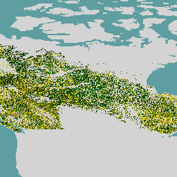
Canadian primary forest dataset is a satellite-based forest age map for 2019 across Canada's forested ecozones at a 30-m spatial resolution. Remotely-sensed data from Landsat (disturbances, surface reflectance composites, forest structure) and MODIS (Gross Primary Production) are utilized to determine age.
Forest age can be determined where disturbance can be identified directly (disturbance approach) or inferred using spectral information (recovery approach) or using inverted allometric equations to model age where there is no evidence of disturbance (allometric approach). The disturbance approach is based upon satellite data and mapped changes and is the most accurate. The recovery approach also relies upon satellite data plus logic regarding forest succession, with an accuracy that is greater than pure modeling.
Given the lack of widespread recent disturbance over Canada's forests, the allometric approach is required over the greatest area (86.6%). Using information regarding realized heights and growth and yield modeling, ages are estimated where none are otherwise possible. Trees of all ages are mapped, with trees >150 years old combined in an "old tree" category.
Bands
Bands
Pixel size: 30 meters (all bands)
| Name | Units | Pixel Size | Description |
|---|---|---|---|
forest |
y | 30 meters | Forest age |
Terms of Use
Terms of Use
The forest age map described herein for Canada's forested ecosystems is declared open source and supported by the Government of Canada. The dataset is licensed under the CC-BY 4.0 license.
Explore with Earth Engine
Code Editor (JavaScript)
var dataset = ee.ImageCollection('CANADA/NFIS/NTEMS/CA_FOREST_AGE');

Map.setCenter(-107.94, 58.18, 3);
Map.addLayer(
    dataset,
    {palette: ['006600', '002200', 'fff700', 'ab7634', 'c4d0ff', 'ffffff']},
    'Canada Primary Forest Data');