- 数据集可用时间
- 2000-02-11T00:00:00Z–2000-02-22T00:00:00Z
- 数据集提供方
- NASA/CGIAR
- 标签
说明
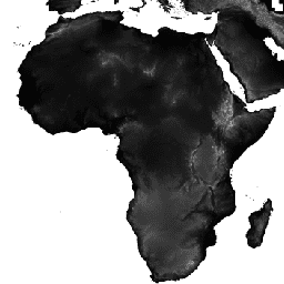
航天飞机雷达地形测绘任务 (SRTM) 数字高程数据集最初的目的是提供近乎全球范围的一致、高质量高程数据。此版本的 SRTM 数字高程数据经过处理,可填补数据空白,并方便用户使用。
频段
波段
| 名称 | 单位 | 最小值 | 最大值 | 像素尺寸 | 说明 |
|---|---|---|---|---|---|
elevation |
米 | -444* | 8806* | 90 米 | 海拔 |
使用条款
使用条款
分发。未经 CIAT 明确书面许可,用户不得进行任何商业性、非免费的转售或再分发。用户应在因使用此数据集而创建的任何报告、出版物、新数据集、衍生产品或服务中注明 CIAT 为所用来源。CIAT 还会要求重印任何出版物,并通知任何重新分发工作。如需商业用途的数据访问权限,请发送请求至 Andy Jarvis [a.jarvis@cgiar.org]。
无保证或责任。CIAT 提供这些数据,但不提供任何形式的明示或暗示保证,包括适销性和特定用途适用性方面的保证。对于因使用任何数据而造成的附带性、后果性或特殊损害,CIAT 概不承担任何责任。
致谢和引用。我们恳请所有用户在任何使用此数据制作的已发布材料中引用此数据,并尽可能将网页链接到 CIAT-CSI SRTM 网站。
引用
引用:
Jarvis, A.,H.I. Reuter, A. Nelson, E. 格瓦拉。2008 年。全球空洞填充 SRTM 版本 4,可从 CGIAR-CSI SRTM 90 米数据库获取:https://srtm.csi.cgiar.org。
通过 Earth Engine 探索
代码编辑器 (JavaScript)
var dataset = ee.Image('CGIAR/SRTM90_V4');
var elevation = dataset.select('elevation');
var slope = ee.Terrain.slope(elevation);
Map.setCenter(-112.8598, 36.2841, 10);
Map.addLayer(slope, {min: 0, max: 60}, 'slope');
import ee
import geemap.core as geemap
Colab (Python)
dataset = ee.Image('CGIAR/SRTM90_V4')
elevation = dataset.select('elevation')
slope = ee.Terrain.slope(elevation)

m = geemap.Map()
m.set_center(-112.8598, 36.2841, 10)
m.add_layer(slope, {'min': 0, 'max': 60}, 'slope')
m