- 데이터 세트 사용 가능 기간
- 2000-01-01T00:00:00Z–2020-01-01T00:00:00Z
- 데이터 세트 제공업체
- Center for International Earth Science Information Network의 NASA SEDAC
- 태그
설명
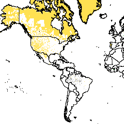
이 데이터 세트에는 각 픽셀 내 영구적인 얼음과 물을 제외한 토지 면적의 추정치가 픽셀당 제곱킬로미터로 포함되어 있으며, GPW v4.11 인구 밀도 데이터 세트를 계산하는 데 사용되었습니다.
Gridded Population of World Version 4 (GPWv4), Revision 11은 30초 (약 1km) 그리드 셀에서 2000년, 2005년, 2010년, 2015년, 2020년의 전 세계 인구 분포를 모델링합니다. 인구는 인구조사 및 행정 단위의 인구 비례 할당을 사용하여 셀에 분배됩니다. 인구 입력 데이터는 2005년에서 2014년 사이에 실시된 2010년 인구 조사 결과에서 제공되는 가장 상세한 공간 해상도로 수집됩니다. 입력 데이터는 모델링된 각 연도의 인구 추정치를 생성하기 위해 외삽됩니다.
대역
픽셀 크기
927.67미터
대역
| 이름 | 최소 | 최대 | 픽셀 크기 | 설명 |
|---|---|---|---|---|
land_area |
0* | 0.86* | 미터 | 각 30초 호 픽셀 내의 토지 면적 추정치입니다. |
이용약관
이용약관
인용
Center for International Earth Science Information Network - CIESIN - Columbia University. 2018년. Gridded Population of the World, Version 4 (GPWv4): Land Area, Revision 11. Palisades, NY: NASA Socioeconomic Data and Applications Center (SEDAC). https://doi.org/10.7927/H4Z60M4Z. 액세스한 날짜는 DAY MONTH YEAR입니다.
DOI
Earth Engine으로 탐색하기
코드 편집기(JavaScript)
var dataset = ee.ImageCollection('CIESIN/GPWv411/GPW_Land_Area');
var raster = dataset.select('land_area');
var raster_vis = {
  'min': 0.0,
  'palette': [
    'ecefb7',
    '745638'
  ],
  'max': 0.86
};
Map.setCenter(26.4, 19.81, 1);
Map.addLayer(raster, raster_vis, 'land_area');