- Ketersediaan Set Data
- 2000-01-01T00:00:00Z–2020-01-01T00:00:00Z
- Penyedia Set Data
- NASA SEDAC di Center for International Earth Science Information Network
- Tag
Deskripsi
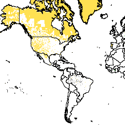
Set data ini merepresentasikan sumber data Sensus yang digunakan untuk menghasilkan estimasi populasi GPW v4.11. Piksel yang memiliki nilai yang sama mencerminkan sumber data yang sama, yang paling sering berupa negara atau wilayah.
Gridded Population of World Version 4 (GPWv4), Revision 11 memodelkan distribusi populasi manusia global untuk tahun 2000, 2005, 2010, 2015, dan 2020 pada sel petak 30 detik busur (sekitar 1 km). Populasi didistribusikan ke sel menggunakan alokasi proporsional populasi dari sensus dan unit administratif. Data input populasi dikumpulkan pada resolusi spasial paling detail yang tersedia dari hasil sensus putaran 2010, yang dilakukan antara tahun 2005 dan 2014. Data input diekstrapolasi untuk menghasilkan estimasi populasi untuk setiap tahun yang dimodelkan.
Band
Ukuran Piksel
927,67 meter
Band
| Nama | Min | Maks | Ukuran Piksel | Deskripsi |
|---|---|---|---|---|
national_identifier_grid |
4* | 999* | meter | Bilangan bulat yang merepresentasikan sumber data sensus yang digunakan untuk menghasilkan estimasi populasi GPWv4.11. Piksel (sel petak) yang memiliki nilai yang sama mencerminkan sumber data yang sama, yang paling sering berupa negara atau wilayah. Perhatikan bahwa data ini mewakili area yang dicakup oleh data statistik sebagaimana disediakan, dan bukan representasi resmi batas negara atau wilayah. |
Persyaratan Penggunaan
Persyaratan Penggunaan
Kutipan
Center for International Earth Science Information Network - CIESIN - Columbia University. 2018. Gridded Population of the World, Version 4 (GPWv4): National Identifier Grid, Revisi 11. Palisades, NY: NASA Socioeconomic Data and Applications Center (SEDAC). https://doi.org/10.7927/H4F47M2C. Diakses pada HARI BULAN TAHUN.
DOI
Menjelajahi dengan Earth Engine
Code Editor (JavaScript)
var dataset = ee.ImageCollection('CIESIN/GPWv411/GPW_National_Identifier_Grid');
var raster = dataset.select('national_identifier_grid');
var raster_vis = {
  'min': 4.0,
  'palette': [
    '000000',
    'ffffff'
  ],
  'max': 999.0
};
Map.setCenter(-88.6, 26.4, 1);
Map.addLayer(raster, raster_vis, 'national_identifier_grid');