- Доступность набора данных
- 2000-01-01T00:00:00Z–2020-01-01T00:00:00Z
- Поставщик наборов данных
- NASA SEDAC в Центре международной информационной сети наук о Земле
- Теги
Описание
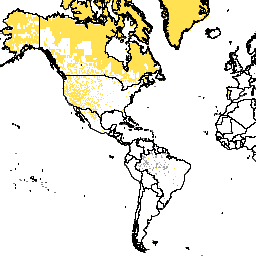
Этот набор данных представляет собой источник данных переписи населения, использованный для расчета оценок численности населения GPW v4.11. Пиксели с одинаковыми значениями соответствуют одному и тому же источнику данных, чаще всего стране или территории.
Модель населения мира с координатной сеткой версии 4 (GPWv4), редакция 11, моделирует распределение населения мира за 2000, 2005, 2010, 2015 и 2020 годы в ячейках сетки с шагом 30 угловых секунд (приблизительно 1 км). Население распределяется по ячейкам пропорционально, исходя из данных переписи и административных единиц. Входные данные о населении собираются с максимально возможным пространственным разрешением, доступным по результатам раунда переписей 2010 года, проводившихся с 2005 по 2014 год. Входные данные экстраполируются для получения оценок численности населения для каждого моделируемого года.
Группы
Размер пикселя
927,67 метра
Группы
| Имя | Мин. | Макс | Размер пикселя | Описание |
|---|---|---|---|---|
national_identifier_grid | 4* | 999* | метров | Целое число, представляющее источник данных переписи, использованный для расчета оценок численности населения GPWv4.11. Пикселы (ячейки сетки) с одинаковым значением соответствуют одному и тому же источнику данных, чаще всего стране или территории. Обратите внимание, что эти данные представляют собой территорию, охватываемую статистическими данными, в том виде, в котором они предоставлены, и не являются официальным представлением границ страны или территории. |
Условия эксплуатации
Условия эксплуатации
Цитаты
Центр международной информационной сети по наукам о Земле (CIESIN) — Колумбийский университет. 2018. Население мира с координатной сеткой, версия 4 (GPWv4): Национальная идентификационная сетка, редакция 11. Палисейдс, штат Нью-Йорк: Центр социально-экономических данных и приложений НАСА (SEDAC). https://doi.org/10.7927/H4F47M2C . Дата обращения: ДЕНЬ МЕСЯЦ ГОД.
DOI
Исследуйте с Earth Engine
Редактор кода (JavaScript)
var dataset = ee.ImageCollection('CIESIN/GPWv411/GPW_National_Identifier_Grid');
var raster = dataset.select('national_identifier_grid');
var raster_vis = {
  'min': 4.0,
  'palette': [
    '000000',
    'ffffff'
  ],
  'max': 999.0
};
Map.setCenter(-88.6, 26.4, 1);
Map.addLayer(raster, raster_vis, 'national_identifier_grid');