- 데이터 세트 제공
- 2019-01-01T00:00:00Z–2019-01-01T00:00:00Z
- 데이터 세트 출처
- FAO Forestry Division (TPP 500m 농지) FAO Forestry Division (TPP 1km 농지) FAO Forestry Division (TPP 500m 농업) FAO Forestry Division (TPP 1km 농업)
- 주기
- 1년
- 태그
설명
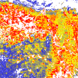
'나무 근처에 거주하는 사람'(TPP)은 삼림에 관한 협력적 파트너십(CPF)의 삼림 관련 지표(GCS) 글로벌 핵심 세트의 지표 13(극빈층 중 삼림 의존 인구수) 개발에 기여하는 데이터 세트 중 하나입니다. TPP 데이터 세트는 4가지 다른 나무 근접 인구 (숲 밖의 나무) 추정치를 제공하며, 모두 2019년 데이터로 전 세계 수준에서 픽셀 크기가 100미터입니다. 데이터 세트에 관해 자세히 알아보기
대역
대역
픽셀 크기: 0.0009m (모든 밴드)
| 이름 | 단위 | 픽셀 크기 | 설명 |
|---|---|---|---|
TPP_1km |
인구수/ha | 0.0009미터 | 농지 또는 나무 덮개 비율이 10% 이상인 농지에서 1km 이내에 거주하는 인구수 |
TPP_1km_cropland |
인구수/ha | 0.0009미터 | 나무 덮개가 10% 이상인 농지에서 거주하거나 농지로부터 1km 이내에 거주하는 인구수 |
TPP_500m |
인구수/ha | 0.0009미터 | 나무 덮개가 10% 이상인 농지에서 거주하거나 농지로부터 500m 이내에 거주하는 인구수 |
TPP_500m_cropland |
인구수/ha | 0.0009미터 | 수목 피복률이 10% 이상인 농지에서 거주하거나 농지로부터 500m 이내에 거주하는 인구수 |
이용약관
이용약관
인용
FAO 2022. 세계의 산림 현황 (SOFO) - 녹색 회복과 포용적이고 회복력 있는 지속 가능한 경제 구축을 위한 산림 경로 FAO, Rome. https://www.fao.org/documents/card/en/c/cb9360en
Newton, P., Castle, S.E., Kinzer, A.T., Miller, D.C., Oldekop, J.A., Linhares-Juvenal, T., Pina, L., Madrid, M., & de Lamo, J. 2022년. The number of forest- and tree-proximate people: a new methodology and global estimates, One Earth, 2020 doi:10.1016/j.oneear.2020.08.016,
DOI
Earth Engine으로 탐색
코드 편집기(JavaScript)
var coll = ee.ImageCollection('FAO/SOFO/1/TPP');
var image = coll.first().select('TPP_1km');
Map.setCenter(17.5, 20, 3);
Map.addLayer(
    image, {min: 0, max: 12, palette: ['blue', 'yellow', 'red']},
    'Tree proximate people – 1km cutoff distance');