Page Summary
-
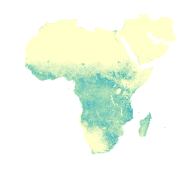
The dataset provides actual transpiration data for vegetation canopy in mm/day, averaged over 10-day periods (dekads).
-
Data is available from January 1, 2009, to March 1, 2023, with a pixel size of 248.2 meters.
-
This data is part of the WaPOR database provided by FAO UN, intended for scientific and research use.
-
The dataset includes a single band,
L1_T_D, representing dekadal transpiration in mm. -
Usage of this data aligns with FAO's open data principles for statistical databases.
- Dataset Availability
- 2009-01-01T00:00:00Z–2023-03-01T00:00:00Z
- Dataset Producer
- FAO UN
- Cadence
- 10 Days
- Tags
Description
The transpiration (T) data component (dekadal, in mm/day) is the actual transpiration of the vegetation canopy. The value of each pixel represents the average daily actual transpiration for that specific dekad.
Bands
Bands
Pixel size: 248.2 meters (all bands)
| Name | Units | Scale | Pixel Size | Description |
|---|---|---|---|---|
L1_T_D |
mm | 0.1 | 248.2 meters | Transpiration (Dekadal) [mm] |
Terms of Use
Terms of Use
The Food and Agriculture Organization of the United Nations (FAO) is mandated to collect, analyze, interpret, and disseminate information related to nutrition, food, and agriculture. In this regard, it publishes a number of databases on topics related to FAO's mandate, and encourages the use of them for scientific and research purposes. Consistent with the principles of openness and sharing envisioned under the Open Data Licensing For Statistical Databases, and consistent with the mandate of FAO, data from the Water Productivity Open Access Portal (WaPOR), as part of AQUASTAT - FAO's Global Information System on Water and Agriculture, is available free to the user community.
Citations
FAO 2018. WaPOR Database Methodology: Level 1. Remote Sensing for Water Productivity Technical Report: Methodology Series. Rome, FAO. 72 pages.
FAO 2020. WaPOR V2 Database Methodology. Remote Sensing for Water Productivity Technical Report: Methodology Series. Rome, FAO. https://www.fao.org/3/ca9894en/CA9894EN.pdf
Explore with Earth Engine
Code Editor (JavaScript)
var coll = ee.ImageCollection('FAO/WAPOR/2/L1_T_D');
var image = coll.first();
Map.setCenter(17.5, 20, 3);
Map.addLayer(image, {min: 0, max: 50});