-
CFSR:气候预报系统再分析

美国国家环境预测中心 (NCEP) 气候预测系统再分析 (CFSR) 旨在提供 32 年记录期(从 1979 年 1 月到 2010 年 12 月)内这些耦合域状态的最佳估计值,并以全球高分辨率耦合大气-海洋-陆地表面-海冰系统执行。 气候 日光 通量 预报 地球物理 ncep -
CFSV2:NCEP 气候预测系统第 2 版,每 6 小时协调一次产品

美国国家环境预测中心 (NCEP) 气候预测系统 (CFS) 是一种完全耦合的模型,可表示地球大气、海洋、陆地和海冰之间的相互作用。CFS 由 NCEP 的环境建模中心 (EMC) 开发。运行中的 CFS 已升级到 … 气候 日光 通量 预报 地球物理 ncep -
Daymet V4:每日地面天气和气候学摘要

Daymet V4 提供美国本土、夏威夷和波多黎各的网格化每日天气参数估计值(波多黎各的数据从 1950 年开始提供)。它源自所选气象站数据和各种支持性数据源。与之前版本相比,Daymet … climate daily daylight flux geophysical nasa -
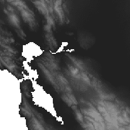
协调版 Landsat Sentinel-2 (DSWx-HLS) V1 的动态地表水范围

此数据集包含 1 级动态 OPERA 地表水范围产品版本 3。这些数据是自 2023 年 4 月起经过验证的地表水范围观测数据。产品文档中介绍了使用方面的已知问题和注意事项。用于生成每个产品的输入数据集是“Harmonized … 地球物理 Landsat 衍生 NASA OPERA Sentinel2 衍生 地表 -
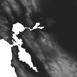
基于 Sentinel-1 的动态地表水范围 (DSWx-S1) V1

此数据集包含来自 Sentinel-1 的 3 级动态 OPERA 地表水范围 (DSWX-S1)。DSWx-S1 可提供近乎全球的陆地地表水范围地理映射,空间分辨率为 30 米,采用军事网格参考系统 (MGRS) 网格系统,时间重访频率介于 … 地球物理 nasa opera sentinel1-derived surface surface-ground-water -
GLCF:Landsat 全球内陆水体

全球内陆水体数据集显示了内陆地表水体,包括淡水湖和咸水湖、河流和水库。自 GLS 2000 纪元以来,已识别出 3,650,723 平方公里的内陆水域,其中约四分之三位于北美洲和亚洲。寒带森林和苔原… glcf landsat-derived nasa surface-ground-water umd water -
GRACE 月度质量网格 - 海洋 EOFR
GRACE Tellus Monthly Mass Grids 提供相对于 2004-2010 年时间平均基线的月度重力异常。此数据集中的数据以“等效水厚度”为单位,表示质量偏差(以厘米为单位的水垂直范围)。如需了解详情,请参阅提供方的… crs gfz grace gravity jpl mass -
GRACE 月度质量网格版本 06 版本 04 - 陆地

月度陆地质量网格包含水质量异常值,以等效水厚度表示,该厚度是根据指定时间跨度内 GRACE 和 GRACE-FO 的时变重力观测结果得出的,并且相对于指定的时间平均参考周期。等效水厚度表示总陆地水存储区异常值… crs gfz grace gravity jpl land -
GRACE 月度质量网格版本 06 版本 04 - 海洋
GRACE Tellus Monthly Mass Grids 提供相对于 2004-2010 年时间平均基线的月度重力异常。此数据集中的数据以“等效水厚度”为单位,表示质量偏差(以厘米为单位的水垂直范围)。如需了解详情,请参阅提供方的… crs gfz grace gravity jpl mass -
GRACE 月度质量网格版本 6.3 版本 4 - 全球 Mascon

此数据集包含网格化月度全球蓄水量/高度异常值(相对于时间平均值),这些数据源自 GRACE 和 GRACE-FO,并由 JPL 使用 Mascon 方法 (RL06.3Mv04) 进行处理。这些数据以 netCDF 格式提供在单个数据文件中,可用于分析… grace 重力 jpl mascon 质量 nasa -
GRACE 月度质量网格版本 04 - 全球 Mascon(CRI 过滤)

此数据集包含网格化月度全球蓄水量/高度异常值(相对于时间平均值),这些数据源自 GRACE 和 GRACE-FO,并由 JPL 使用 Mascon 方法 (RL06.3Mv04) 进行处理。这些数据以 netCDF 格式提供在单个数据文件中,可用于分析… grace 重力 jpl mascon 质量 nasa -
全球洪水数据库 v1(2000 年至 2018 年)

全球洪灾数据库包含 2000 年至 2018 年间发生的 913 次洪灾事件的范围和时间分布地图。如需了解详情,请参阅相关期刊文章。洪灾事件数据是从达特茅斯洪灾观测站收集的,并用于收集 MODIS 影像。所选的 913 次… 洪水 地表水 地表地下水 水 -
HUC02:USGS 流域边界数据集(区域)

流域边界数据集 (WBD) 是水文单元 (HU) 数据的综合汇总集合,符合国家级划界和分辨率标准。它定义了地表水排泄到某一点的面积范围,但在沿海或湖滨地区,… 水文 地表水-地下水 表格 USGS 水 流域 -
HUC04:USGS 子区域流域边界数据集
流域边界数据集 (WBD) 是水文单元 (HU) 数据的综合汇总集合,符合国家级划界和分辨率标准。它定义了地表水排泄到某一点的面积范围,但在沿海或湖滨地区,… 水文 地表水-地下水 表格 USGS 水 流域 -
HUC06:USGS 流域边界数据集(流域)

流域边界数据集 (WBD) 是水文单元 (HU) 数据的综合汇总集合,符合国家级划界和分辨率标准。它定义了地表水排泄到某一点的面积范围,但在沿海或湖滨地区,… 水文 地表水-地下水 表格 USGS 水 流域 -
HUC08:USGS 子流域流域边界数据集

流域边界数据集 (WBD) 是水文单元 (HU) 数据的综合汇总集合,符合国家级划界和分辨率标准。它定义了地表水排泄到某一点的面积范围,但在沿海或湖滨地区,… 水文 地表水-地下水 表格 USGS 水 流域 -
HUC10:USGS 流域边界数据集

流域边界数据集 (WBD) 是水文单元 (HU) 数据的综合汇总集合,符合国家级划界和分辨率标准。它定义了地表水排泄到某一点的面积范围,但在沿海或湖滨地区,… 水文 地表水-地下水 表格 USGS 水 流域 -
HUC12:美国地质调查局的子流域流域边界数据集

流域边界数据集 (WBD) 是水文单元 (HU) 数据的综合汇总集合,符合国家级划界和分辨率标准。它定义了地表水排泄到某一点的面积范围,但在沿海或湖滨地区,… 水文 地表水-地下水 表格 USGS 水 流域 -
HYCOM:混合坐标海洋模型,海平面高度
混合坐标海洋模型 (HYCOM) 是一种数据同化混合等密度面-sigma-压力(广义)坐标海洋模型。托管在 EE 中的 HYCOM 数据子集包含盐度、温度、速度和海拔高度变量。这些变量已插值到 80.48°S 和 … 之间的均匀 0.08 度纬度/经度网格中。 海拔 hycom nopp 海洋 水 -
HYCOM:混合坐标海洋模型,水温和盐度

混合坐标海洋模型 (HYCOM) 是一种数据同化混合等密度面-sigma-压力(广义)坐标海洋模型。托管在 EE 中的 HYCOM 数据子集包含盐度、温度、速度和海拔高度变量。这些变量已插值到 80.48°S 和 … 之间的均匀 0.08 度纬度/经度网格中。 hycom nopp oceans sst water -
HYCOM:混合坐标海洋模型,水流速度

混合坐标海洋模型 (HYCOM) 是一种数据同化混合等密度面-sigma-压力(广义)坐标海洋模型。托管在 EE 中的 HYCOM 数据子集包含盐度、温度、速度和海拔高度变量。这些变量已插值到 80.48°S 和 … 之间的均匀 0.08 度纬度/经度网格中。 hycom nopp oceans velocity water -
JRC 全球地表水地图层,v1.2 [已弃用]

此数据集包含 1984 年至 2019 年地表水的时空分布地图,并提供有关这些水域的范围和变化情况的统计信息。如需了解详情,请参阅相关期刊文章:High-resolution mapping of global surface water and its … 地球物理 google jrc landsat-derived 地表 地表地下水 -
JRC 全球地表水地图绘制图层,版本 1.4

此数据集包含 1984 年至 2021 年地表水的时空分布地图,并提供有关这些水域的范围和变化情况的统计信息。如需了解详情,请参阅相关期刊文章:High-resolution mapping of global surface water and its … change-detection geophysical google jrc landsat-derived surface -
JRC 全球地表水元数据,v1.4

此数据集包含 1984 年至 2021 年地表水的时空分布地图,并提供有关这些水域的范围和变化情况的统计信息。如需了解详情,请参阅相关期刊文章:High-resolution mapping of global surface water and its … 地球物理 google jrc landsat-derived 地表 地表地下水 -
JRC Monthly Water History,v1.4

此数据集包含 1984 年至 2021 年地表水的时空分布地图,并提供有关这些水域的范围和变化情况的统计信息。如需了解详情,请参阅相关期刊文章:High-resolution mapping of global surface water and its … 地球物理 Google 历史记录 jrc 基于 Landsat 的 月度 -
JRC Monthly Water Recurrence,v1.4

此数据集包含 1984 年至 2021 年地表水的时空分布地图,并提供有关这些水域的范围和变化情况的统计信息。如需了解详情,请参阅相关期刊文章:High-resolution mapping of global surface water and its … 地球物理 Google 历史记录 jrc 基于 Landsat 的 月度 -
JRC Yearly Water Classification History,v1.4

此数据集包含 1984 年至 2021 年地表水的时空分布地图,并提供有关这些水域的范围和变化情况的统计信息。如需了解详情,请参阅相关期刊文章:High-resolution mapping of global surface water and its … annual geophysical google history jrc landsat-derived -
MERRA-2 M2T1NXSLV:单层诊断 V5.12.4

M2T1NXSLV(或 tavg1_2d_slv_Nx)是现代回顾性研究和应用分析版本 2 (MERRA-2) 中的每小时时间平均二维数据集。此集合包含常用垂直高度的气象诊断信息,例如 2 米(或 10 米、850 hPa、500 hPa、250 hPa)高度的气温,… atmosphere climate humidity merra nasa pressure -
OpenET DisALEXI 月度蒸发蒸腾量 v2.0

大气-陆地交换逆向 / 大气-陆地交换逆向的分解 (ALEXI/DisALEXI)。DisALEXI 已作为 OpenET 框架的一部分移植到 Google Earth Engine。Anderson 等人 (2012 年、2018 年) 介绍了基准 ALEXI/DisALEXI 模型结构。ALEXI 蒸散量 (ET) 模型专门使用时间… 蒸发蒸腾 Landsat 衍生 月度 OpenET 发布者-数据集 水 -
OpenET DisALEXI 月度蒸散量 v2.1

大气-陆地交换逆向 / 大气-陆地交换逆向的分解 (ALEXI/DisALEXI)。DisALEXI 已作为 OpenET 框架的一部分移植到 Google Earth Engine。Anderson 等人 (2012 年、2018 年) 介绍了基准 ALEXI/DisALEXI 模型结构。ALEXI 蒸散量 (ET) 模型专门使用时间… 蒸发蒸腾 Landsat 衍生 月度 OpenET 发布者-数据集 水 -
OpenET Ensemble Monthly Evapotranspiration v2.0

OpenET 数据集包含基于卫星的数据,这些数据反映了通过蒸发蒸腾 (ET) 过程从地表转移到大气中的总水量。OpenET 提供来自多个卫星驱动模型的 ET 数据,还会根据这些数据计算出一个“集成值”,… 蒸散量 派生自 GridMET 派生自 Landsat 月度 OpenET 发布者-数据集 -
OpenET Ensemble Monthly Evapotranspiration v2.1

OpenET 数据集包含基于卫星的数据,这些数据反映了通过蒸发蒸腾 (ET) 过程从地表转移到大气中的总水量。OpenET 提供来自多个卫星驱动模型的 ET 数据,还会根据这些数据计算出一个“集成值”,… 蒸散量 派生自 GridMET 派生自 Landsat 月度 OpenET 发布者-数据集 -
OpenET PT-JPL 月度蒸散量 v2.0

Priestley-Taylor Jet Propulsion Laboratory (PT-JPL)。OpenET 框架中 PT-JPL 模型的核心公式与 Fisher 等人 (2008) 详述的原始公式相比没有变化。不过,我们对 PT-JPL 的模型输入和时间积分进行了增强和更新,以考虑… 蒸散量 派生自 GridMET 派生自 Landsat 月度 OpenET 发布者-数据集 -
OpenET PT-JPL 月度蒸发蒸腾 v2.1

Priestley-Taylor Jet Propulsion Laboratory (PT-JPL)。OpenET 框架中 PT-JPL 模型的核心公式与 Fisher 等人 (2008) 详述的原始公式相比没有变化。不过,我们对 PT-JPL 的模型输入和时间积分进行了增强和更新,以考虑… 蒸散量 派生自 GridMET 派生自 Landsat 月度 OpenET 发布者-数据集 -
OpenET SIMS 月度蒸散量 v2.0

卫星灌溉管理支持 (SIMS)。NASA 卫星灌溉管理支持 (SIMS) 模型最初旨在支持从灌溉土地对作物系数和蒸发蒸腾 (ET) 进行卫星测绘,并增加对这些数据的访问权限,以支持在灌溉调度和区域评估中使用这些数据… 蒸散量 派生自 GridMET 派生自 Landsat 月度 OpenET 发布者-数据集 -
OpenET SIMS 月度蒸散量 v2.1

卫星灌溉管理支持 (SIMS)。NASA 卫星灌溉管理支持 (SIMS) 模型最初旨在支持从灌溉土地对作物系数和蒸发蒸腾 (ET) 进行卫星测绘,并增加对这些数据的访问权限,以支持在灌溉调度和区域评估中使用这些数据… 蒸散量 派生自 GridMET 派生自 Landsat 月度 OpenET 发布者-数据集 -
OpenET SSEBop 月度蒸发蒸腾量 v2.0

Operational Simplified Surface Energy Balance (SSEBop)。Senay 等人 (2013, 2017) 提出的操作型简化地表能量平衡 (SSEBop) 模型是一种基于热量的简化地表能量模型,用于根据卫星湿度测量原理 (Senay 2018) 估计实际蒸散量。OpenET SSEBop 实现使用 … 蒸散量 派生自 GridMET 派生自 Landsat 月度 OpenET 发布者-数据集 -
OpenET SSEBop 月度蒸发蒸腾量 v2.1

Operational Simplified Surface Energy Balance (SSEBop)。简化的运行表面能平衡 (SSEBop) 模型(Senay 等人,2013 年;2023 年)是一种基于热量的实际蒸散量 (ET) 估算方法,它利用了卫星湿度测量原理(Senay,2018 年)。作为…中的核心模型之一 蒸散量 派生自 GridMET 派生自 Landsat 月度 OpenET 发布者-数据集 -
OpenET eeMETRIC 月度蒸发蒸腾量 v2.0

利用内部校准模型 (eeMETRIC) 以高分辨率绘制蒸散量的 Google Earth Engine 实现。eeMETRIC 应用了 Allen 等人 (2007 年;2015 年) 和 Allen 等人 (2013b 年) 的高级 METRIC 算法和流程,其中近地表气温与… 蒸散量 派生自 GridMET 派生自 Landsat 月度 OpenET 发布者-数据集 -
OpenET eeMETRIC 月度蒸发蒸腾量 v2.1

利用内部校准模型 (eeMETRIC) 以高分辨率绘制蒸散量的 Google Earth Engine 实现。eeMETRIC 应用了 Allen 等人 (2007 年;2015 年) 和 Allen 等人 (2013b 年) 的高级 METRIC 算法和流程,其中近地表气温与… 蒸散量 派生自 GridMET 派生自 Landsat 月度 OpenET 发布者-数据集 -
OpenET geeSEBAL 月度蒸发蒸腾 v2.0

Google Earth Engine 对陆地表面能量平衡算法 (SEBAL) 模型的实现。有关当前 geeSEBAL 版本的概览,请参阅 Laipelt 等人 (2021) 的论文,该版本基于 Bastiaanssen 等人 (1998) 开发的原始算法。OpenET geeSEBAL … 蒸散量 派生自 GridMET 派生自 Landsat 月度 OpenET 发布者-数据集 -
OpenET geeSEBAL 月度蒸散量 v2.1

Google Earth Engine 对陆地表面能量平衡算法 (SEBAL) 模型的实现。有关当前 geeSEBAL 版本的概览,请参阅 Laipelt 等人 (2021) 的论文,该版本基于 Bastiaanssen 等人 (1998) 开发的原始算法。OpenET geeSEBAL … 蒸散量 派生自 GridMET 派生自 Landsat 月度 OpenET 发布者-数据集 -
SoilGrids250m 2.0 - 体积含水量
在 6 个标准深度(0-5 厘米、5-15 厘米、15-30 厘米、30-60 厘米、60-100 厘米、100-200 厘米)下,在 10kPa、33kPa 和 1500kPa 吸力下的体积含水量(以 10^-3 立方厘米/立方厘米为单位,即 0.1 v% 或 1 毫米/米)。预测结果是基于分位数随机森林的数字土壤测绘方法得出的,该方法利用了全球… 土壤 土壤湿度 水 -
WAPOR 实际蒸发蒸腾量和截留量 2.0

实际蒸散量和截留量 (ETIa)(每 10 天,单位为 mm/天)是土壤蒸发量 (E)、冠层蒸腾量 (T) 和被叶片截留的降雨蒸发量 (I) 的总和。每个像素的值表示给定 10 天内的平均每日 ETIa。 农业 粮农组织 wapor 水 水蒸气 -
WAPOR 实际蒸散量和截留量 3.0

实际蒸散量和截留量 (ETIa)(每 10 天,单位为 mm/天)是土壤蒸发量 (E)、冠层蒸腾量 (T) 和被叶片截留的降雨蒸发量 (I) 的总和。每个像素的值表示给定 10 天内的平均每日 ETIa。 农业 粮农组织 wapor 水 水蒸气 -
WAPOR 每日参考蒸发蒸腾量 2.0

参考蒸散量 (RET) 是指假设的参考作物的蒸散量,它模拟了水分充足的草地表面的行为。每个像素表示以毫米为单位的日参考蒸散量。 农业 粮农组织 wapor 水 水蒸气 -
WAPOR Daily Reference Evapotranspiration 3.0
参考蒸散量 (RET) 是指假设的参考作物的蒸散量,它模拟了水分充足的草地表面的行为。每个像素表示以毫米为单位的日参考蒸散量。 农业 粮农组织 wapor 水 水蒸气 -
WAPOR 十天蒸发量 2.0

蒸发量 (E) 数据分量(以 10 天为单位,单位为 mm/天)是土壤表面的实际蒸发量。每个像素的值表示相应 10 天的日平均实际蒸发量。 农业 粮农组织 wapor 水 水蒸气 -
WAPOR Dekadal Evaporation 3.0
蒸发量 (E) 数据分量(以 10 天为单位,单位为 mm/天)是土壤表面的实际蒸发量。每个像素的值表示相应 10 天的日平均实际蒸发量。 农业 粮农组织 wapor 水 水蒸气 -
WAPOR Dekadal Interception 2.0

拦截 (I) 数据分量(旬,单位为 mm/天)表示植被冠层拦截的降雨蒸发量。截留是指降雨被树叶截获的过程。其中一部分收集到的雨水会再次蒸发。每个像素的值表示平均… 农业 粮农组织 wapor 水 水蒸气 -
WAPOR Dekadal Interception 3.0
拦截 (I) 数据分量(旬,单位为 mm/天)表示植被冠层拦截的降雨蒸发量。截留是指降雨被树叶截获的过程。其中一部分收集到的雨水会再次蒸发。每个像素的值表示平均… 农业 粮农组织 wapor 水 水蒸气 -
WAPOR 十天净初级生产力 2.0

净初级生产力 (NPP) 是生态系统的一项基本特征,表示在光合作用驱动下二氧化碳转化为生物质的过程。像素值表示相应旬的日平均 NPP。 农业 粮农组织 植物生产力 wapor 水 -
WAPOR 旬参考蒸散量 2.0

参考蒸散量 (RET) 是指假设的参考作物的蒸散量,它模拟了水分充足的草地表面的行为。每个像素的值表示相应旬的日参考蒸散量的平均值。 农业 粮农组织 wapor 水 水蒸气 -
WAPOR 旬参考蒸散量 3.0
参考蒸散量 (RET) 是指假设的参考作物的蒸散量,它模拟了水分充足的草地表面的行为。每个像素的值表示相应旬的日参考蒸散量的平均值。 农业 粮农组织 wapor 水 水蒸气 -
WAPOR Dekadal Transpiration 2.0

蒸腾量 (T) 数据分量(以十天为单位,单位为 mm/天)是植被冠层的实际蒸腾量。每个像素的值表示相应十天的平均每日实际蒸腾量。 农业 粮农组织 wapor 水 水蒸气 -
WAPOR Dekadal Transpiration 3.0

蒸腾量 (T) 数据分量(以十天为单位,单位为 mm/天)是植被冠层的实际蒸腾量。每个像素的值表示相应十天的平均每日实际蒸腾量。 农业 粮农组织 全球 wapor 水 水蒸气 -
WWF HydroATLAS 流域级别 03

BasinATLAS 是 HydroATLAS 数据库的一个组成部分,而 HydroATLAS 数据库是 HydroSHEDS 的一个组成部分。BasinATLAS 以高空间分辨率为世界上的所有流域提供标准化的水文环境属性信息汇编。此数据集包含 56 个变量的数据,分为 281 个属性和… 地球物理 hydroatlas 水文 水文学 hydrosheds srtm -
WWF HydroATLAS 流域级别 04

BasinATLAS 是 HydroATLAS 数据库的一个组成部分,而 HydroATLAS 数据库是 HydroSHEDS 的一个组成部分。BasinATLAS 以高空间分辨率为世界上的所有流域提供标准化的水文环境属性信息汇编。此数据集包含 56 个变量的数据,分为 281 个属性和… 地球物理 hydroatlas 水文 水文学 hydrosheds srtm -
WWF HydroATLAS 流域级别 05

BasinATLAS 是 HydroATLAS 数据库的一个组成部分,而 HydroATLAS 数据库是 HydroSHEDS 的一个组成部分。BasinATLAS 以高空间分辨率为世界上的所有流域提供标准化的水文环境属性信息汇编。此数据集包含 56 个变量的数据,分为 281 个属性和… 地球物理 hydroatlas 水文 水文学 hydrosheds srtm -
WWF HydroATLAS 流域级别 06
BasinATLAS 是 HydroATLAS 数据库的一个组成部分,而 HydroATLAS 数据库是 HydroSHEDS 的一个组成部分。BasinATLAS 以高空间分辨率为世界上的所有流域提供标准化的水文环境属性信息汇编。此数据集包含 56 个变量的数据,分为 281 个属性和… 地球物理 hydroatlas 水文 水文学 hydrosheds srtm -
WWF HydroATLAS 流域级别 07
BasinATLAS 是 HydroATLAS 数据库的一个组成部分,而 HydroATLAS 数据库是 HydroSHEDS 的一个组成部分。BasinATLAS 以高空间分辨率为世界上的所有流域提供标准化的水文环境属性信息汇编。此数据集包含 56 个变量的数据,分为 281 个属性和… 地球物理 hydroatlas 水文 水文学 hydrosheds srtm -
WWF HydroATLAS 流域级别 08

BasinATLAS 是 HydroATLAS 数据库的一个组成部分,而 HydroATLAS 数据库是 HydroSHEDS 的一个组成部分。BasinATLAS 以高空间分辨率为世界上的所有流域提供标准化的水文环境属性信息汇编。此数据集包含 56 个变量的数据,分为 281 个属性和… 地球物理 hydroatlas 水文 水文学 hydrosheds srtm -
WWF HydroATLAS 流域级别 09

BasinATLAS 是 HydroATLAS 数据库的一个组成部分,而 HydroATLAS 数据库是 HydroSHEDS 的一个组成部分。BasinATLAS 以高空间分辨率为世界上的所有流域提供标准化的水文环境属性信息汇编。此数据集包含 56 个变量的数据,分为 281 个属性和… 地球物理 hydroatlas 水文 水文学 hydrosheds srtm -
WWF HydroATLAS 流域级别 10
BasinATLAS 是 HydroATLAS 数据库的一个组成部分,而 HydroATLAS 数据库是 HydroSHEDS 的一个组成部分。BasinATLAS 以高空间分辨率为世界上的所有流域提供标准化的水文环境属性信息汇编。此数据集包含 56 个变量的数据,分为 281 个属性和… 地球物理 hydroatlas 水文 水文学 hydrosheds srtm -
WWF HydroATLAS 流域级别 11

BasinATLAS 是 HydroATLAS 数据库的一个组成部分,而 HydroATLAS 数据库是 HydroSHEDS 的一个组成部分。BasinATLAS 以高空间分辨率为世界上的所有流域提供标准化的水文环境属性信息汇编。此数据集包含 56 个变量的数据,分为 281 个属性和… 地球物理 hydroatlas 水文 水文学 hydrosheds srtm -
WWF HydroATLAS 流域级别 12

BasinATLAS 是 HydroATLAS 数据库的一个组成部分,而 HydroATLAS 数据库是 HydroSHEDS 的一个组成部分。BasinATLAS 以高空间分辨率为世界上的所有流域提供标准化的水文环境属性信息汇编。此数据集包含 56 个变量的数据,分为 281 个属性和… 地球物理 hydroatlas 水文 水文学 hydrosheds srtm -
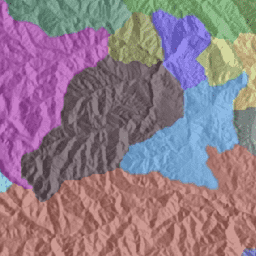
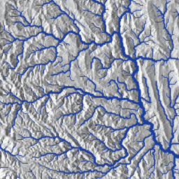
WWF HydroSHEDS 盆地级别 1

HydroSHEDS 是一种地图产品,可提供格式一致的水文地理信息,适用于区域和全球范围的应用。它提供了一套不同比例的地理参考数据集(矢量和栅格),包括河流网络、分水岭边界、排水方向和流量累积。HydroSHEDS 基于… 地球物理 水文地理 水文 HydroSHEDS SRTM 地表水-地下水 -
WWF HydroSHEDS 盆地级别 10
HydroSHEDS 是一种地图产品,可提供格式一致的水文地理信息,适用于区域和全球范围的应用。它提供了一套不同比例的地理参考数据集(矢量和栅格),包括河流网络、分水岭边界、排水方向和流量累积。HydroSHEDS 基于… 地球物理 水文地理 水文 HydroSHEDS SRTM 地表水-地下水 -
WWF HydroSHEDS 盆地级别 11

HydroSHEDS 是一种地图产品,可提供格式一致的水文地理信息,适用于区域和全球范围的应用。它提供了一套不同比例的地理参考数据集(矢量和栅格),包括河流网络、分水岭边界、排水方向和流量累积。HydroSHEDS 基于… 地球物理 水文地理 水文 HydroSHEDS SRTM 地表水-地下水 -
WWF HydroSHEDS 盆地级别 12

HydroSHEDS 是一种地图产品,可提供格式一致的水文地理信息,适用于区域和全球范围的应用。它提供了一套不同比例的地理参考数据集(矢量和栅格),包括河流网络、分水岭边界、排水方向和流量累积。HydroSHEDS 基于… 地球物理 水文地理 水文 HydroSHEDS SRTM 地表水-地下水 -
WWF HydroSHEDS 盆地级别 2

HydroSHEDS 是一种地图产品,可提供格式一致的水文地理信息,适用于区域和全球范围的应用。它提供了一套不同比例的地理参考数据集(矢量和栅格),包括河流网络、分水岭边界、排水方向和流量累积。HydroSHEDS 基于… 地球物理 水文地理 水文 HydroSHEDS SRTM 地表水-地下水 -
WWF HydroSHEDS 盆地级别 3

HydroSHEDS 是一种地图产品,可提供格式一致的水文地理信息,适用于区域和全球范围的应用。它提供了一套不同比例的地理参考数据集(矢量和栅格),包括河流网络、分水岭边界、排水方向和流量累积。HydroSHEDS 基于… 地球物理 水文地理 水文 HydroSHEDS SRTM 地表水-地下水 -
WWF HydroSHEDS 盆地级别 4

HydroSHEDS 是一种地图产品,可提供格式一致的水文地理信息,适用于区域和全球范围的应用。它提供了一套不同比例的地理参考数据集(矢量和栅格),包括河流网络、分水岭边界、排水方向和流量累积。HydroSHEDS 基于… 地球物理 水文地理 水文 HydroSHEDS SRTM 地表水-地下水 -
WWF HydroSHEDS 流域级别 5

HydroSHEDS 是一种地图产品,可提供格式一致的水文地理信息,适用于区域和全球范围的应用。它提供了一套不同比例的地理参考数据集(矢量和栅格),包括河流网络、分水岭边界、排水方向和流量累积。HydroSHEDS 基于… 地球物理 水文地理 水文 HydroSHEDS SRTM 地表水-地下水 -
WWF HydroSHEDS 盆地第 6 级

HydroSHEDS 是一种地图产品,可提供格式一致的水文地理信息,适用于区域和全球范围的应用。它提供了一套不同比例的地理参考数据集(矢量和栅格),包括河流网络、分水岭边界、排水方向和流量累积。HydroSHEDS 基于… 地球物理 水文地理 水文 HydroSHEDS SRTM 地表水-地下水 -
WWF HydroSHEDS 盆地第 7 级

HydroSHEDS 是一种地图产品,可提供格式一致的水文地理信息,适用于区域和全球范围的应用。它提供了一套不同比例的地理参考数据集(矢量和栅格),包括河流网络、分水岭边界、排水方向和流量累积。HydroSHEDS 基于… 地球物理 水文地理 水文 HydroSHEDS SRTM 地表水-地下水 -
WWF HydroSHEDS 盆地 8 级

HydroSHEDS 是一种地图产品,可提供格式一致的水文地理信息,适用于区域和全球范围的应用。它提供了一套不同比例的地理参考数据集(矢量和栅格),包括河流网络、分水岭边界、排水方向和流量累积。HydroSHEDS 基于… 地球物理 水文地理 水文 HydroSHEDS SRTM 地表水-地下水 -
WWF HydroSHEDS 流域第 9 级

HydroSHEDS 是一种地图产品,可提供格式一致的水文地理信息,适用于区域和全球范围的应用。它提供了一套不同比例的地理参考数据集(矢量和栅格),包括河流网络、分水岭边界、排水方向和流量累积。HydroSHEDS 基于… 地球物理 水文地理 水文 HydroSHEDS SRTM 地表水-地下水 -
WWF HydroSHEDS 排水方向,15 角秒
HydroSHEDS 是一种地图产品,可提供格式一致的水文地理信息,适用于区域和全球范围的应用。它提供了一套不同比例的地理参考数据集(矢量和栅格),包括河流网络、分水岭边界、排水方向和流量累积。HydroSHEDS 基于… 方向 排水 流向 地球物理 水文地理 水文 -
WWF HydroSHEDS 水流方向,3 角秒

HydroSHEDS 是一种地图产品,可提供格式一致的水文地理信息,适用于区域和全球范围的应用。它提供了一套不同比例的地理参考数据集(矢量和栅格),包括河流网络、分水岭边界、排水方向和流量累积。HydroSHEDS 基于… 方向 排水 流向 地球物理 水文地理 水文 -
WWF HydroSHEDS 水流方向,30 角秒

HydroSHEDS 是一种地图产品,可提供格式一致的水文地理信息,适用于区域和全球范围的应用。它提供了一套不同比例的地理参考数据集(矢量和栅格),包括河流网络、分水岭边界、排水方向和流量累积。HydroSHEDS 基于… 方向 排水 流向 地球物理 水文地理 水文 -
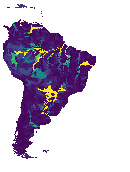
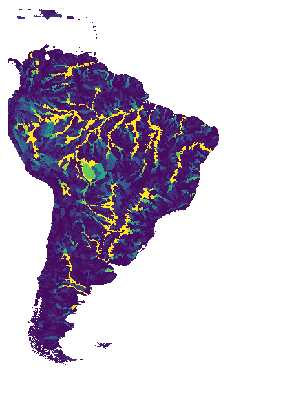
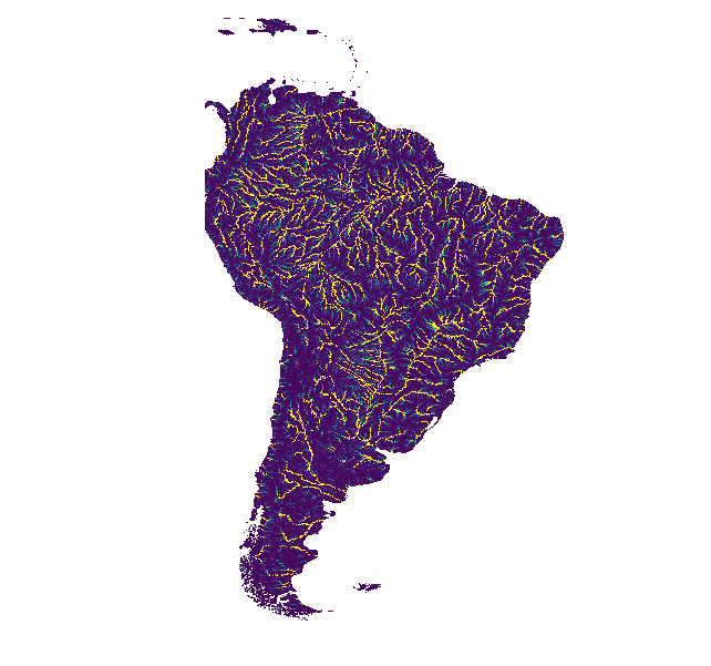
WWF HydroSHEDS 流向累积,15 角秒

HydroSHEDS 是一种地图产品,可提供格式一致的水文地理信息,适用于区域和全球范围的应用。它提供了一套不同比例的地理参考数据集(矢量和栅格),包括河流网络、分水岭边界、排水方向和流量累积。HydroSHEDS 基于… 累积 排水 流 地球物理 水文地理 水文 -
WWF HydroSHEDS 流向累积,30 角秒

HydroSHEDS 是一种地图产品,可提供格式一致的水文地理信息,适用于区域和全球范围的应用。它提供了一套不同比例的地理参考数据集(矢量和栅格),包括河流网络、分水岭边界、排水方向和流量累积。HydroSHEDS 基于… 累积 排水 流 地球物理 水文地理 水文 -
WWF HydroSHEDS Free Flowing Rivers Network v1
HydroSHEDS 是一种地图产品,可提供格式一致的水文地理信息,适用于区域和全球范围的应用。它提供了一套不同比例的地理参考数据集(矢量和栅格),包括河流网络、分水岭边界、排水方向和流量累积。HydroSHEDS 基于… 地球物理 水文地理 水文 HydroSHEDS SRTM 地表水-地下水 -
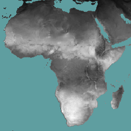
WWF HydroSHEDS 水文条件 DEM,15 角秒

HydroSHEDS 是一种地图产品,可提供格式一致的水文地理信息,适用于区域和全球范围的应用。它提供了一套不同比例的地理参考数据集(矢量和栅格),包括河流网络、分水岭边界、排水方向和流量累积。HydroSHEDS 基于… 有条件 dem 海拔 地球物理 水文 水文 -
WWF HydroSHEDS 水文条件 DEM,3 角秒
HydroSHEDS 是一种地图产品,可提供格式一致的水文地理信息,适用于区域和全球范围的应用。它提供了一套不同比例的地理参考数据集(矢量和栅格),包括河流网络、分水岭边界、排水方向和流量累积。HydroSHEDS 基于… 有条件 dem 海拔 地球物理 水文 水文 -
WWF HydroSHEDS 水文条件 DEM,30 角秒
HydroSHEDS 是一种地图产品,可提供格式一致的水文地理信息,适用于区域和全球范围的应用。它提供了一套不同比例的地理参考数据集(矢量和栅格),包括河流网络、分水岭边界、排水方向和流量累积。HydroSHEDS 基于… 有条件 dem 海拔 地球物理 水文 水文 -
WWF HydroSHEDS 空白填充 DEM,3 角秒
HydroSHEDS 是一种地图产品,可提供格式一致的水文地理信息,适用于区域和全球范围的应用。它提供了一套不同比例的地理参考数据集(矢量和栅格),包括河流网络、分水岭边界、排水方向和流量累积。HydroSHEDS 基于… dem 海拔 地球物理 水文地理 水文 hydrosheds
Datasets tagged water in Earth Engine
[null,null,[],[],["The content describes numerous datasets focused on water resources and related environmental factors. Key datasets include WAPOR's measures of evapotranspiration, evaporation, interception, net primary production, and reference evapotranspiration. Other datasets include GLCF's inland water mapping, global flood data, HYCOM's ocean model data, JRC's global surface water mapping, and GRACE's monthly mass grids. Additional datasets cover weather, climate, evapotranspiration models from OpenET, and watershed boundaries from USGS, HydroATLAS, and HydroSHEDS. Tags classify each dataset for searchability.\n"]]