- مدى توفّر مجموعة البيانات
- 2018-01-01T00:00:00Z–2025-12-11T00:00:00Z
- مزوّد مجموعة البيانات
- منظمة الأغذية والزراعة التابعة للأمم المتحدة
- سلسلة نقاط التواصل
- 10 أيام
- العلامات
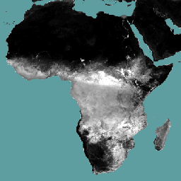
الوصف
التبخّر والنتح الفعليان والاعتراض (ETIa) (كل 10 أيام، بالملليمتر/اليوم) هو مجموع التبخّر من التربة (E) والنتح من الغطاء النباتي (T) والتبخّر من مياه الأمطار التي تم اعتراضها بواسطة الأوراق (I). تمثّل قيمة كل بكسل متوسط مؤشر ETIa اليومي في فترة عشرية معيّنة.
النطاقات
حجم البكسل
248.2 متر
النطاقات
| الاسم | الوحدات | النطاق | حجم البكسل | الوصف |
|---|---|---|---|---|
L1-AETI-D |
مم | 0.1 | متر | التبخّر والنتح الفعلي والاعتراض (كل 10 أيام) [ملم] |
بنود الاستخدام
بنود الاستخدام
منظمة الأغذية والزراعة التابعة للأمم المتحدة (الفاو) هي منظمة مكلفة بجمع وتحليل وتفسير ونشر المعلومات المتعلقة بالتغذية والغذاء والزراعة. وفي هذا الصدد، تنشر المنظمة عددًا من قواعد البيانات حول مواضيع ذات صلة بولايتها، وتشجّع على استخدامها لأغراض علمية وبحثية. بما يتوافق مع مبادئ الانفتاح والمشاركة المنصوص عليها في ترخيص البيانات المفتوحة لقواعد البيانات الإحصائية، وبما يتوافق مع ولاية منظمة الأغذية والزراعة، تتوفّر البيانات من بوابة الوصول المفتوح إلى إنتاجية المياه (WaPOR)، كجزء من AQUASTAT - نظام المعلومات العالمي التابع لمنظمة الأغذية والزراعة بشأن المياه والزراعة، مجانًا لمجتمع المستخدمين.
الاقتباسات
منظمة الأغذية والزراعة 2018. WaPOR Database Methodology: Level 1. Remote Sensing for Water Productivity Technical Report: Methodology Series. روما، منظمة الأغذية والزراعة. 72 صفحة
منظمة الأغذية والزراعة 2020. WaPOR V2 Database Methodology. Remote Sensing for Water Productivity Technical Report: Methodology Series. روما، منظمة الأغذية والزراعة (الفاو). https://www.fao.org/3/ca9894en/CA9894EN.pdf
الاستكشاف باستخدام Earth Engine
أداة تعديل الرموز (JavaScript)
var coll = ee.ImageCollection('FAO/WAPOR/3/L1_AETI_D');
var image = coll.first();
Map.setCenter(17.5, 20, 3);
Map.addLayer(image, {min: 0, max: 50});