רכיב הנתונים של היירוט (I) (עשרוני, במילימטרים ליום) מייצג את האידוי של מי גשמים שייורטו מחופת הצמחייה. התהליך שבו העלים קולטים את מי הגשמים. חלק מהגשם שנקלט יתאדה שוב. הערך של כל פיקסל מייצג את הממוצע היומי של כמות המים שמתאדים מהצמחייה באותו דקאד ספציפי.
תחום תדרים
גודל הפיקסל 248.2 מטרים
תחום תדרים
שם
יחידות
קנה מידה
גודל הפיקסל
תיאור
L1-I-D
מ"מ
0.1
מטרים
Interception (Dekadal) [mm]
תנאים והגבלות
תנאים והגבלות
הארגון למזון וחקלאות של האו"ם (FAO) מוסמך לאסוף, לנתח, לפרש ולהפיץ מידע שקשור לתזונה, למזון ולחקלאות. לכן, הארגון מפרסם מספר מסדי נתונים בנושאים שקשורים למנדט שלו, ומעודד את השימוש בהם למטרות מדעיות ומחקריות. בהתאם לעקרונות של פתיחות ושיתוף שמופיעים ברישיון לנתונים פתוחים עבור מסדי נתונים סטטיסטיים, ובהתאם למנדט של FAO, נתונים מפורטל הגישה הפתוחה של Water Productivity (WaPOR), כחלק מAQUASTAT – מערכת המידע הגלובלית של FAO בנושא מים וחקלאות, זמינים בחינם לקהילת המשתמשים.
ציטוטים ביבליוגרפיים
ציטוטים ביבליוגרפיים:
FAO 2023. WaPOR Database Methodology: Level 1. חישה מרחוק לצורך מדידת פרודוקטיביות המים
דוח טכני: סדרת מתודולוגיות. רומא, FAO. 72 דפים.
רכיב הנתונים של ההתייצבות (I) (עשרוני, במילימטרים ליום) מייצג את האידוי של מי הגשמים שהתייצבו מחופת הצמחייה. יירוט הוא התהליך שבו העלים קולטים את מי הגשמים. חלק מהגשם שנקלט יתאדה שוב. הערך של כל פיקסל מייצג את הממוצע היומי של ההתאיידות של ההפרעה לאותו …
[null,null,[],[],[],null,["Dataset Availability\n: 2009-01-01T00:00:00Z--2025-08-11T00:00:00Z\n\nDataset Provider\n:\n\n\n [FAO UN](https://www.fao.org/in-action/remote-sensing-for-water-productivity/wapor-data-access/en)\n\nCadence\n: 10 Days\n\nTags\n:\n[agriculture](/earth-engine/datasets/tags/agriculture) [fao](/earth-engine/datasets/tags/fao) [wapor](/earth-engine/datasets/tags/wapor) [water](/earth-engine/datasets/tags/water) [water-vapor](/earth-engine/datasets/tags/water-vapor) \n\nDescription \nThe interception (I) data component (dekadal, in mm/day) represents the evaporation\nof intercepted rainfall from the vegetation canopy. Interception is the process\nwhere rainfall is captured by the leaves. Part of this captured rainfall will\nevaporate again. The value of each pixel represents the average daily evaporated\ninterception for that specific dekad.\n\nBands\n\n\n**Pixel Size**\n\n248.2 meters\n\n**Bands**\n\n| Name | Units | Scale | Pixel Size | Description |\n|----------|-------|-------|------------|-------------------------------|\n| `L1-I-D` | mm | 0.1 | meters | Interception (Dekadal) \\[mm\\] |\n\nTerms of Use\n\n**Terms of Use**\n\nThe Food and Agriculture Organization of the United Nations (FAO) is\nmandated to collect, analyze, interpret, and disseminate information related\nto nutrition, food, and agriculture. In this regard, it publishes a number\nof databases on topics related to FAO's mandate, and encourages the use of\nthem for scientific and research purposes. Consistent with the principles\nof openness and sharing envisioned under the [Open Data Licensing For\nStatistical Databases](http://www.fao.org/3/ca7570en/ca7570en.pdf), and\nconsistent with the mandate of FAO, data from the [Water Productivity Open\nAccess Portal (WaPOR)](https://www.fao.org/in-action/remote-sensing-for-water-productivity/wapor-data-access/en), as part\nof [AQUASTAT](http://www.fao.org/aquastat/en/) - FAO's Global Information\nSystem on Water and Agriculture, is available free to the user community.\n\nCitations \nCitations:\n\n- FAO 2023. WaPOR Database Methodology: Level 1. Remote Sensing for Water Productivity\n Technical Report: Methodology Series. Rome, FAO. 72 pages.\n- FAO 2023. WaPOR V3 Database Methodology. Remote Sensing for Water\n Productivity Technical Report: Methodology Series. Rome, FAO.\n \u003chttps://www.fao.org/3/cc6964en/cc6964en.pdf
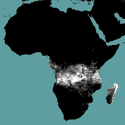
\u003e\n\nExplore with Earth Engine **Important:** Earth Engine is a platform for petabyte-scale scientific analysis and visualization of geospatial datasets, both for public benefit and for business and government users. Earth Engine is free to use for research, education, and nonprofit use. To get started, please [register for Earth Engine access.](https://console.cloud.google.com/earth-engine)\n\nCode Editor (JavaScript) \n\n```javascript\nvar coll = ee.ImageCollection('FAO/WAPOR/3/L1_I_D');\nvar image = coll.first();\nMap.setCenter(17.5, 20, 3);\nMap.addLayer(image, {min: 0, max: 50});\n```\n[Open in Code Editor](https://code.earthengine.google.com/?scriptPath=Examples:Datasets/FAO/FAO_WAPOR_3_L1_I_D) \n[WAPOR Dekadal Interception 3.0](/earth-engine/datasets/catalog/FAO_WAPOR_3_L1_I_D) \nThe interception (I) data component (dekadal, in mm/day) represents the evaporation of intercepted rainfall from the vegetation canopy. Interception is the process where rainfall is captured by the leaves. Part of this captured rainfall will evaporate again. The value of each pixel represents the average daily evaporated interception for that ... \nFAO/WAPOR/3/L1_I_D, agriculture,fao,wapor,water,water-vapor \n2009-01-01T00:00:00Z/2025-08-11T00:00:00Z \n-40.0044644 -30.0044643 40.0044643 65.0044644 \nGoogle Earth Engine \nhttps://developers.google.com/earth-engine/datasets\n\n- [](https://doi.org/https://www.fao.org/in-action/remote-sensing-for-water-productivity/wapor-data-access/en)\n- [](https://doi.org/https://developers.google.com/earth-engine/datasets/catalog/FAO_WAPOR_3_L1_I_D)"]]