Yakalanan yağış (I) veri bileşeni (on günlük, mm/gün cinsinden), yakalanan yağışın bitki örtüsü kanopisinde buharlaşmasını ifade eder. Yağmurun yapraklar tarafından tutulmasına yağmur tutma denir. Bu yağmur suyunun bir kısmı tekrar buharlaşır. Her pikselin değeri, söz konusu dekad için ortalama günlük buharlaşan yağmur suyu miktarını gösterir.
Bantlar
Piksel Boyutu 248,2 metre
Bantlar
Ad
Birimler
Ölçek
Piksel Boyutu
Açıklama
L1-I-D
mm
0,1
metre
Yakalanan yağış (Dekadal) [mm]
Kullanım Şartları
Kullanım Şartları
Birleşmiş Milletler Gıda ve Tarım Örgütü (FAO), beslenme, gıda ve tarımla ilgili bilgileri toplamak, analiz etmek, yorumlamak ve yaymakla görevlidir. Bu bağlamda, FAO'nun yetki alanıyla ilgili konularda bir dizi veritabanı yayınlar ve bunların bilimsel ve araştırma amaçlı kullanımını teşvik eder. Open Data Licensing For Statistical Databases (İstatistik Veritabanları İçin Açık Veri Lisanslama) kapsamında öngörülen açıklık ve paylaşım ilkeleriyle tutarlı olarak ve FAO'nun yetkisiyle uyumlu şekilde, AQUASTAT'ın (FAO'nun Su ve Tarım Konusundaki Küresel Bilgi Sistemi) bir parçası olan Water Productivity Open Access Portal (WaPOR)'daki (Su Verimliliği Açık Erişim Portalı) veriler, kullanıcı topluluğuna ücretsiz olarak sunulur.
Alıntılar
Alıntılar:
FAO 2023. WaPOR Database Methodology: Level 1. Su Verimliliği İçin Uzaktan Algılama
Teknik Rapor: Metodoloji Serisi. Roma, FAO. 72 sayfa.
Yakalanan yağışın bitki örtüsü tarafından buharlaşmasını ifade eden, yakalama (I) veri bileşeni (mm/gün cinsinden, on günlük) Yağmurun yapraklar tarafından tutulması işlemine yağmur tutma denir. Bu yağmur suyunun bir kısmı tekrar buharlaşır. Her pikselin değeri, söz konusu … için ortalama günlük buharlaşan yağmur suyu miktarını gösterir.
[null,null,[],[],[],null,["Dataset Availability\n: 2009-01-01T00:00:00Z--2025-08-11T00:00:00Z\n\nDataset Provider\n:\n\n\n [FAO UN](https://www.fao.org/in-action/remote-sensing-for-water-productivity/wapor-data-access/en)\n\nCadence\n: 10 Days\n\nTags\n:\n[agriculture](/earth-engine/datasets/tags/agriculture) [fao](/earth-engine/datasets/tags/fao) [wapor](/earth-engine/datasets/tags/wapor) [water](/earth-engine/datasets/tags/water) [water-vapor](/earth-engine/datasets/tags/water-vapor) \n\nDescription \nThe interception (I) data component (dekadal, in mm/day) represents the evaporation\nof intercepted rainfall from the vegetation canopy. Interception is the process\nwhere rainfall is captured by the leaves. Part of this captured rainfall will\nevaporate again. The value of each pixel represents the average daily evaporated\ninterception for that specific dekad.\n\nBands\n\n\n**Pixel Size**\n\n248.2 meters\n\n**Bands**\n\n| Name | Units | Scale | Pixel Size | Description |\n|----------|-------|-------|------------|-------------------------------|\n| `L1-I-D` | mm | 0.1 | meters | Interception (Dekadal) \\[mm\\] |\n\nTerms of Use\n\n**Terms of Use**\n\nThe Food and Agriculture Organization of the United Nations (FAO) is\nmandated to collect, analyze, interpret, and disseminate information related\nto nutrition, food, and agriculture. In this regard, it publishes a number\nof databases on topics related to FAO's mandate, and encourages the use of\nthem for scientific and research purposes. Consistent with the principles\nof openness and sharing envisioned under the [Open Data Licensing For\nStatistical Databases](http://www.fao.org/3/ca7570en/ca7570en.pdf), and\nconsistent with the mandate of FAO, data from the [Water Productivity Open\nAccess Portal (WaPOR)](https://www.fao.org/in-action/remote-sensing-for-water-productivity/wapor-data-access/en), as part\nof [AQUASTAT](http://www.fao.org/aquastat/en/) - FAO's Global Information\nSystem on Water and Agriculture, is available free to the user community.\n\nCitations \nCitations:\n\n- FAO 2023. WaPOR Database Methodology: Level 1. Remote Sensing for Water Productivity\n Technical Report: Methodology Series. Rome, FAO. 72 pages.\n- FAO 2023. WaPOR V3 Database Methodology. Remote Sensing for Water\n Productivity Technical Report: Methodology Series. Rome, FAO.\n \u003chttps://www.fao.org/3/cc6964en/cc6964en.pdf
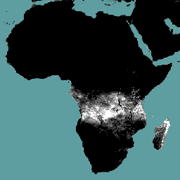
\u003e\n\nExplore with Earth Engine **Important:** Earth Engine is a platform for petabyte-scale scientific analysis and visualization of geospatial datasets, both for public benefit and for business and government users. Earth Engine is free to use for research, education, and nonprofit use. To get started, please [register for Earth Engine access.](https://console.cloud.google.com/earth-engine)\n\nCode Editor (JavaScript) \n\n```javascript\nvar coll = ee.ImageCollection('FAO/WAPOR/3/L1_I_D');\nvar image = coll.first();\nMap.setCenter(17.5, 20, 3);\nMap.addLayer(image, {min: 0, max: 50});\n```\n[Open in Code Editor](https://code.earthengine.google.com/?scriptPath=Examples:Datasets/FAO/FAO_WAPOR_3_L1_I_D) \n[WAPOR Dekadal Interception 3.0](/earth-engine/datasets/catalog/FAO_WAPOR_3_L1_I_D) \nThe interception (I) data component (dekadal, in mm/day) represents the evaporation of intercepted rainfall from the vegetation canopy. Interception is the process where rainfall is captured by the leaves. Part of this captured rainfall will evaporate again. The value of each pixel represents the average daily evaporated interception for that ... \nFAO/WAPOR/3/L1_I_D, agriculture,fao,wapor,water,water-vapor \n2009-01-01T00:00:00Z/2025-08-11T00:00:00Z \n-40.0044644 -30.0044643 40.0044643 65.0044644 \nGoogle Earth Engine \nhttps://developers.google.com/earth-engine/datasets\n\n- [](https://doi.org/https://www.fao.org/in-action/remote-sensing-for-water-productivity/wapor-data-access/en)\n- [](https://doi.org/https://developers.google.com/earth-engine/datasets/catalog/FAO_WAPOR_3_L1_I_D)"]]