- זמינות קבוצת הנתונים
- 2018-01-01T00:00:00Z–2025-12-29T00:00:00Z
- ספק קבוצת הנתונים
- הארגון למזון וחקלאות של האו"ם
- קצב
- יום אחד
- תגים
תיאור
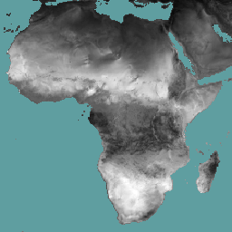
האידוי והדיות הפוטנציאליים (RET) מוגדרים כאידוי והדיות של גידול חקלאי היפותטי לייחוס, והם מדמים את ההתנהגות של משטח דשא מושקה היטב. כל פיקסל מייצג את האידוי והדיות היומיים במילימטרים.
רצועות
גודל הפיקסל
18,924 מטרים
רצועות
| שם | יחידות | קנה מידה | גודל הפיקסל | תיאור |
|---|---|---|---|---|
L1-RET-E |
מ"מ | 0.1 | מטרים | אידוי ודיות לייחוס (יומי) [מ"מ] |
תנאים והגבלות
תנאים והגבלות
הארגון למזון וחקלאות של האו"ם (FAO) מוסמך לאסוף, לנתח, לפרש ולהפיץ מידע שקשור לתזונה, למזון ולחקלאות. לכן, הארגון מפרסם מספר מסדי נתונים בנושאים שקשורים למנדט שלו, ומעודד את השימוש בהם למטרות מחקר ולמטרות מדעיות. בהתאם לעקרונות של פתיחות ושיתוף שמופיעים ברישיון לנתונים פתוחים עבור מסדי נתונים סטטיסטיים, ובהתאם למנדט של FAO, הארגון מעמיד בחינם לרשותה של קהילת המשתמשים נתונים מ-Water Productivity Open Access Portal (הפורטל בגישה פתוחה לנושאי פרודוקטיביות של שימוש במים – WaPOR), כחלק מ-AQUASTAT – מערכת המידע הגלובלית של FAO בנושאי מים וחקלאות.
ציטוטים ביבליוגרפיים
FAO 2018. WaPOR Database Methodology: Level 1. Remote Sensing for Water Productivity Technical Report: Methodology Series. Rome, FAO. 72 דפים.
FAO 2020. WaPOR V2 Database Methodology. Remote Sensing for Water Productivity Technical Report: Methodology Series. Rome, FAO. https://www.fao.org/3/ca9894en/CA9894EN.pdf
סיור עם פלטפורמת Earth Engine
Code Editor (JavaScript)
var coll = ee.ImageCollection('FAO/WAPOR/3/L1_RET_E');
var image = coll.first();
Map.setCenter(17.5, 20, 3);
Map.addLayer(image, {min: 0, max: 100});