- Ketersediaan Set Data
- 2018-01-01T00:00:00Z–2025-12-29T00:00:00Z
- Penyedia Set Data
- FAO PBB
- Frekuensi
- 1 Hari
- Tag
Deskripsi
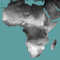
Evapotranspirasi referensi (RET) didefinisikan sebagai evapotranspirasi dari tanaman referensi hipotetis dan mensimulasikan perilaku permukaan rumput yang diairi dengan baik. Setiap piksel mewakili evapotranspirasi referensi harian dalam mm.
Band
Ukuran Piksel
18924 meter
Band
| Nama | Unit | Skala | Ukuran Piksel | Deskripsi |
|---|---|---|---|---|
L1-RET-E |
mm | 0,1 | meter | Evapotranspirasi Referensi (Harian) [mm] |
Persyaratan Penggunaan
Persyaratan Penggunaan
Food and Agriculture Organization of the United Nations (FAO) diberi mandat untuk mengumpulkan, menganalisis, menafsirkan, dan menyebarkan informasi terkait nutrisi, makanan, dan pertanian. Dalam hal ini, FAO memublikasikan sejumlah database tentang topik yang terkait dengan mandatnya, dan mendorong penggunaan database tersebut untuk tujuan ilmiah dan penelitian. Sesuai dengan prinsip keterbukaan dan berbagi yang diatur dalam Open Data Licensing For Statistical Databases, dan sesuai dengan mandat FAO, data dari Water Productivity Open Access Portal (WaPOR), sebagai bagian dari AQUASTAT - Sistem Informasi Global FAO tentang Air dan Pertanian, tersedia secara gratis untuk komunitas pengguna.
Kutipan
FAO 2018. Metodologi Database WaPOR: Level 1. Remote Sensing for Water Productivity Technical Report: Methodology Series. Roma, FAO. 72 halaman.
FAO 2020. Metodologi Database WaPOR V2. Remote Sensing for Water Productivity Technical Report: Methodology Series. Roma, FAO. https://www.fao.org/3/ca9894en/CA9894EN.pdf
Mengeksplorasi dengan Earth Engine
Editor Kode (JavaScript)
var coll = ee.ImageCollection('FAO/WAPOR/3/L1_RET_E');
var image = coll.first();
Map.setCenter(17.5, 20, 3);
Map.addLayer(image, {min: 0, max: 100});