- Veri Kümesi Kullanılabilirliği
- 2009-01-01T00:00:00Z–2026-04-11T00:00:00Z
- Veri Kümesi Üreticisi
- FAO UN
- Adım frekansı
- 10 gün
- Etiketler
Açıklama
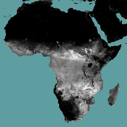
Terleme (T) veri bileşeni (on günlük, mm/gün cinsinden), bitki örtüsünün gerçek terlemesidir. Her pikselin değeri, söz konusu dekad için ortalama günlük gerçek terlemeyi gösterir.
Bantlar
Bantlar
Piksel boyutu: 248,2 metre (tüm bantlar)
| Ad | Birimler | Ölçek | Piksel Boyutu | Açıklama |
|---|---|---|---|---|
L1-T-D |
mm | 0,1 | 248,2 metre | Terleme (Dekadal) [mm] |
Kullanım Şartları
Kullanım Şartları
Birleşmiş Milletler Gıda ve Tarım Örgütü (FAO), beslenme, gıda ve tarımla ilgili bilgileri toplamak, analiz etmek, yorumlamak ve yaymakla görevlidir. Bu bağlamda, FAO'nun yetki alanıyla ilgili konularda bir dizi veritabanı yayınlar ve bunların bilimsel ve araştırma amaçlı kullanımını teşvik eder. Open Data Licensing For Statistical Databases (İstatistik Veritabanları İçin Açık Veri Lisanslama) kapsamında öngörülen açıklık ve paylaşım ilkeleriyle tutarlı olarak ve FAO'nun yetkisi doğrultusunda, AQUASTAT'ın (FAO'nun Su ve Tarım Konusundaki Küresel Bilgi Sistemi) bir parçası olan Water Productivity Open Access Portal (WaPOR)'daki (Su Verimliliği Açık Erişim Portalı) veriler kullanıcı topluluğuna ücretsiz olarak sunulur.
Alıntılar
FAO 2018. WaPOR Database Methodology: Level 1. Su Verimliliği İçin Uzaktan Algılama Teknik Raporu: Metodoloji Serisi. Roma, FAO. 72 sayfa
FAO 2020. WaPOR V2 Veritabanı Metodolojisi. Su Verimliliği İçin Uzaktan Algılama Teknik Raporu: Metodoloji Serisi. Rome, FAO. https://www.fao.org/3/ca9894en/CA9894EN.pdf
Earth Engine ile Keşif
Kod Düzenleyici (JavaScript)
var coll = ee.ImageCollection('FAO/WAPOR/3/L1_T_D');
var image = coll.first();
Map.setCenter(17.5, 20, 3);
Map.addLayer(image, {min: 0, max: 50});