- Disponibilidade do conjunto de dados
- 1999-01-01T00:00:00Z–2020-01-01T00:00:00Z
- Produtor de conjunto de dados
- Tags
Descrição
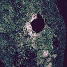
Essa coleção contém resultados pré-calculados da execução do algoritmo de detecção e classificação de mudanças contínuas (CCDC, na sigla em inglês) em 20 anos de dados de refletância da superfície do Landsat. O CCDC é um algoritmo de descoberta de pontos de interrupção que usa ajuste harmônico com um limite dinâmico de RMSE para detectar pontos de interrupção em dados de série temporal.
O conjunto de dados foi criado com base nas séries temporais de refletância de superfície do Landsat 5, 7 e 8 Collection-1, Tier-1, usando todas as imagens diurnas entre 01/01/1999 e 31/12/2019. Cada imagem foi pré-processada para mascarar pixels identificados como nuvem, sombra ou neve (de acordo com a banda "pixel_qa"), pixels saturados e pixels com uma opacidade atmosférica > 300 (conforme identificado pelas bandas "sr_atmos_opacity" e "sr_aerosol"). Os pixels repetidos na sobreposição de cenas norte/sul foram duplicados. Os resultados foram gerados em blocos de 2 graus para todas as massas de terra entre -60° e +85° de latitude. As imagens são adequadas para simplesmente mosaic() em uma imagem global.
O algoritmo CCDC foi executado com os parâmetros padrão, exceto dateFormat:
- tmaskBands: ['green', 'swir']
- minObservations: 6
- chiSquareProbability: 0.99
- minNumOfYearsScaler: 1.33
- dateFormat: 1 (ano fracionário)
- lambda: 20
- maxIterations: 25000
Cada pixel na saída é codificado usando matrizes de comprimento variável. O comprimento externo de cada matriz (eixo 0) corresponde ao número de pontos de interrupção encontrados naquele local. As bandas de coeficientes contêm matrizes bidimensionais, em que cada matriz interna contém os fatores de escalonamento para os oito termos no modelo harmônico linear, na ordem: [offset, t, cos(ωt), sin(ωt), cos(2ωt), sin(2ωt), cos(3ωt), sin(3ωt)], em que ω = 2Π. Os modelos são dimensionados para produzir unidades de refletância (0,0 a 1,0) para as bandas ópticas e graus (K) / 100,0 para a banda térmica.
Note que, como as bandas de saída são matrizes, só é possível reduzir a resolução delas usando uma política de pirâmide SAMPLE. Em níveis de zoom mais baixos, os resultados geralmente não são mais representativos dos dados de resolução total. Por exemplo, os limites dos blocos podem ser vistos devido às máscaras com redução de resolução. Portanto, não é recomendável usar esse conjunto de dados em resoluções menores que 240 m/pixel.
Não há planos atuais de adicionar recursos de 2020 em diante a esse conjunto de dados.
Bandas
Bandas
Tamanho do pixel: 30 metros (todas as bandas)
| Nome | Tamanho do pixel | Descrição |
|---|---|---|
tStart |
30 metros | Matriz unidimensional que contém a data de início de cada segmento (ano fracionário). |
tEnd |
30 metros | Matriz unidimensional que contém a data do fim de cada segmento (ano fracionário). |
tBreak |
30 metros | Matriz unidimensional que contém a data do ponto de interrupção detectado de cada segmento (ano fracionário). |
numObs |
30 metros | Matriz unidimensional que contém o número de observações encontradas em cada segmento. |
changeProb |
30 metros | Uma pseudoprobabilidade de que o ponto de interrupção detectado seja real. |
BLUE_coefs |
30 metros | Matriz bidimensional que contém coeficientes do modelo harmônico para a banda azul de cada segmento. |
GREEN_coefs |
30 metros | Matriz bidimensional que contém coeficientes do modelo harmônico para a banda verde, para cada segmento. |
RED_coefs |
30 metros | Matriz bidimensional que contém coeficientes do modelo harmônico para a banda vermelha, para cada segmento. |
NIR_coefs |
30 metros | Matriz bidimensional que contém coeficientes do modelo harmônico para a banda do infravermelho próximo, para cada segmento. |
SWIR1_coefs |
30 metros | Matriz bidimensional que contém coeficientes do modelo harmônico para a banda de infravermelho de ondas curtas (1,55 μm a 1,75 μm) de cada segmento. |
SWIR2_coefs |
30 metros | Matriz bidimensional que contém coeficientes do modelo harmônico para a banda de infravermelho de ondas curtas (2,09 μm a 2,35 μm) de cada segmento. |
TEMP_coefs |
30 metros | Matriz bidimensional que contém coeficientes do modelo harmônico para a banda térmica de cada segmento. |
BLUE_rmse |
30 metros | Matriz unidimensional que contém o REMQ do modelo para a banda azul, em cada segmento. |
GREEN_rmse |
30 metros | Matriz unidimensional que contém o REMQ do modelo para a faixa verde, em cada segmento. |
RED_rmse |
30 metros | Matriz unidimensional que contém o REMQ do modelo para a banda vermelha, em cada segmento. |
NIR_rmse |
30 metros | Matriz unidimensional que contém o REMQ do modelo para a banda do infravermelho próximo em cada segmento. |
SWIR1_rmse |
30 metros | Matriz unidimensional que contém o REMQ do modelo para a banda de infravermelho de ondas curtas (1,55 μm a 1,75 μm) de cada segmento. |
SWIR2_rmse |
30 metros | Matriz unidimensional que contém o REMQ do modelo para a banda de infravermelho de ondas curtas (2,09 μm a 2,35 μm) em cada segmento. |
TEMP_rmse |
30 metros | Matriz unidimensional que contém o REMQ do modelo para a banda térmica em cada segmento. |
BLUE_magnitude |
30 metros | Matriz unidimensional que contém a magnitude do ponto de interrupção detectado para a banda azul em cada segmento. |
GREEN_magnitude |
30 metros | Matriz unidimensional que contém a magnitude do ponto de interrupção detectado para a faixa verde em cada segmento. |
RED_magnitude |
30 metros | Matriz unidimensional que contém a magnitude do ponto de interrupção detectado para a banda vermelha em cada segmento. |
NIR_magnitude |
30 metros | Matriz unidimensional que contém a magnitude do ponto de interrupção detectado para a banda do infravermelho próximo em cada segmento. |
SWIR1_magnitude |
30 metros | Matriz unidimensional que contém a magnitude do ponto de interrupção detectado para a banda de infravermelho de ondas curtas 1 (1,55 μm a 1,75 μm) em cada segmento. |
SWIR2_magnitude |
30 metros | Matriz unidimensional que contém a magnitude do ponto de interrupção detectado para a banda de infravermelho de ondas curtas 2 (2,09 μm a 2,35 μm) em cada segmento. |
TEMP_magnitude |
30 metros | Matriz unidimensional que contém a magnitude do ponto de interrupção detectado para a banda térmica em cada segmento. |
Termos de Uso
Termos de Uso