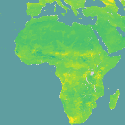
محتوى المياه الحجمي عند قوة امتصاص تبلغ 10 كيلو باسكال و33 كيلو باسكال و1500 كيلو باسكال بوحدة 10^-3 سم^3/سم^3 (0.1% من الحجم أو 1 ملم/م) عند 6 أعماق عادية (من 0 إلى 5 سم ومن 5 إلى 15 سم ومن 15 إلى 30 سم ومن 30 إلى 60 سم ومن 60 إلى 100 سم ومن 100 إلى 200 سم). تم استخلاص التوقعات باستخدام نهج رقمي لرسم خرائط التربة استنادًا إلى طريقة "الغابة العشوائية الكمية"، وذلك بالاستفادة من مجموعة عالمية من بيانات ملفات التربة الشخصية والطبقات البيئية.
تتضمّن مجموعة البيانات هذه توقّعات لثلاثة مستويات امتصاص مختلفة، ما يقدّم إحصاءات حول مدى توفّر المياه في التربة.
يتم تنظيم مجموعة البيانات في ثلاثة أصول رئيسية: /wv0010 و/wv0033 و/wv1500. تحتوي كل مادة عرض من هذه المواد على نطاقات تمثّل خصائص التربة على أعماق وكميات مختلفة. تتّبع أسماء النطاقات النمط val_<depth>_<quantile>، حيث يمثّل depth نطاق عمق التربة (على سبيل المثال، 0-5 سم، 5-15 سم، 15-30 سم، 30-60 سم، 60-100 سم، 100-200 سم) وquantile يمثّل مقياسًا إحصائيًا (مثل المتوسط، Q0.05، Q0.5، Q0.95).
لم يتم تضمين نطاق عدم اليقين بعد. يمكن حساب نسبة الخطأ من خلال نسبة المدى الربيعي (عرض فاصل التوقّع بنسبة% 90) إلى الوسيط: (Q0.95-Q0.05)/Q0.50.
Global mapping of volumetric water retention at 100, 330 and 15000 cm
suction using the WoSIS database
Turek M.E., Poggio L., Batjes N.H., Armindo R.A., de Jong van Lier Q.,
de Sousa L., Heuvelink G.B.M. (2023)
International Soil and Water Conservation Research, 11 (2), pp. 225-239.
محتوى الماء الحجمي عند قوة امتصاص تبلغ 10 كيلو باسكال و33 كيلو باسكال و1500 كيلو باسكال بوحدة 10^-3 سم^3/سم^3 (0.1% من الحجم أو 1 ملم/م) على 6 أعماق عادية (من 0 إلى 5 سم، ومن 5 إلى 15 سم، ومن 15 إلى 30 سم، ومن 30 إلى 60 سم، ومن 60 إلى 100 سم، ومن 100 إلى 200 سم). تم استخلاص التوقعات باستخدام أسلوب رسم خرائط التربة الرقمية استنادًا إلى "الغابة العشوائية الكمية"، بالاستفادة من مجموعة عالمية من بيانات ملفات التربة الشخصية …
[null,null,[],[],[],null,["# SoilGrids250m 2.0 - Volumetric Water Content\n\nDataset Availability\n: 1905-04-01T00:00:00Z--2016-07-05T00:00:00Z\n\nDataset Provider\n:\n\n\n [ISRIC - World Soil Information](https://www.isric.org/explore/soilgrids)\n\nTags\n:\n[soil](/earth-engine/datasets/tags/soil) [soil-moisture](/earth-engine/datasets/tags/soil-moisture) [water](/earth-engine/datasets/tags/water) \n\n#### Description\n\nVolumetric Water Content at 10kPa, 33kPa, and 1500kPa suction in\n10\\^-3 cm\\^3/cm\\^3 (0.1 v% or 1 mm/m) at 6 standard depths (0-5cm, 5-15cm,\n15-30cm, 30-60cm, 60-100cm, 100-200cm). Predictions were derived using a\ndigital soil mapping approach based on Quantile Random Forest, drawing on a\nglobal compilation of soil profile data and environmental layers.\nThis dataset includes predictions for three different suction levels,\nproviding insights into soil water availability.\n\nThe dataset is organized into three main assets: `/wv0010`, `/wv0033`,\nand `/wv1500`. Each of these assets contains bands representing soil\nproperties at different depths and quantiles. The band names follow the\npattern `val_\u003cdepth\u003e_\u003cquantile\u003e`, where `depth` represents a soil depth\nrange (e.g., 0-5cm, 5-15cm, 15-30cm, 30-60cm, 60-100cm, 100-200cm) and\n`quantile` represents a statistical measure (e.g., mean, Q0.05, Q0.5,\nQ0.95).\n\nThe uncertainty band is not yet included. It is possible to calculate\nthe uncertainty from the ratio between the inter-quantile range\n(90% prediction interval width) and the median: (Q0.95-Q0.05)/Q0.50.\n\nDocumentation:\n\n- [Scientific Paper](https://www.sciencedirect.com/science/article/pii/S2095633922000636?via%3Dihub)\n\n### Bands\n\n\n**Pixel Size**\n\n250 meters\n\n**Bands**\n\n| Name | Units | Pixel Size | Description |\n|-----------------------|-------------|------------|--------------------------------------------------|\n| `val_0_5cm_mean` | cm\\^3/cm\\^3 | meters | Mean Volumetric Water Content (0-5cm depth) |\n| `val_0_5cm_Q0_05` | cm\\^3/cm\\^3 | meters | Q0.05 Volumetric Water Content (0-5cm depth) |\n| `val_0_5cm_Q0_5` | cm\\^3/cm\\^3 | meters | Q0.5 Volumetric Water Content (0-5cm depth) |\n| `val_0_5cm_Q0_95` | cm\\^3/cm\\^3 | meters | Q0.95 Volumetric Water Content (0-5cm depth) |\n| `val_5_15cm_mean` | cm\\^3/cm\\^3 | meters | Mean Volumetric Water Content (5-15cm depth) |\n| `val_5_15cm_Q0_05` | cm\\^3/cm\\^3 | meters | Q0.05 Volumetric Water Content (5-15cm depth) |\n| `val_5_15cm_Q0_5` | cm\\^3/cm\\^3 | meters | Q0.5 Volumetric Water Content (5-15cm depth) |\n| `val_5_15cm_Q0_95` | cm\\^3/cm\\^3 | meters | Q0.95 Volumetric Water Content (5-15cm depth) |\n| `val_15_30cm_mean` | cm\\^3/cm\\^3 | meters | Mean Volumetric Water Content (15-30cm depth) |\n| `val_15_30cm_Q0_05` | cm\\^3/cm\\^3 | meters | Q0.05 Volumetric Water Content (15-30cm depth) |\n| `val_15_30cm_Q0_5` | cm\\^3/cm\\^3 | meters | Q0.5 Volumetric Water Content (15-30cm depth) |\n| `val_15_30cm_Q0_95` | cm\\^3/cm\\^3 | meters | Q0.95 Volumetric Water Content (15-30cm depth) |\n| `val_30_60cm_mean` | cm\\^3/cm\\^3 | meters | Mean Volumetric Water Content (30-60cm depth) |\n| `val_30_60cm_Q0_05` | cm\\^3/cm\\^3 | meters | Q0.05 Volumetric Water Content (30-60cm depth) |\n| `val_30_60cm_Q0_5` | cm\\^3/cm\\^3 | meters | Q0.5 Volumetric Water Content (30-60cm depth) |\n| `val_30_60cm_Q0_95` | cm\\^3/cm\\^3 | meters | Q0.95 Volumetric Water Content (30-60cm depth) |\n| `val_60_100cm_mean` | cm\\^3/cm\\^3 | meters | Mean Volumetric Water Content (60-100cm depth) |\n| `val_60_100cm_Q0_05` | cm\\^3/cm\\^3 | meters | Q0.05 Volumetric Water Content (60-100cm depth) |\n| `val_60_100cm_Q0_5` | cm\\^3/cm\\^3 | meters | Q0.5 Volumetric Water Content (60-100cm depth) |\n| `val_60_100cm_Q0_95` | cm\\^3/cm\\^3 | meters | Q0.95 Volumetric Water Content (60-100cm depth) |\n| `val_100_200cm_mean` | cm\\^3/cm\\^3 | meters | Mean Volumetric Water Content (100-200cm depth) |\n| `val_100_200cm_Q0_05` | cm\\^3/cm\\^3 | meters | Q0.05 Volumetric Water Content (100-200cm depth) |\n| `val_100_200cm_Q0_5` | cm\\^3/cm\\^3 | meters | Q0.5 Volumetric Water Content (100-200cm depth) |\n| `val_100_200cm_Q0_95` | cm\\^3/cm\\^3 | meters | Q0.95 Volumetric Water Content (100-200cm depth) |\n\n### Terms of Use\n\n**Terms of Use**\n\n[CC-BY-4.0](https://spdx.org/licenses/CC-BY-4.0.html)\n\n### Citations\n\nCitations:\n\n- Global mapping of volumetric water retention at 100, 330 and 15000 cm\n suction using the WoSIS database\n Turek M.E., Poggio L., Batjes N.H., Armindo R.A., de Jong van Lier Q.,\n de Sousa L., Heuvelink G.B.M. (2023)\n International Soil and Water Conservation Research, 11 (2), pp. 225-239.\n\n### DOIs\n\n- \u003chttps://doi.org/10.1016/j.iswcr.2022.08.001\u003e\n\n### Explore with Earth Engine\n\n| **Important:** Earth Engine is a platform for petabyte-scale scientific analysis and visualization of geospatial datasets, both for public benefit and for business and government users. Earth Engine is free to use for research, education, and nonprofit use. To get started, please [register for Earth Engine access.](https://console.cloud.google.com/earth-engine)\n\n### Code Editor (JavaScript)\n\n```javascript\nvar dataset = ee.Image('ISRIC/SoilGrids250m/v2_0/wv0010').select('val_0_5cm_Q0_95');\n\nMap.setCenter(-105.25, 52.5, 3);\n\nMap.addLayer(\n dataset, {\n min: -0.061,\n max: 0.636,\n palette: [\n '#440154', '#482878', '#3E4A89', '#31688E', '#26828E', '#1F9E89',\n '#35B779', '#6DCD59', '#B4DE2C', '#FDE725'\n ]\n },\n 'SoilGrids250m 10kPa Q0.95 0-5cm');\n```\n[Open in Code Editor](https://code.earthengine.google.com/?scriptPath=Examples:Datasets/ISRIC/ISRIC_SoilGrids250m_v2_0) \n[SoilGrids250m 2.0 - Volumetric Water Content](/earth-engine/datasets/catalog/ISRIC_SoilGrids250m_v2_0) \nVolumetric Water Content at 10kPa, 33kPa, and 1500kPa suction in 10\\^-3 cm\\^3/cm\\^3 (0.1 v% or 1 mm/m) at 6 standard depths (0-5cm, 5-15cm, 15-30cm, 30-60cm, 60-100cm, 100-200cm). Predictions were derived using a digital soil mapping approach based on Quantile Random Forest, drawing on a global compilation of soil profile data ... \nISRIC/SoilGrids250m/v2_0, soil,soil-moisture,water \n1905-04-01T00:00:00Z/2016-07-05T00:00:00Z \n-56 -180 84 180 \nGoogle Earth Engine \nhttps://developers.google.com/earth-engine/datasets\n\n- [https://doi.org/10.1016/j.iswcr.2022.08.001](https://doi.org/https://www.isric.org/explore/soilgrids)\n- [https://doi.org/10.1016/j.iswcr.2022.08.001](https://doi.org/https://developers.google.com/earth-engine/datasets/catalog/ISRIC_SoilGrids250m_v2_0)"]]