- Disponibilité de l'ensemble de données
- 2006-01-24T00:00:00Z–2011-05-12T00:00:00Z
- Producteur de l'ensemble de données
- Centre de recherche sur l'observation de la Terre de la JAXA
- Tags
Description
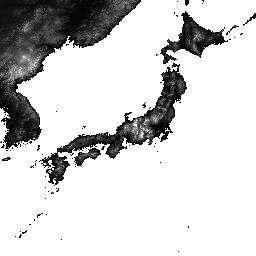
ALOS World 3D – 30m (AW3D30) est un ensemble de données de modèle numérique de surface (MNS) mondial avec une résolution horizontale d'environ 30 mètres (maillage d'une seconde d'arc). L'ensemble de données est basé sur l'ensemble de données DSM (version maillée de 5 mètres) des données topographiques World 3D. Pour en savoir plus, consultez la documentation sur l'ensemble de données.
Cet ensemble de données ingérées combine les données des versions 3.1, 4.0 et 4.1.
Version 4.1 (avril 2024) : cette mise à jour majeure a permis de publier 19 051 tuiles couvrant les régions du monde (à l'exception de l'Antarctique et du Japon). Il intègre de nouvelles données supplémentaires pour combler les vides et corrige les anomalies partielles détectées dans les versions 3.1 et 3.2, tout en comblant à nouveau les vides. Pour obtenir des informations spécifiques sur les mises à jour des tuiles dans la version 4.1, veuillez utiliser le filtre de la version 4.1 sur les tuiles de carte ou consulter la dernière description du format.
Version 4.0 (avril 2023) : cette mise à jour a permis de publier 1 886 tuiles,améliorant ainsi les régions à basse et moyenne latitude, ainsi que les zones situées au sud de 60 degrés de latitude.
Voici les principales modifications : 1. Nouvelles données supplémentaires pour le remplissage des vides. 2. Correction des anomalies partielles et remplissage des zones vides (deux vignettes). 3. Mise à jour des côtes pour les régions situées au sud de 60 degrés de latitude (44 tuiles). 4. Masque d'eau de la mer Caspienne désactivé et complété par des données d'altitude (54 tuiles). 5. Extraction et correction de nouvelles zones d'anomalies partielles en Amérique du Sud (1 786 tuiles). 6. Pour obtenir des informations détaillées sur les tuiles de la version 4.0, veuillez utiliser le filtre de la version 4.0 sur les tuiles de carte ou consulter la description du format.
La version 3.2, publiée en janvier 2021, est une version améliorée créée en repensant le format dans la zone de haute latitude, les données auxiliaires et la méthode de traitement. Un espacement de pixels différent pour chaque zone de latitude a été adopté dans la zone de haute latitude. Les données sur le littoral, qui font partie des ensembles de données auxiliaires, ont été modifiées et de nouvelles données supplémentaires ont été utilisées. De plus, la version 3 d'AW3D a également été utilisée comme source de données pour le Japon. De plus, la méthode de détection des valeurs anormales dans le processus a été améliorée.
L'altitude du DSM AW3D est calculée par un processus de mise en correspondance d'images qui utilise une paire stéréoscopique d'images optiques. Les nuages, la neige et la glace sont automatiquement identifiés lors du traitement, et les informations de masquage sont appliquées. Toutefois, des points non concordants subsistent parfois, en particulier autour (ou aux bords) des zones de nuages, de neige et de glace, ce qui entraîne des erreurs de hauteur dans le DSM final.
Bandes
Bandes de fréquences
Taille des pixels : 30 mètres (toutes les bandes)
| Nom | Min | Max | Taille des pixels | Description | |||||||||||||||||||||||||||||||||||||||||||||||||||||||||||||||||||||||||||||||||||||||||||||||
|---|---|---|---|---|---|---|---|---|---|---|---|---|---|---|---|---|---|---|---|---|---|---|---|---|---|---|---|---|---|---|---|---|---|---|---|---|---|---|---|---|---|---|---|---|---|---|---|---|---|---|---|---|---|---|---|---|---|---|---|---|---|---|---|---|---|---|---|---|---|---|---|---|---|---|---|---|---|---|---|---|---|---|---|---|---|---|---|---|---|---|---|---|---|---|---|---|---|---|---|
DSM |
-433* | 8 768* | 30 mètres | Hauteur au-dessus du niveau de la mer. 16 bits signés. Altitude (en mètres) convertie à partir de la hauteur ellipsoïdale basée sur ITRF97 et GRS80, à l'aide du modèle de géoïde EGM96†1. |
|||||||||||||||||||||||||||||||||||||||||||||||||||||||||||||||||||||||||||||||||||||||||||||||
STK |
1* | 54* | 30 mètres | Nombre d'empilement du DSM de l'unité de scène utilisé pour produire le DSM. La bande est obtenue en rééchantillonnant le nombre d'empilements pour le DSM à une résolution de 5 m à une résolution de 30 m. |
|||||||||||||||||||||||||||||||||||||||||||||||||||||||||||||||||||||||||||||||||||||||||||||||
MSK |
30 mètres | Masque de 8 bits pour la bande. |
|||||||||||||||||||||||||||||||||||||||||||||||||||||||||||||||||||||||||||||||||||||||||||||||||
Conditions d'utilisation
Conditions d'utilisation
Cet ensemble de données est disponible sans frais selon les conditions spécifiées dans les Conditions d'utilisation du modèle numérique de surface global ALOS.
Citations
- T. Tadono, H. Ishida, F. Oda, S. Naito, K. Minakawa, H. Iwamoto
- Precise Global DEM Generation By ALOS PRISM, ISPRS Annals of the Photogrammetry, Remote Sensing and Spatial Information Sciences, Vol.II-4, pp.71-76, 2014. Fichier PDF
J. Takaku, T. Tadono, K. Tsutsui : Generation of High Resolution Global DSM from ALOS PRISM, The International Archives of the Photogrammetry, Remote Sensing and Spatial Information Sciences, Vol. XL-4, pp.243-248, ISPRS, 2014. Fichier PDF
J. Takaku, T. Tadono, K. Tsutsui, M. Ichikawa : Validation of 'AW3D' Global DSM Generated from ALOS PRISM, ISPRS Annals of the Photogrammetry, Remote Sensing and Spatial Information Sciences, Vol.III-4, pp.25-31, 2016. Fichier PDF
T. Tadono, H. Nagai, H. Ishida, F. Oda, S. Naito, K. Minakawa, H. Iwamoto : validation initiale du modèle numérique de surface global à maillage de 30 m généré par ALOS PRISM, The International Archives of the Photogrammetry, Remote Sensing and Spatial Information Sciences, ISPRS, vol. XLI-B4, pp.157-162, 2016. Fichier PDF
J. Takaku, T. Tadono, M. Doutsu, F. Ohgushi, and H. Kai, : "Updates of 'AW3D30' ALOS Global Digital Surface Model in Antarctica with Other Open Access Datasets", Int. Arch. Photogramm. Remote Sens. Spatial Inf. Sci., XLIII-B4-2021, 401-408, 2021. Fichier PDF
Explorer avec Earth Engine
Éditeur de code (JavaScript)
var dataset = ee.ImageCollection('JAXA/ALOS/AW3D30/V4_1');
var elevation = dataset.select('DSM');
var elevationVis = {
  min: 0,
  max: 5000,
  palette: ['0000ff', '00ffff', 'ffff00', 'ff0000', 'ffffff']
};
Map.setCenter(138.73, 35.36, 11);
Map.addLayer(elevation, elevationVis, 'Elevation');

// Reproject an image mosaic using a projection from one of the image tiles,
// rather than using the default projection returned by .mosaic().
var proj = elevation.first().select(0).projection();
var slopeReprojected = ee.Terrain.slope(elevation.mosaic()
                             .setDefaultProjection(proj));
Map.addLayer(slopeReprojected, {min: 0, max: 45}, 'Slope');