ALOS World 3D - 30m (AW3D30)는 수평 해상도가 약 30m (1초 메쉬)인 전 세계 디지털 표면 모델 (DSM) 데이터 세트입니다. 이 데이터 세트는 World 3D Topographic Data의 DSM 데이터 세트(5미터 메시 버전)를 기반으로 합니다.
자세한 내용은 데이터 세트 문서를 참고하세요.
이 수집된 데이터 세트는 버전 3.1, 4.0, 4.1의 데이터를 결합합니다.
버전 4.1(2024년 4월): 이 주요 업데이트에서는 남극과 일본을 제외한 전 세계 지역을 포함하는 타일 19,051개가 출시되었습니다. 버전 3.1과 3.2에서 발견된 부분적 이상을 수정하고 공백을 다시 채우는 것과 함께 공백 채우기를 위한 새로운 보충 데이터를 통합합니다. v4.1의 특정 타일 업데이트의 경우 지도 타일에서 v4.1 필터를 사용하거나 최신 형식 설명을 참고하세요.
버전 4.0 (2023년 4월): 이 업데이트에서는 1,886개의 타일이 출시되어 저위도 및 중위도 지역과 위도 60도 남쪽 지역이 개선되었습니다.
주요 변경사항은 다음과 같습니다.
1. 빈 공간 채우기를 위한 새로운 보충 데이터입니다.
2. 부분 이상치 수정 및 빈 공간 다시 채우기 (2개 타일)
3. 위도 60도 남쪽 지역의 해안선이 업데이트되었습니다 (44개 타일).
4. 카스피해 물 마스크가 사용 중지되고 고도 데이터로 보완되었습니다(54개 타일).
5. 남미에서 새로운 부분적 이상 영역을 추출하고 수정했습니다(1,786개 타일).
6. v4.0의 자세한 타일 정보는 지도 타일에서 v4.0 필터를 사용하거나 형식 설명을 참고하세요.
2021년 1월에 출시된 버전 3.2는 고위도 지역의 형식, 보조 데이터, 처리 방법을 재고하여 개선된 버전입니다. 고위도 지역에서는 각 위도 영역에 대해 서로 다른 픽셀 간격이 채택되었습니다. 보조 데이터 세트 중 하나인 해안선 데이터가 변경되었으며 새로운 보충 데이터가 사용되었습니다. 또한 일본의 소스 데이터로 AW3D 버전 3도 사용되었습니다.
또한 프로세스에서 비정상 값을 감지하는 방법이 개선되었습니다.
AW3D DSM 고도는 스테레오 광학 이미지 쌍을 사용하는 이미지 매칭 프로세스를 통해 계산됩니다. 처리 중에 구름, 눈, 얼음이 자동으로 식별되고 마스크 정보가 적용됩니다. 하지만 특히 구름, 눈, 얼음 지역 주변 (또는 가장자리)에 불일치 포인트가 남아 최종 DSM에 일부 높이 오류가 발생하는 경우가 있습니다.
대역
픽셀 크기 30미터
대역
이름
최소
최대
픽셀 크기
설명
DSM
-433*
8768*
미터
해발 고도입니다. 부호 있는 16비트입니다.
EGM96†1 지오이드 모델을 사용하여 ITRF97 및 GRS80을 기반으로 한 타원체 높이에서 변환된 고도 (미터)입니다.
STK
1*
54*
미터
DSM 생성에 사용된 장면 단위 DSM의 스태킹 번호입니다. 밴드는 5m 해상도 DSM의 스태킹 번호를 30m 해상도로 리샘플링하여 파생됩니다.
T. Tadono, H. Ishida, F. Oda, S. Naito, K. Minakawa, H. Iwamoto
Precise Global DEM Generation By ALOS PRISM, ISPRS Annals of
the Photogrammetry, Remote Sensing and Spatial Information Sciences,
Vol.II-4, pp.71-76, 2014. PDF 파일
J. Takaku, T. Tadono, K. Tsutsui : Generation of High Resolution
Global DSM from ALOS PRISM, The International Archives of the Photogrammetry,
Remote Sensing and Spatial Information Sciences, Vol. XL-4, pp.243-248,
ISPRS, 2014. PDF 파일
J. Takaku, T. Tadono, K. Tsutsui, M. Ichikawa : Validation of
'AW3D' Global DSM Generated from ALOS PRISM, ISPRS
Annals of the Photogrammetry, Remote Sensing and Spatial Information
Sciences, Vol.III-4, pp.25-31, 2016. PDF 파일
T. Tadono, H. Nagai, H. Ishida, F. Oda, S. Naito, K. Minakawa,
H. Iwamoto : Initial Validation of the 30 m-mesh Global Digital
Surface Model Generated by ALOS PRISM, The International Archives
of the Photogrammetry, Remote Sensing and Spatial Information Sciences,
ISPRS, Vol. XLI-B4, pp.157-162, 2016. PDF 파일
J. Takaku, T. Tadono, M. Doutsu, F. Ohgushi, and H. Kai, : "Updates of
'AW3D30' ALOS Global Digital Surface Model in Antarctica with Other Open
Access Datasets", Int. Arch. Photogramm. Remote Sens. Spatial Inf. Sci.,
XLIII-B4-2021, 401-408, 2021. PDF 파일
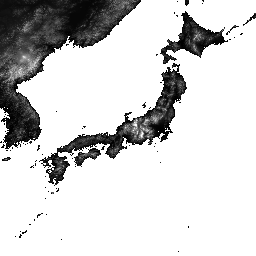
ALOS World 3D - 30m (AW3D30)은 수평 해상도가 약 30m (1초 메쉬)인 전 세계 디지털 표면 모델 (DSM) 데이터 세트입니다. 이 데이터 세트는 World 3D Topographic Data의 DSM 데이터 세트 (5미터 메쉬 버전)를 기반으로 합니다. 자세한 내용은 데이터 세트 문서를 참고하세요. …
[null,null,[],[],[],null,["# ALOS DSM: Global 30m v4.1\n\nDataset Availability\n: 2006-01-24T00:00:00Z--2011-05-12T00:00:00Z\n\nDataset Provider\n:\n\n\n [JAXA Earth Observation Research Center](https://www.eorc.jaxa.jp/ALOS/en/dataset/aw3d30/aw3d30_e.htm)\n\nTags\n:\n[alos](/earth-engine/datasets/tags/alos) [dem](/earth-engine/datasets/tags/dem) [elevation](/earth-engine/datasets/tags/elevation) [elevation-topography](/earth-engine/datasets/tags/elevation-topography) [geophysical](/earth-engine/datasets/tags/geophysical) [jaxa](/earth-engine/datasets/tags/jaxa) [topography](/earth-engine/datasets/tags/topography) \n\n#### Description\n\nALOS World 3D - 30m (AW3D30) is a global digital surface\nmodel (DSM) dataset with a horizontal resolution of approximately\n30 meters (1 arcsec mesh). The dataset is based on the DSM dataset\n(5-meter mesh version) of the [World 3D Topographic Data](https://www.aw3d.jp/en/).\nMore details are available in the dataset [documentation](https://www.eorc.jaxa.jp/ALOS/en/dataset/aw3d30/data/aw3d30v4.1_product_e_1.0.pdf).\n\nThis ingested dataset combines data from versions 3.1, 4.0, and 4.1.\n\nVersion 4.1 (April 2024): This major update released 19,051 tiles covering\nglobal regions (excluding Antarctica and Japan). It incorporates new\nsupplementary data for void filling and corrects partial anomalies found in\nversions 3.1 and 3.2, along with re-filling voids. For specific tile updates\nin v4.1, please use the v4.1 filter on map tiles or consult the latest\nformat description.\n\nVersion 4.0 (April 2023): This update released 1,886 tiles, improving low\nand mid-latitude regions and areas south of 60 degrees latitude.\n\nKey changes include:\n1. New supplementary data for void filling.\n2. Correction of partial anomalies and re-filling of voids (2 tiles).\n3. Updated coastlines for regions south of 60 degrees latitude (44 tiles).\n4. Disabled Caspian Sea water mask and supplemented with elevation data\n(54 tiles).\n5. Extracted and corrected new partial anomaly areas in South America\n(1,786 tiles).\n6. For detailed tile information for v4.0, please use the v4.0 filter on\nmap tiles or refer to the format description.\n\nVersion 3.2, released in January 2021, is an improved version created by\nreconsidering the format in the high latitude area, auxiliary data, and\nprocessing method. Different pixel spacing for each latitude zone was\nadopted at high latitude area. Coastline data, which is one of the\nauxiliary datasets, was changed, and new supplementary data was used. In\naddition, as a source data for Japan, AW3D version 3 was also used.\nFurthermore, the method of detecting anomalous values in the process was\nimproved.\n| **Note:** See the code example for the recommended way of computing slope. Unlike most DEMs in Earth Engine, this is an image collection due to multiple resolutions of source files that make it impossible to mosaic them into a single asset, so the slope computations need a reprojection.\n\nThe AW3D DSM elevation is calculated by an image matching process\nthat uses a stereo pair of optical images. Clouds, snow, and ice are\nautomatically identified during processing and applied the\nmask information. However, mismatched points sometimes\nremain especially surrounding (or at the edges of) clouds, snow,\nand ice areas, which cause some height errors in the final DSM.\n\n### Bands\n\n\n**Pixel Size**\n\n30 meters\n\n**Bands**\n\n| Name | Min | Max | Pixel Size | Description |\n|-------|--------|--------|------------|-------------------------------------------------------------------------------------------------------------------------------------------------------------|---|---|---|---|---|---|---|---|---|---|---|---|---|---|---|---|---|---|---|---|---|---|---|---|---|---|---|---|---|---|---|---|---|---|---|---|---|---|---|---|---|---|---|---|---|---|---|---|---|---|---|---|---|---|---|---|---|---|---|---|---|---|---|---|---|---|---|---|---|---|---|---|---|---|---|---|---|---|---|---|---|---|---|---|---|---|---|---|---|---|---|---|---|---|---|\n| `DSM` | -433\\* | 8768\\* | meters | Height above sea level. Signed 16 bits. Elevation (in meter) converted from the ellipsoidal height based on ITRF97 and GRS80, using EGM96†1 geoid model. |\n| `STK` | 1\\* | 54\\* | meters | Stacking number of the scene unit DSM used in producing DSM. The band is derived by resampling the stacking number for 5m resolution DSM to 30m resolution. |\n| `MSK` | | | meters | 8-bit mask for the band. |\n| Bitmask for MSK - Bits 0-7: Generated from resampled DSM. - 0: Valid - 1: Cloud and snow mask (invalid). - 2: Land water and low correlation mask (valid). - 3: Sea mask (valid). - 4: Void filled with GSI DTM (valid). - 8: Void filled with Shuttle Radar Topography Mission SRTM-1 Version 3 (valid). - 12: Void filled with PRISM DSM (valid). - 16: Void filled with ViewFinder Panoramas DEM (valid). - 24: Void filled with ASTER GDEM v2 (valid). - 28: Void filled with ArcticDEM v2 (valid). - 32: Void filled with TanDEM-X 90m DEM (valid). - 36: Void filled with ArcticDEM v3 (valid). - 40: Void filled with ASTER GDEM v3 (valid). - 44: Void filled with REMA v1.1 (valid). - 48: Void filled with Copernicus DEM GLO-30 (valid). - 52: Void filled with ArcticDEM v4 (valid). - 252: Void filled with applied IDW method (gdal_fillnodata) (valid) ||||||||||||||||||||||||||||||||||||||||||||||||||||||||||||||||||||||||||||||||||||||||||||||||||||\n\n\\* estimated min or max value\n\n### Terms of Use\n\n**Terms of Use**\n\nThis dataset is available to use with no charge under\nthe conditions specified in the [Terms of use for ALOS Global Digital\nSurface Model](https://earth.jaxa.jp/en/data/policy/).\n\n### Citations\n\nCitations:\n\n-\n\n T. Tadono, H. Ishida, F. Oda, S. Naito, K. Minakawa, H. Iwamoto\n : Precise Global DEM Generation By ALOS PRISM, ISPRS Annals of\n the Photogrammetry, Remote Sensing and Spatial Information Sciences,\n Vol.II-4, pp.71-76, 2014. [PDF file](https://www.isprs-ann-photogramm-remote-sens-spatial-inf-sci.net/II-4/71/2014/isprsannals-II-4-71-2014.pdf)\n- J. Takaku, T. Tadono, K. Tsutsui : Generation of High Resolution\n Global DSM from ALOS PRISM, The International Archives of the Photogrammetry,\n Remote Sensing and Spatial Information Sciences, Vol. XL-4, pp.243-248,\n ISPRS, 2014. [PDF file](https://www.int-arch-photogramm-remote-sens-spatial-inf-sci.net/XL-4/243/2014/isprsarchives-XL-4-243-2014.pdf)\n- J. Takaku, T. Tadono, K. Tsutsui, M. Ichikawa : Validation of\n 'AW3D' Global DSM Generated from ALOS PRISM, ISPRS\n Annals of the Photogrammetry, Remote Sensing and Spatial Information\n Sciences, Vol.III-4, pp.25-31, 2016. [PDF file](https://www.isprs-ann-photogramm-remote-sens-spatial-inf-sci.net/III-4/25/2016/isprs-annals-III-4-25-2016.pdf)\n- T. Tadono, H. Nagai, H. Ishida, F. Oda, S. Naito, K. Minakawa,\n H. Iwamoto : Initial Validation of the 30 m-mesh Global Digital\n Surface Model Generated by ALOS PRISM, The International Archives\n of the Photogrammetry, Remote Sensing and Spatial Information Sciences,\n ISPRS, Vol. XLI-B4, pp.157-162, 2016. [PDF file](https://www.int-arch-photogramm-remote-sens-spatial-inf-sci.net/XLI-B4/157/2016/isprs-archives-XLI-B4-157-2016.pdf)\n- J. Takaku, T. Tadono, M. Doutsu, F. Ohgushi, and H. Kai, : \"Updates of\n 'AW3D30' ALOS Global Digital Surface Model in Antarctica with Other Open\n Access Datasets\", Int. Arch. Photogramm. Remote Sens. Spatial Inf. Sci.,\n XLIII-B4-2021, 401-408, 2021. [PDF file](https://www.int-arch-photogramm-remote-sens-spatial-inf-sci.net/XLIII-B4-2021/401/2021/isprs-archives-XLIII-B4-2021-401-2021.pdf)\n\n### Explore with Earth Engine\n\n| **Important:** Earth Engine is a platform for petabyte-scale scientific analysis and visualization of geospatial datasets, both for public benefit and for business and government users. Earth Engine is free to use for research, education, and nonprofit use. To get started, please [register for Earth Engine access.](https://console.cloud.google.com/earth-engine)\n\n### Code Editor (JavaScript)\n\n```javascript\nvar dataset = ee.ImageCollection('JAXA/ALOS/AW3D30/V4_1');\nvar elevation = dataset.select('DSM');\nvar elevationVis = {\n min: 0,\n max: 5000,\n palette: ['0000ff', '00ffff', 'ffff00', 'ff0000', 'ffffff']\n};\nMap.setCenter(138.73, 35.36, 11);\nMap.addLayer(elevation, elevationVis, 'Elevation');\n\n// Reproject an image mosaic using a projection from one of the image tiles,\n// rather than using the default projection returned by .mosaic().\nvar proj = elevation.first().select(0).projection();\nvar slopeReprojected = ee.Terrain.slope(elevation.mosaic()\n .setDefaultProjection(proj));\nMap.addLayer(slopeReprojected, {min: 0, max: 45}, 'Slope');\n```\n[Open in Code Editor](https://code.earthengine.google.com/?scriptPath=Examples:Datasets/JAXA/JAXA_ALOS_AW3D30_V4_1) \n[ALOS DSM: Global 30m v4.1](/earth-engine/datasets/catalog/JAXA_ALOS_AW3D30_V4_1) \nALOS World 3D - 30m (AW3D30) is a global digital surface model (DSM) dataset with a horizontal resolution of approximately 30 meters (1 arcsec mesh). The dataset is based on the DSM dataset (5-meter mesh version) of the World 3D Topographic Data. More details are available in the dataset documentation. ... \nJAXA/ALOS/AW3D30/V4_1, alos,dem,elevation,elevation-topography,geophysical,jaxa,topography \n2006-01-24T00:00:00Z/2011-05-12T00:00:00Z \n-90 -180 90 180 \nGoogle Earth Engine \nhttps://developers.google.com/earth-engine/datasets\n\n- [](https://doi.org/https://www.eorc.jaxa.jp/ALOS/en/dataset/aw3d30/aw3d30_e.htm)\n- [](https://doi.org/https://developers.google.com/earth-engine/datasets/catalog/JAXA_ALOS_AW3D30_V4_1)"]]