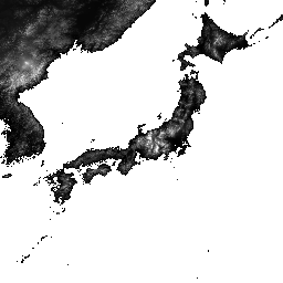
O ALOS World 3D - 30m (AW3D30) é um conjunto de dados global de modelo digital de superfície (DSM) com uma resolução horizontal de aproximadamente 30 metros (malha de 1 segundo de arco). O conjunto de dados é baseado no conjunto de dados DSM (versão de malha de 5 metros) dos Dados topográficos mundiais em 3D.
Mais detalhes estão disponíveis na documentação do conjunto de dados.
Esse conjunto de dados ingerido combina dados das versões 3.1, 4.0 e 4.1.
Versão 4.1 (abril de 2024): essa grande atualização lançou 19.051 blocos que cobrem regiões globais (exceto Antártica e Japão). Ele incorpora novos dados complementares para preenchimento de vazios e corrige anomalias parciais encontradas nas versões 3.1 e 3.2, além de preencher novamente os vazios. Para atualizações específicas de blocos
na v4.1, use o filtro v4.1 em blocos de mapa ou consulte a descrição
de formato mais recente.
Versão 4.0 (abril de 2023): essa atualização lançou 1.886 blocos, melhorando regiões de baixa e média latitude e áreas ao sul de 60 graus de latitude.
As principais mudanças incluem:
1. Novos dados complementares para preenchimento de lacunas.
2. Correção de anomalias parciais e preenchimento de vazios (dois blocos).
3. Atualização dos litorais para regiões ao sul de 60 graus de latitude (44 blocos).
4. Desativamos a máscara de água do Mar Cáspio e complementamos com dados de elevação (54 blocos).
5. Extração e correção de novas áreas de anomalia parcial na América do Sul (1.786 blocos).
6. Para informações detalhadas sobre blocos da v4.0, use o filtro v4.0 em blocos de mapa ou consulte a descrição do formato.
A versão 3.2, lançada em janeiro de 2021, é uma versão aprimorada criada ao reconsiderar o formato na área de alta latitude, os dados auxiliares e o método de processamento. Um espaçamento de pixel diferente para cada zona de latitude foi adotado em áreas de alta latitude. Os dados de linha costeira, que são um dos conjuntos de dados auxiliares, foram alterados, e novos dados complementares foram usados. Além disso, como uma fonte de dados para o Japão, também foi usada a versão 3 do AW3D.
Além disso, o método de detecção de valores anômalos no processo foi aprimorado.
A elevação do DSM do AW3D é calculada por um processo de correspondência de imagens que usa um par estéreo de imagens ópticas. Nuvens, neve e gelo são identificados automaticamente durante o processamento e recebem as informações de máscara. No entanto, pontos incompatíveis às vezes permanecem, especialmente em torno (ou nas bordas) de áreas de nuvens, neve e gelo, o que causa alguns erros de altura no DSM final.
Bandas
Tamanho do pixel 30 metros
Bandas
Nome
Mín.
Máx.
Tamanho do pixel
Descrição
DSM
-433*
8768*
metros
Altura acima do nível do mar. 16 bits assinados.
Elevação (em metros) convertida da altura elipsoidal com base no ITRF97 e no GRS80, usando o modelo geoidal EGM96†1.
STK
1*
54*
metros
Número de empilhamento do DSM da unidade de cena usado na produção do DSM. A faixa é derivada da reamostragem do número de empilhamento para DSM de resolução de 5 m para 30 m.
MSK
metros
Máscara de 8 bits para a banda.
Bitmask para MSK
Bits 0 a 7: gerados do DSM reamostrado.
0: Válido
1: máscara de nuvem e neve (inválida).
2: máscara de água e baixa correlação (válida).
3: máscara de mar (válida).
4: Vazio preenchido com DTM do GSI (válido).
8: Vazio preenchido com a Missão de Topografia por Radar de Ônibus Espacial (SRTM-1), versão 3 (válida).
12: Vazio preenchido com PRISM DSM (válido).
16: Vazio preenchido com DEM de panoramas do ViewFinder (válido).
24: Vazio preenchido com ASTER GDEM v2 (válido).
28: Vazio preenchido com ArcticDEM v2 (válido).
32: Vazio preenchido com DEM de 90 m do TanDEM-X (válido).
36: Vazio preenchido com ArcticDEM v3 (válido).
40: Vazio preenchido com ASTER GDEM v3 (válido).
44: espaço preenchido com REMA v1.1 (válido).
48: Vazio preenchido com o DEM GLO-30 do Copernicus (válido).
52: Vazio preenchido com ArcticDEM v4 (válido).
252: Vazio preenchido com o método IDW aplicado (gdal_fillnodata) (válido)
T. Tadono, H. Ishida, F. Oda, S. Naito, K. Minakawa, H. Iwamoto
Precise Global DEM Generation By ALOS PRISM, ISPRS Annals of
the Photogrammetry, Remote Sensing and Spatial Information Sciences,
Vol.II-4, pp.71-76, 2014. Arquivo PDF
J. Takaku, T. Tadono, K. Tsutsui : Generation of High Resolution
Global DSM from ALOS PRISM, The International Archives of the Photogrammetry,
Remote Sensing and Spatial Information Sciences, Vol. XL-4, pp.243-248,
ISPRS, 2014. Arquivo PDF
J. Takaku, T. Tadono, K. Tsutsui, M. Ichikawa : Validation of
'AW3D' Global DSM Generated from ALOS PRISM, ISPRS
Annals of the Photogrammetry, Remote Sensing and Spatial Information
Sciences, Vol.III-4, pp.25-31, 2016. Arquivo PDF
T. Tadono, H. Nagai, H. Ishida, F. Oda, S. Naito, K. Minakawa,
H. Iwamoto : Initial Validation of the 30 m-mesh Global Digital
Surface Model Generated by ALOS PRISM, The International Archives
of the Photogrammetry, Remote Sensing and Spatial Information Sciences,
ISPRS, Vol. XLI-B4, pp.157-162, 2016. Arquivo PDF
J. Takaku, T. Tadono, M. Doutsu, F. Ohgushi e H. Kai, : "Updates of
'AW3D30' ALOS Global Digital Surface Model in Antarctica with Other Open
Access Datasets", Int. Arch. Photogramm. Remote Sens. Spatial Inf. Sci.,
XLIII-B4-2021, 401-408, 2021. Arquivo PDF
O ALOS World 3D - 30m (AW3D30) é um conjunto de dados global de modelo digital de superfície (DSM, na sigla em inglês) com uma resolução horizontal de aproximadamente 30 metros (malha de 1 segundo de arco). O conjunto de dados é baseado no conjunto de dados DSM (versão de malha de 5 metros) dos dados topográficos mundiais em 3D. Mais detalhes estão disponíveis na documentação do conjunto de dados. …
[null,null,[],[],[],null,["# ALOS DSM: Global 30m v4.1\n\nDataset Availability\n: 2006-01-24T00:00:00Z--2011-05-12T00:00:00Z\n\nDataset Provider\n:\n\n\n [JAXA Earth Observation Research Center](https://www.eorc.jaxa.jp/ALOS/en/dataset/aw3d30/aw3d30_e.htm)\n\nTags\n:\n[alos](/earth-engine/datasets/tags/alos) [dem](/earth-engine/datasets/tags/dem) [elevation](/earth-engine/datasets/tags/elevation) [elevation-topography](/earth-engine/datasets/tags/elevation-topography) [geophysical](/earth-engine/datasets/tags/geophysical) [jaxa](/earth-engine/datasets/tags/jaxa) [topography](/earth-engine/datasets/tags/topography) \n\n#### Description\n\nALOS World 3D - 30m (AW3D30) is a global digital surface\nmodel (DSM) dataset with a horizontal resolution of approximately\n30 meters (1 arcsec mesh). The dataset is based on the DSM dataset\n(5-meter mesh version) of the [World 3D Topographic Data](https://www.aw3d.jp/en/).\nMore details are available in the dataset [documentation](https://www.eorc.jaxa.jp/ALOS/en/dataset/aw3d30/data/aw3d30v4.1_product_e_1.0.pdf).\n\nThis ingested dataset combines data from versions 3.1, 4.0, and 4.1.\n\nVersion 4.1 (April 2024): This major update released 19,051 tiles covering\nglobal regions (excluding Antarctica and Japan). It incorporates new\nsupplementary data for void filling and corrects partial anomalies found in\nversions 3.1 and 3.2, along with re-filling voids. For specific tile updates\nin v4.1, please use the v4.1 filter on map tiles or consult the latest\nformat description.\n\nVersion 4.0 (April 2023): This update released 1,886 tiles, improving low\nand mid-latitude regions and areas south of 60 degrees latitude.\n\nKey changes include:\n1. New supplementary data for void filling.\n2. Correction of partial anomalies and re-filling of voids (2 tiles).\n3. Updated coastlines for regions south of 60 degrees latitude (44 tiles).\n4. Disabled Caspian Sea water mask and supplemented with elevation data\n(54 tiles).\n5. Extracted and corrected new partial anomaly areas in South America\n(1,786 tiles).\n6. For detailed tile information for v4.0, please use the v4.0 filter on\nmap tiles or refer to the format description.\n\nVersion 3.2, released in January 2021, is an improved version created by\nreconsidering the format in the high latitude area, auxiliary data, and\nprocessing method. Different pixel spacing for each latitude zone was\nadopted at high latitude area. Coastline data, which is one of the\nauxiliary datasets, was changed, and new supplementary data was used. In\naddition, as a source data for Japan, AW3D version 3 was also used.\nFurthermore, the method of detecting anomalous values in the process was\nimproved.\n| **Note:** See the code example for the recommended way of computing slope. Unlike most DEMs in Earth Engine, this is an image collection due to multiple resolutions of source files that make it impossible to mosaic them into a single asset, so the slope computations need a reprojection.\n\nThe AW3D DSM elevation is calculated by an image matching process\nthat uses a stereo pair of optical images. Clouds, snow, and ice are\nautomatically identified during processing and applied the\nmask information. However, mismatched points sometimes\nremain especially surrounding (or at the edges of) clouds, snow,\nand ice areas, which cause some height errors in the final DSM.\n\n### Bands\n\n\n**Pixel Size**\n\n30 meters\n\n**Bands**\n\n| Name | Min | Max | Pixel Size | Description |\n|-------|--------|--------|------------|-------------------------------------------------------------------------------------------------------------------------------------------------------------|---|---|---|---|---|---|---|---|---|---|---|---|---|---|---|---|---|---|---|---|---|---|---|---|---|---|---|---|---|---|---|---|---|---|---|---|---|---|---|---|---|---|---|---|---|---|---|---|---|---|---|---|---|---|---|---|---|---|---|---|---|---|---|---|---|---|---|---|---|---|---|---|---|---|---|---|---|---|---|---|---|---|---|---|---|---|---|---|---|---|---|---|---|---|---|\n| `DSM` | -433\\* | 8768\\* | meters | Height above sea level. Signed 16 bits. Elevation (in meter) converted from the ellipsoidal height based on ITRF97 and GRS80, using EGM96†1 geoid model. |\n| `STK` | 1\\* | 54\\* | meters | Stacking number of the scene unit DSM used in producing DSM. The band is derived by resampling the stacking number for 5m resolution DSM to 30m resolution. |\n| `MSK` | | | meters | 8-bit mask for the band. |\n| Bitmask for MSK - Bits 0-7: Generated from resampled DSM. - 0: Valid - 1: Cloud and snow mask (invalid). - 2: Land water and low correlation mask (valid). - 3: Sea mask (valid). - 4: Void filled with GSI DTM (valid). - 8: Void filled with Shuttle Radar Topography Mission SRTM-1 Version 3 (valid). - 12: Void filled with PRISM DSM (valid). - 16: Void filled with ViewFinder Panoramas DEM (valid). - 24: Void filled with ASTER GDEM v2 (valid). - 28: Void filled with ArcticDEM v2 (valid). - 32: Void filled with TanDEM-X 90m DEM (valid). - 36: Void filled with ArcticDEM v3 (valid). - 40: Void filled with ASTER GDEM v3 (valid). - 44: Void filled with REMA v1.1 (valid). - 48: Void filled with Copernicus DEM GLO-30 (valid). - 52: Void filled with ArcticDEM v4 (valid). - 252: Void filled with applied IDW method (gdal_fillnodata) (valid) ||||||||||||||||||||||||||||||||||||||||||||||||||||||||||||||||||||||||||||||||||||||||||||||||||||\n\n\\* estimated min or max value\n\n### Terms of Use\n\n**Terms of Use**\n\nThis dataset is available to use with no charge under\nthe conditions specified in the [Terms of use for ALOS Global Digital\nSurface Model](https://earth.jaxa.jp/en/data/policy/).\n\n### Citations\n\nCitations:\n\n-\n\n T. Tadono, H. Ishida, F. Oda, S. Naito, K. Minakawa, H. Iwamoto\n : Precise Global DEM Generation By ALOS PRISM, ISPRS Annals of\n the Photogrammetry, Remote Sensing and Spatial Information Sciences,\n Vol.II-4, pp.71-76, 2014. [PDF file](https://www.isprs-ann-photogramm-remote-sens-spatial-inf-sci.net/II-4/71/2014/isprsannals-II-4-71-2014.pdf)\n- J. Takaku, T. Tadono, K. Tsutsui : Generation of High Resolution\n Global DSM from ALOS PRISM, The International Archives of the Photogrammetry,\n Remote Sensing and Spatial Information Sciences, Vol. XL-4, pp.243-248,\n ISPRS, 2014. [PDF file](https://www.int-arch-photogramm-remote-sens-spatial-inf-sci.net/XL-4/243/2014/isprsarchives-XL-4-243-2014.pdf)\n- J. Takaku, T. Tadono, K. Tsutsui, M. Ichikawa : Validation of\n 'AW3D' Global DSM Generated from ALOS PRISM, ISPRS\n Annals of the Photogrammetry, Remote Sensing and Spatial Information\n Sciences, Vol.III-4, pp.25-31, 2016. [PDF file](https://www.isprs-ann-photogramm-remote-sens-spatial-inf-sci.net/III-4/25/2016/isprs-annals-III-4-25-2016.pdf)\n- T. Tadono, H. Nagai, H. Ishida, F. Oda, S. Naito, K. Minakawa,\n H. Iwamoto : Initial Validation of the 30 m-mesh Global Digital\n Surface Model Generated by ALOS PRISM, The International Archives\n of the Photogrammetry, Remote Sensing and Spatial Information Sciences,\n ISPRS, Vol. XLI-B4, pp.157-162, 2016. [PDF file](https://www.int-arch-photogramm-remote-sens-spatial-inf-sci.net/XLI-B4/157/2016/isprs-archives-XLI-B4-157-2016.pdf)\n- J. Takaku, T. Tadono, M. Doutsu, F. Ohgushi, and H. Kai, : \"Updates of\n 'AW3D30' ALOS Global Digital Surface Model in Antarctica with Other Open\n Access Datasets\", Int. Arch. Photogramm. Remote Sens. Spatial Inf. Sci.,\n XLIII-B4-2021, 401-408, 2021. [PDF file](https://www.int-arch-photogramm-remote-sens-spatial-inf-sci.net/XLIII-B4-2021/401/2021/isprs-archives-XLIII-B4-2021-401-2021.pdf)\n\n### Explore with Earth Engine\n\n| **Important:** Earth Engine is a platform for petabyte-scale scientific analysis and visualization of geospatial datasets, both for public benefit and for business and government users. Earth Engine is free to use for research, education, and nonprofit use. To get started, please [register for Earth Engine access.](https://console.cloud.google.com/earth-engine)\n\n### Code Editor (JavaScript)\n\n```javascript\nvar dataset = ee.ImageCollection('JAXA/ALOS/AW3D30/V4_1');\nvar elevation = dataset.select('DSM');\nvar elevationVis = {\n min: 0,\n max: 5000,\n palette: ['0000ff', '00ffff', 'ffff00', 'ff0000', 'ffffff']\n};\nMap.setCenter(138.73, 35.36, 11);\nMap.addLayer(elevation, elevationVis, 'Elevation');\n\n// Reproject an image mosaic using a projection from one of the image tiles,\n// rather than using the default projection returned by .mosaic().\nvar proj = elevation.first().select(0).projection();\nvar slopeReprojected = ee.Terrain.slope(elevation.mosaic()\n .setDefaultProjection(proj));\nMap.addLayer(slopeReprojected, {min: 0, max: 45}, 'Slope');\n```\n[Open in Code Editor](https://code.earthengine.google.com/?scriptPath=Examples:Datasets/JAXA/JAXA_ALOS_AW3D30_V4_1) \n[ALOS DSM: Global 30m v4.1](/earth-engine/datasets/catalog/JAXA_ALOS_AW3D30_V4_1) \nALOS World 3D - 30m (AW3D30) is a global digital surface model (DSM) dataset with a horizontal resolution of approximately 30 meters (1 arcsec mesh). The dataset is based on the DSM dataset (5-meter mesh version) of the World 3D Topographic Data. More details are available in the dataset documentation. ... \nJAXA/ALOS/AW3D30/V4_1, alos,dem,elevation,elevation-topography,geophysical,jaxa,topography \n2006-01-24T00:00:00Z/2011-05-12T00:00:00Z \n-90 -180 90 180 \nGoogle Earth Engine \nhttps://developers.google.com/earth-engine/datasets\n\n- [](https://doi.org/https://www.eorc.jaxa.jp/ALOS/en/dataset/aw3d30/aw3d30_e.htm)\n- [](https://doi.org/https://developers.google.com/earth-engine/datasets/catalog/JAXA_ALOS_AW3D30_V4_1)"]]