- Veri Kümesi Kullanılabilirliği
- 2006-01-24T00:00:00Z–2011-05-12T00:00:00Z
- Veri Kümesi Üreticisi
- JAXA Earth Observation Research Center
- Etiketler
Açıklama
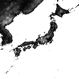
ALOS World 3D - 30m (AW3D30), yaklaşık 30 metre (1 yay saniyesi ağ) yatay çözünürlüğe sahip küresel bir dijital yüzey modeli (DSM) veri kümesidir. Veri kümesi, World 3D Topographic Data'nın DSM veri kümesini (5 metrelik ağ sürümü) temel alır. Daha fazla ayrıntıyı veri kümesi belgelerinde bulabilirsiniz.
Bu alınan veri kümesi, 3.1, 4.0 ve 4.1 sürümlerindeki verileri birleştirir.
4.1 sürümü (Nisan 2024): Bu büyük güncellemede,dünya genelindeki bölgeleri (Antarktika ve Japonya hariç) kapsayan 19.051 karo yayınlandı. Boşluk doldurma için yeni ek veriler içerir ve boşlukları yeniden doldurmanın yanı sıra 3.1 ve 3.2 sürümlerinde bulunan kısmi anormallikleri düzeltir. 4.1 sürümündeki belirli döşeme güncellemeleri için lütfen harita döşemelerinde 4.1 filtresini kullanın veya en son biçim açıklamasına bakın.
Sürüm 4.0 (Nisan 2023): Bu güncellemede 1.886 döşeme yayınlandı. Böylece, düşük ve orta enlemli bölgeler ile 60 derece enlemin güneyindeki alanlar iyileştirildi.
Başlıca değişiklikler: 1. Boşluk doldurma için yeni ek veriler. 2. Kısmi anormalliklerin düzeltilmesi ve boşlukların yeniden doldurulması (2 döşeme). 3. 60 derece enlemin güneyindeki bölgeler için güncellenen kıyı şeritleri (44 döşeme). 4. Hazar Denizi su maskesi devre dışı bırakıldı ve yükseklik verileriyle desteklendi (54 parça). 5. Güney Amerika'da yeni kısmi anomali alanları çıkarıldı ve düzeltildi (1.786 döşeme). 6. 4.0 sürümü için ayrıntılı döşeme bilgileri edinmek istiyorsanız lütfen harita döşemelerinde 4.0 filtresini kullanın veya biçim açıklamasına bakın.
Ocak 2021'de yayınlanan 3.2 sürümü, yüksek enlem bölgesindeki biçim, yardımcı veriler ve işleme yöntemi yeniden değerlendirilerek oluşturulan geliştirilmiş bir sürümdür. Yüksek enlem bölgesinde her enlem bölgesi için farklı piksel aralığı kullanıldı. Yardımcı veri kümelerinden biri olan kıyı şeridi verileri değiştirildi ve yeni ek veriler kullanıldı. Ayrıca Japonya için kaynak veri olarak AW3D sürüm 3 de kullanıldı. Ayrıca, süreçteki anormal değerleri algılama yöntemi de iyileştirildi.
AW3D DSM yüksekliği, optik görüntülerin stereo çiftini kullanan bir görüntü eşleştirme işlemiyle hesaplanır. Bulutlar, kar ve buz, işleme sırasında otomatik olarak tanımlanır ve maske bilgileri uygulanır. Ancak, özellikle bulutların, karın ve buz alanlarının çevresinde (veya kenarlarında) bazen eşleşmeyen noktalar kalır. Bu durum, nihai DSM'de bazı yükseklik hatalarına neden olur.
Bantlar
Bantlar
Piksel boyutu: 30 metre (tüm bantlar)
| Ad | Min. | Maks. | Piksel Boyutu | Açıklama | |||||||||||||||||||||||||||||||||||||||||||||||||||||||||||||||||||||||||||||||||||||||||||||||
|---|---|---|---|---|---|---|---|---|---|---|---|---|---|---|---|---|---|---|---|---|---|---|---|---|---|---|---|---|---|---|---|---|---|---|---|---|---|---|---|---|---|---|---|---|---|---|---|---|---|---|---|---|---|---|---|---|---|---|---|---|---|---|---|---|---|---|---|---|---|---|---|---|---|---|---|---|---|---|---|---|---|---|---|---|---|---|---|---|---|---|---|---|---|---|---|---|---|---|---|
DSM |
-433* | 8.768* | 30 metre | Deniz seviyesinden yükseklik. İmzalı 16 bit. EGM96†1 jeoid modeli kullanılarak ITRF97 ve GRS80'e dayalı elipsoidal yükseklikten dönüştürülen yükseklik (metre cinsinden). |
|||||||||||||||||||||||||||||||||||||||||||||||||||||||||||||||||||||||||||||||||||||||||||||||
STK |
1* | 54* | 30 metre | DSM oluşturmada kullanılan sahne birimi DSM'nin yığınlama sayısı. Bant, 5 m çözünürlüklü DSM için yığınlama sayısı 30 m çözünürlüğe yeniden örneklenerek elde edilir. |
|||||||||||||||||||||||||||||||||||||||||||||||||||||||||||||||||||||||||||||||||||||||||||||||
MSK |
30 metre | Bant için 8 bitlik maske. |
|||||||||||||||||||||||||||||||||||||||||||||||||||||||||||||||||||||||||||||||||||||||||||||||||
Kullanım Şartları
Kullanım Şartları
Bu veri kümesi, ALOS Global Digital Surface Model Kullanım Şartları'nda belirtilen koşullar kapsamında ücretsiz olarak kullanılabilir.
Alıntılar
- T. Tadono, H. Ishida, F. Oda, S. Naito, K. Minakawa, H. Iwamoto
- Precise Global DEM Generation By ALOS PRISM, ISPRS Annals of the Photogrammetry, Remote Sensing and Spatial Information Sciences, Vol.II-4, pp.71-76, 2014. PDF dosyası
J. Takaku, T. Tadono, K. Tsutsui : Generation of High Resolution Global DSM from ALOS PRISM, The International Archives of the Photogrammetry, Remote Sensing and Spatial Information Sciences, Vol. XL-4, pp.243-248, ISPRS, 2014. PDF dosyası
J. Takaku, T. Tadono, K. Tsutsui, M. Ichikawa : Validation of 'AW3D' Global DSM Generated from ALOS PRISM, ISPRS Annals of the Photogrammetry, Remote Sensing and Spatial Information Sciences, Vol.III-4, pp.25-31, 2016. PDF dosyası
T. Tadono, H. Nagai, H. Ishida, F. Oda, S. Naito, K. Minakawa, H. Iwamoto : Initial Validation of the 30 m-mesh Global Digital Surface Model Generated by ALOS PRISM, The International Archives of the Photogrammetry, Remote Sensing and Spatial Information Sciences, ISPRS, Vol. XLI-B4, pp.157-162, 2016. PDF dosyası
J. Takaku, T. Tadono, M. Doutsu, F. Ohgushi ve H. Kai, : "Updates of 'AW3D30' ALOS Global Digital Surface Model in Antarctica with Other Open Access Datasets", Int. Arch. Photogramm. Remote Sens. Spatial Inf. Sci., XLIII-B4-2021, 401-408, 2021. PDF dosyası
Earth Engine ile Keşif
Kod Düzenleyici (JavaScript)
var dataset = ee.ImageCollection('JAXA/ALOS/AW3D30/V4_1');
var elevation = dataset.select('DSM');
var elevationVis = {
  min: 0,
  max: 5000,
  palette: ['0000ff', '00ffff', 'ffff00', 'ff0000', 'ffffff']
};
Map.setCenter(138.73, 35.36, 11);
Map.addLayer(elevation, elevationVis, 'Elevation');

// Reproject an image mosaic using a projection from one of the image tiles,
// rather than using the default projection returned by .mosaic().
var proj = elevation.first().select(0).projection();
var slopeReprojected = ee.Terrain.slope(elevation.mosaic()
                             .setDefaultProjection(proj));
Map.addLayer(slopeReprojected, {min: 0, max: 45}, 'Slope');