- ডেটাসেটের প্রাপ্যতা
- 2022-09-26T00:00:00Z–2024-01-08T00:00:00Z
- ডেটাসেট প্রযোজক
- JAXA EORC
- ট্যাগ
বর্ণনা
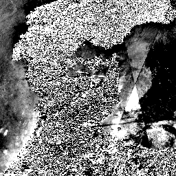
২০২৪ সালের ১লা জানুয়ারী রাত থেকে, জাপানের বিভিন্ন মন্ত্রণালয় এবং সংশ্লিষ্ট সংস্থার অনুরোধের ভিত্তিতে, JAXA ALOS-2 PALSAR-2 জরুরি পর্যবেক্ষণ ব্যবস্থা চালু করেছে। যেহেতু JAXA মনে করে যে এই জরুরি পর্যবেক্ষণের তথ্য দুর্যোগ ব্যবস্থাপনার জন্য অত্যন্ত উপযোগী হবে, তাই তারা এই তথ্যগুলো সর্বসাধারণের ব্যবহার এবং গবেষণার জন্য গুগল আর্থ ইঞ্জিনে উন্মুক্ত করার সিদ্ধান্ত নিয়েছে।
JAXA ১-৩ জানুয়ারী এবং ৮ জানুয়ারী ২০২৪-এর জন্য ৩মি একক পোলারাইজেশন সহ PALSAR-2 লেভেল ২.১ স্ট্রিপ ম্যাপ মোড পর্যবেক্ষণ ডেটা, কিছু আর্কাইভ ডেটার সাথে প্রকাশ করেছে। PALSAR-2 লেভেল ২.১ ডেটা ডিজিটাল এলিভেশন মডেল ব্যবহার করে লেভেল ১.১ ডেটা থেকে অর্থোরেটিফাইড করা হয়। নিম্নলিখিত সমীকরণ ব্যবহার করে DN মানগুলিকে ডেসিবেল (dB) এককে সিগমা নট মানে রূপান্তর করা যেতে পারে:
- σ 0 = 10*লগ 10 (DN 2 ) - 83.0 dB
নিচে সেই তারিখগুলো দেওয়া হলো যেগুলোর ডেটা ডেটাসেটে রয়েছে।
| পর্যবেক্ষণ তারিখ | ফ্রেম | বিম | এ/ডি |
|---|---|---|---|
| ২০২৪/০১/০১ এবং ২০২২/০৯/২৬ | ০৭৫০, ০৭৬০, ০৭৭০ | U2-6L | আরোহী। |
| ২০২৪/০১/০২ এবং ২০২৩/০৬/০৬ | ২৮২০, ২৮৩০, ২৮৪০ | ইউ২-৮এল | বর্ণনা। |
| ২০২৪/০১/০৮, ২০২৪/০১/০৩ এবং ২০২৩/১২/০৬ | ০৭২০, ০৭৩০ | U2-9R | আরোহী। |
ব্যান্ড
ব্যান্ড
পিক্সেল সাইজ: ৩ মিটার (সকল ব্যান্ড)
| নাম | পিক্সেল আকার | বর্ণনা |
|---|---|---|
b1 | ৩ মিটার | HH পোলারাইজেশন ভূখণ্ড-সমতলকৃত গামা-নট পশ্চাৎ বিক্ষেপ সহগ। |
ব্যবহারের শর্তাবলী
ব্যবহারের শর্তাবলী
যে কেউ এই ডেটা শুধুমাত্র অবাণিজ্যিক ব্যবহারের শর্তে বিনামূল্যে ব্যবহার করতে পারেন। ব্যবহারের বিস্তারিত শর্তাবলীর জন্য JAXA G-Portal পরিষেবার শর্তাবলী (ধারা ৭. G-Portal ডেটা সম্পর্কিত শর্তাবলী) দেখুন।
উদ্ধৃতি
এই গবেষণাপত্রে ব্যবহৃত তথ্য জাপান মহাকাশ গবেষণা সংস্থা (JAXA)-এর ভূ-পর্যবেক্ষণ গবেষণা কেন্দ্র (EORC) কর্তৃক সরবরাহ করা হয়েছে।
আর্থ ইঞ্জিন দিয়ে অন্বেষণ করুন
কোড এডিটর (জাভাস্ক্রিপ্ট)
var coll = ee.ImageCollection('JAXA/ALOS/PALSAR-2/Level2_1/StripMap_202401');

var vis = {min: 0, max: 8000};

// Visualize different date ranges
var visualizeDateRange = function(startDate, endDate, layerName) {
  var dateRange = coll.filterDate(startDate, endDate);
  Map.addLayer(dateRange, vis, layerName);
};

visualizeDateRange('2023-06-06', '2023-06-07', 'Before-2023-06-06');
visualizeDateRange('2023-06-12', '2023-06-13', 'Before-2023-06-12');
visualizeDateRange('2022-09-26', '2022-09-27', 'Before-2022-09-26');
visualizeDateRange('2023-12-06', '2023-12-07', 'Before-2023-12-06');
visualizeDateRange('2024-01-01', '2024-01-02', 'After-2024-01-01');
visualizeDateRange('2024-01-02', '2024-01-03', 'After-2024-01-02');
visualizeDateRange('2024-01-03', '2024-01-04', 'After-2024-01-03');
visualizeDateRange('2024-01-08', '2024-01-09', 'After-2024-01-08');

Map.setCenter(137.2228, 37.1204, 8);