O mosaico global de 25 m do PALSAR/PALSAR-2 é uma imagem global de SAR contínua criada pela junção de faixas de imagens de SAR do PALSAR/PALSAR-2. Para cada ano e local, os dados de faixa foram selecionados por inspeção visual dos mosaicos de navegação disponíveis durante o período, sendo usados preferencialmente aqueles que mostram resposta mínima à umidade da superfície. Em casos em que a disponibilidade era limitada (por exemplo, devido à necessidade de observações durante emergências específicas), os dados foram selecionados do ano anterior ou posterior, incluindo 2006.
Shimada et al. 2014
Não há dados de 2011 a 2014 devido à diferença entre a cobertura temporal do ALOS e do ALOS-2.
As imagens de SAR foram ortorretificadas e corrigidas por inclinação usando o modelo digital de elevação SRTM de 90 m.
Um processo de remoção de faixas (Shimada & Isoguchi, 2002, 2010) foi aplicado para igualar as diferenças de intensidade entre faixas vizinhas, que ocorrem principalmente devido a diferenças sazonais e diárias nas condições de umidade da superfície.
Os dados de polarização são armazenados como números digitais de 16 bits (DN).
Os valores de DN podem ser convertidos em valores de gama zero em decibel (dB) usando a seguinte equação:
γ₀ = 10log₁₀(DN²) - 83,0 dB
Atenção:
Os valores de retroespalhamento podem variar significativamente de um caminho para outro em áreas florestais de alta latitude. Isso ocorre devido à mudança na intensidade de retroespalhamento causada pelo congelamento das árvores no inverno.
Coeficiente de retroespalhamento de polarização HH, DN de 16 bits.
HV
metros
Coeficiente de retroespalhamento de polarização HV, DN de 16 bits.
angle
graus
metros
Ângulo de incidência local.
date
metros
Data da observação (dias desde 1º de janeiro de 1970).
qa
metros
Processando informações.
Tabela de classes de qa
Valor
Cor
Descrição
0
#000000
Não há dados
50
#0000ff
Oceano e água
100
#aaaa00
Escala de radar
150
#005555
Sombreamento de radar
255
#aa9988
Terra
Termos de Uso
Termos de Uso
A JAXA mantém a propriedade do conjunto de dados e não garante nenhum problema causado ou possivelmente causado pelo uso dos conjuntos de dados.
Qualquer pessoa que queira publicar resultados usando os conjuntos de dados precisa reconhecer claramente a propriedade dos dados na publicação.
Citações
Citações:
Masanobu Shimada, Takuya Itoh, Takeshi Motooka, Manabu Watanabe, Shiraishi Tomohiro, Rajesh Thapa e Richard Lucas, "New Global Forest/Non-forest Maps from ALOS PALSAR Data (2007-2010)", Remote Sensing of Environment, 155, pp. 13-31, dezembro de 2014. doi:10.1016/j.rse.2014.04.014.
Uma versão mais recente desse conjunto de dados com dados de 2015 a 2021 pode ser encontrada em JAXA/ALOS/PALSAR/YEARLY/SAR_EPOCH. O mosaico global de 25 m do PALSAR/PALSAR-2 é uma imagem global de SAR contínua criada por faixas de mosaico de imagens de SAR do PALSAR/PALSAR-2. Para cada ano e local, os dados de faixa foram selecionados por inspeção visual do …
[null,null,[],[[["\u003cp\u003eThe JAXA/ALOS/PALSAR/YEARLY/SAR dataset provides a global 25m resolution mosaic of PALSAR/PALSAR-2 SAR imagery from 2007-2020, excluding 2011-2014.\u003c/p\u003e\n"],["\u003cp\u003eThe dataset includes HH and HV polarization backscattering coefficients, local incidence angle, observation date, and processing information bands.\u003c/p\u003e\n"],["\u003cp\u003eImagery was orthorectified, slope corrected, and destriped to minimize intensity differences between neighboring strips.\u003c/p\u003e\n"],["\u003cp\u003eDN values can be converted to gamma naught values (dB) using the equation: γ₀ = 10log₁₀(DN²) - 83.0 dB.\u003c/p\u003e\n"],["\u003cp\u003eBackscatter values may vary over high latitude forests due to seasonal changes in tree freezing.\u003c/p\u003e\n"]]],[],null,["# Global PALSAR-2/PALSAR Yearly Mosaic, version 1\n\nDataset Availability\n: 2007-01-01T00:00:00Z--2020-01-01T00:00:00Z\n\nDataset Provider\n:\n\n\n [JAXA EORC](https://www.eorc.jaxa.jp/ALOS/en/dataset/fnf_e.htm)\n\nTags\n:\n[alos](/earth-engine/datasets/tags/alos) [alos2](/earth-engine/datasets/tags/alos2) [eroc](/earth-engine/datasets/tags/eroc) [jaxa](/earth-engine/datasets/tags/jaxa) [palsar](/earth-engine/datasets/tags/palsar) [palsar2](/earth-engine/datasets/tags/palsar2) [sar](/earth-engine/datasets/tags/sar) [satellite-imagery](/earth-engine/datasets/tags/satellite-imagery) \n\n#### Description\n\nA newer version of this dataset with data for 2015-2021 can be found in\n[JAXA/ALOS/PALSAR/YEARLY/SAR_EPOCH](/earth-engine/datasets/catalog/JAXA_ALOS_PALSAR_YEARLY_SAR_EPOCH)\n\nThe global 25m PALSAR/PALSAR-2 mosaic is a seamless global\nSAR image created by mosaicking strips of SAR imagery\nfrom PALSAR/PALSAR-2. For each year and location,\nthe strip data were selected through visual inspection of the\nbrowse mosaics available over the period, with those showing minimum\nresponse to surface moisture preferentially used. In cases\nwhere the availability was limited (e.g., because of the requirement\nfor observations during specific emergencies), data were necessarily\nselected from the year before or after, including from 2006.\n[Shimada et al. 2014](https://doi.org/10.1016/j.rse.2014.04.014)\n\nThere is no data for 2011-2014 due to the gap between ALOS and ALOS-2\ntemporal coverage.\n\nThe SAR imagery was ortho-rectificatied and slope corrected\nusing the 90m SRTM Digital Elevation Model.\nA destriping process (Shimada \\& Isoguchi, 2002, 2010) was applied\nto equalize the intensity differences between neighboring strips,\noccurring largely due to seasonal and daily differences\nin surface moisture conditions.\n\nPolarization data are stored as 16-bit digital numbers (DN).\nThe DN values can be converted to gamma naught values\nin decibel unit (dB) using the following equation:\n\n- γ₀ = 10log₁₀(DN²) - 83.0 dB\n\nAttention:\n\n- Backscatter values may vary significantly from path to path over high latitude forest areas. This is due to the change of backscattering intensity caused by freezing trees in winter.\n\nMore information is available in the provider's\n[Dataset Description](https://www.eorc.jaxa.jp/ALOS/en/palsar_fnf/DatasetDescription_PALSAR2_Mosaic_FNF_revH.pdf).\n\n### Bands\n\n\n**Pixel Size**\n\n25 meters\n\n**Bands**\n\n| Name | Units | Pixel Size | Description |\n|---------|-------|------------|--------------------------------------------------------|\n| `HH` | | meters | HH polarization backscattering coefficient, 16-bit DN. |\n| `HV` | | meters | HV polarization backscattering coefficient, 16-bit DN. |\n| `angle` | deg | meters | Local incidence angle. |\n| `date` | | meters | Observation date (days since Jan 1, 1970). |\n| `qa` | | meters | Processing information. |\n\n**qa Class Table**\n\n| Value | Color | Description |\n|-------|---------|-----------------|\n| 0 | #000000 | No data |\n| 50 | #0000ff | Ocean and water |\n| 100 | #aaaa00 | Radar layover |\n| 150 | #005555 | Radar shadowing |\n| 255 | #aa9988 | Land |\n\n### Terms of Use\n\n**Terms of Use**\n\nJAXA retains ownership of the dataset and cannot guarantee\nany problem caused by or possibly caused by using the datasets.\nAnyone wishing to publish any results using the datasets should\nclearly acknowledge the ownership of the data in the publication.\n\n### Citations\n\nCitations:\n\n- Masanobu Shimada, Takuya Itoh, Takeshi Motooka, Manabu Watanabe,\n Shiraishi Tomohiro, Rajesh Thapa, and Richard Lucas, \"New Global\n Forest/Non-forest Maps from ALOS PALSAR Data (2007-2010)\", Remote Sensing\n of Environment, 155, pp. 13-31, December 2014.\n [doi:10.1016/j.rse.2014.04.014.](https://doi.org/10.1016/j.rse.2014.04.014)\n\n### Explore with Earth Engine\n\n| **Important:** Earth Engine is a platform for petabyte-scale scientific analysis and visualization of geospatial datasets, both for public benefit and for business and government users. Earth Engine is free to use for research, education, and nonprofit use. To get started, please [register for Earth Engine access.](https://console.cloud.google.com/earth-engine)\n\n### Code Editor (JavaScript)\n\n```javascript\n
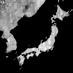
var dataset = ee.ImageCollection('JAXA/ALOS/PALSAR/YEARLY/SAR')\n .filter(ee.Filter.date('2017-01-01', '2018-01-01'));\nvar sarHh = dataset.select('HH');\nvar sarHhVis = {\n min: 0.0,\n max: 10000.0,\n};\nMap.setCenter(136.85, 37.37, 4);\nMap.addLayer(sarHh, sarHhVis, 'SAR HH');\n```\n[Open in Code Editor](https://code.earthengine.google.com/?scriptPath=Examples:Datasets/JAXA/JAXA_ALOS_PALSAR_YEARLY_SAR) \n[Global PALSAR-2/PALSAR Yearly Mosaic, version 1](/earth-engine/datasets/catalog/JAXA_ALOS_PALSAR_YEARLY_SAR) \nA newer version of this dataset with data for 2015-2021 can be found in JAXA/ALOS/PALSAR/YEARLY/SAR_EPOCH The global 25m PALSAR/PALSAR-2 mosaic is a seamless global SAR image created by mosaicking strips of SAR imagery from PALSAR/PALSAR-2. For each year and location, the strip data were selected through visual inspection of the ... \nJAXA/ALOS/PALSAR/YEARLY/SAR, alos,alos2,eroc,jaxa,palsar,palsar2,sar,satellite-imagery \n2007-01-01T00:00:00Z/2020-01-01T00:00:00Z \n-90 -180 90 180 \nGoogle Earth Engine \nhttps://developers.google.com/earth-engine/datasets\n\n- [](https://doi.org/https://www.eorc.jaxa.jp/ALOS/en/dataset/fnf_e.htm)\n- [](https://doi.org/https://developers.google.com/earth-engine/datasets/catalog/JAXA_ALOS_PALSAR_YEARLY_SAR)"]]