Esses dados foram gerados usando 4.185.439 cenas do Landsat 5, 7 e 8 adquiridas entre 16 de março de 1984 e 31 de dezembro de 2019.
Cada pixel foi classificado individualmente como água / não água usando um sistema especializado, e os resultados foram reunidos em um histórico mensal para todo o período e duas épocas (1984-1999, 2000-2019) para detecção de mudanças.
Esse produto de camadas de mapeamento consiste em uma imagem com sete bandas.
Ele mapeia diferentes aspectos da distribuição espacial e temporal da água da superfície nos últimos 35 anos. As áreas onde a água nunca foi detectada são mascaradas.
Bandas
Tamanho do pixel 30 metros
Bandas
Nome
Unidades
Mín.
Máx.
Tamanho do pixel
Descrição
occurrence
%
0
100
metros
A frequência com que a água estava presente.
change_abs
%
-100
100
metros
Mudança absoluta na ocorrência entre duas épocas: 1984-1999 e 2000-2019.
change_norm
%
-100
100
metros
Mudança normalizada na ocorrência. (epoch1-epoch2)/(epoch1+epoch2) * 100
seasonality
0
12
metros
Número de meses em que a água está presente.
recurrence
%
0
100
metros
A frequência com que a água retorna de ano para ano.
transition
metros
Classificação categórica da mudança entre o primeiro e o último ano.
max_extent
metros
Imagem binária que contém 1 em qualquer lugar onde a água já foi detectada.
Máscara de bits para max_extent
Bit 0: flag que indica se a água foi detectada ou não
0: Não é água
1: Água
Tabela de classes de transição
Valor
Cor
Descrição
0
#ffffff
Sem alterações
1
#0000ff
Permanente
2
#22b14c
Novo permanente
3
#d1102d
Perda permanente
4
#99d9ea
Trilha da temporada
5
#b5e61d
Nova temporada
6
#e6a1aa
Perda sazonal
7
#ff7f27
De sazonal para permanente
8
#ffc90e
De permanente para sazonal
9
#7f7f7f
Temporário permanente
10
#c3c3c3
Sazonal efêmero
Termos de Uso
Termos de Uso
Todos os dados aqui são produzidos no âmbito do Programa Copernicus e são fornecidos sem custo financeiro, sem restrição de uso. Para informações completas sobre a licença, consulte o Regulamento do Copernicus.
Publicações, modelos e produtos de dados que usam esses conjuntos de dados precisam incluir o reconhecimento adequado, citando os conjuntos de dados e o artigo do periódico, como na citação a seguir.
Se você estiver usando os dados como uma camada em um mapa publicado, inclua o seguinte texto de atribuição: "Fonte: EC JRC/Google"
Citações
Citações:
Jean-Francois Pekel, Andrew Cottam, Noel Gorelick, Alan S. Belward,
High-resolution mapping of global surface water and its long-term changes.
Nature 540, 418-422 (2016). (doi:10.1038/nature20584)
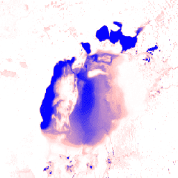
Esse conjunto de dados contém mapas da localização e da distribuição temporal de águas superficiais de 1984 a 2019, além de estatísticas sobre a extensão e a mudança dessas águas. Para mais informações, consulte o artigo associado: High-resolution mapping of global surface water and its long-term changes (Nature, 2016) e …
[null,null,[],[[["\u003cp\u003eThis dataset provides maps of global surface water and its changes from 1984 to 2019, derived from Landsat 5, 7, and 8 imagery.\u003c/p\u003e\n"],["\u003cp\u003eIt includes occurrence, change, seasonality, recurrence, and transition classifications of surface water.\u003c/p\u003e\n"],["\u003cp\u003eThe dataset offers various bands, including water frequency, change detection, and seasonality, at a 30-meter resolution.\u003c/p\u003e\n"],["\u003cp\u003eData is freely available for use with proper attribution to EC JRC/Google and citation of the associated journal article.\u003c/p\u003e\n"],["\u003cp\u003eUsers can explore and analyze the data using Google Earth Engine.\u003c/p\u003e\n"]]],["The dataset maps surface water's location and temporal distribution from March 16, 1984, to December 31, 2019, using Landsat data. It classifies each pixel as water or non-water, providing monthly histories and change detection for two epochs (1984-1999 and 2000-2019). Seven bands map the spatial and temporal distribution, including water occurrence, change, seasonality, recurrence, and transitions. The data, provided by EC JRC/Google, is available through Google Earth Engine and is free to use with proper citation.\n"],null,["# JRC Global Surface Water Mapping Layers, v1.2 [deprecated]\n\nDataset Availability\n: 1984-03-16T00:00:00Z--2020-01-01T00:00:00Z\n\nDataset Provider\n:\n\n\n [EC JRC / Google](https://global-surface-water.appspot.com)\n\nTags\n:\n[geophysical](/earth-engine/datasets/tags/geophysical) [google](/earth-engine/datasets/tags/google) [jrc](/earth-engine/datasets/tags/jrc) [landsat-derived](/earth-engine/datasets/tags/landsat-derived) [surface](/earth-engine/datasets/tags/surface) [surface-ground-water](/earth-engine/datasets/tags/surface-ground-water) [water](/earth-engine/datasets/tags/water) \n\n#### Description\n\nThis dataset contains maps of the location and temporal\ndistribution of surface water from 1984 to 2019 and provides\nstatistics on the extent and change of those water surfaces.\nFor more information see the associated journal article: [High-resolution\nmapping of global surface water and its long-term changes](https://www.nature.com/nature/journal/v540/n7633/full/nature20584.html)\n(Nature, 2016) and the online [Data Users Guide](https://storage.googleapis.com/global-surface-water/downloads_ancillary/DataUsersGuidev2.pdf).\n\nThese data were generated using 4,185,439 scenes from Landsat\n5, 7, and 8 acquired between 16 March 1984 and 31 December 2019.\nEach pixel was individually classified into water / non-water\nusing an expert system and the results were collated into a monthly\nhistory for the entire time period and two epochs (1984-1999,\n2000-2019) for change detection.\n\nThis mapping layers product consists of 1 image containing 7 bands.\nIt maps different facets of the spatial and temporal distribution of\nsurface water over the last 35 years. Areas where water has\nnever been detected are masked.\n\n### Bands\n\n\n**Pixel Size**\n\n30 meters\n\n**Bands**\n\n| Name | Units | Min | Max | Pixel Size | Description |\n|---------------|-------|------|-----|------------|---------------------------------------------------------------------------|---|---|---|---|---|---|---|---|---|---|---|---|---|---|---|---|---|---|---|---|---|---|---|---|---|---|---|---|---|---|---|---|---|---|---|---|---|---|---|---|---|---|---|---|---|---|---|---|---|---|---|---|---|---|---|---|---|---|---|---|---|---|---|---|---|---|---|---|---|---|---|---|---|---|---|---|---|---|---|---|---|---|---|---|---|---|---|---|---|---|---|---|---|---|\n| `occurrence` | % | 0 | 100 | meters | The frequency with which water was present. |\n| `change_abs` | % | -100 | 100 | meters | Absolute change in occurrence between two epochs: 1984-1999 vs 2000-2019. |\n| `change_norm` | % | -100 | 100 | meters | Normalized change in occurrence. (epoch1-epoch2)/(epoch1+epoch2) \\* 100 |\n| `seasonality` | | 0 | 12 | meters | Number of months water is present. |\n| `recurrence` | % | 0 | 100 | meters | The frequency with which water returns from year to year. |\n| `transition` | | | | meters | Categorical classification of change between first and last year. |\n| `max_extent` | | | | meters | Binary image containing 1 anywhere water has ever been detected. |\n| Bitmask for max_extent - Bit 0: Flag indicating if water was detected or not - 0: Not water - 1: Water ||||||||||||||||||||||||||||||||||||||||||||||||||||||||||||||||||||||||||||||||||||||||||||||||||||\n\n**transition Class Table**\n\n| Value | Color | Description |\n|-------|---------|-----------------------|\n| 0 | #ffffff | No change |\n| 1 | #0000ff | Permanent |\n| 2 | #22b14c | New permanent |\n| 3 | #d1102d | Lost permanent |\n| 4 | #99d9ea | Seasonal |\n| 5 | #b5e61d | New seasonal |\n| 6 | #e6a1aa | Lost seasonal |\n| 7 | #ff7f27 | Seasonal to permanent |\n| 8 | #ffc90e | Permanent to seasonal |\n| 9 | #7f7f7f | Ephemeral permanent |\n| 10 | #c3c3c3 | Ephemeral seasonal |\n\n### Terms of Use\n\n**Terms of Use**\n\nAll data here is produced under the Copernicus Programme and is provided\nfree of charge, without restriction of use. For the full license\ninformation see the Copernicus Regulation.\n\nPublications, models, and data products that make use of these datasets\nmust include proper acknowledgement, including citing datasets and the\njournal article as in the following citation.\n\nIf you are using the data as a layer in a published map, please include the\nfollowing attribution text: 'Source: EC JRC/Google'\n\n### Citations\n\nCitations:\n\n- Jean-Francois Pekel, Andrew Cottam, Noel Gorelick, Alan S. Belward,\n High-resolution mapping of global surface water and its long-term changes.\n Nature 540, 418-422 (2016). ([doi:10.1038/nature20584](https://doi.org/10.1038/nature20584))\n\n### Explore with Earth Engine\n\n| **Important:** Earth Engine is a platform for petabyte-scale scientific analysis and visualization of geospatial datasets, both for public benefit and for business and government users. Earth Engine is free to use for research, education, and nonprofit use. To get started, please [register for Earth Engine access.](https://console.cloud.google.com/earth-engine)\n\n### Code Editor (JavaScript)\n\n```javascript\nvar dataset = ee.Image('JRC/GSW1_2/GlobalSurfaceWater');\n\nvar visualization = {\n bands: ['occurrence'],\n min: 0.0,\n max: 100.0,\n palette: ['ffffff', 'ffbbbb', '0000ff']\n};\n\nMap.setCenter(59.414, 45.182, 6);\n\nMap.addLayer(dataset, visualization, 'Occurrence');\n```\n[Open in Code Editor](https://code.earthengine.google.com/?scriptPath=Examples:Datasets/JRC/JRC_GSW1_2_GlobalSurfaceWater) \n[JRC Global Surface Water Mapping Layers, v1.2 \\[deprecated\\]](/earth-engine/datasets/catalog/JRC_GSW1_2_GlobalSurfaceWater) \nThis dataset contains maps of the location and temporal distribution of surface water from 1984 to 2019 and provides statistics on the extent and change of those water surfaces. For more information see the associated journal article: High-resolution mapping of global surface water and its long-term changes (Nature, 2016) and ... \nJRC/GSW1_2/GlobalSurfaceWater, geophysical,google,jrc,landsat-derived,surface,surface-ground-water,water \n1984-03-16T00:00:00Z/2020-01-01T00:00:00Z \n-90 -180 90 180 \nGoogle Earth Engine \nhttps://developers.google.com/earth-engine/datasets\n\n- [](https://doi.org/https://global-surface-water.appspot.com)\n- [](https://doi.org/https://developers.google.com/earth-engine/datasets/catalog/JRC_GSW1_2_GlobalSurfaceWater)"]]