- Dostępność zbioru danych
- 2003-07-29T00:00:00Z–2008-07-29T00:00:00Z
- Dostawca zbioru danych
- USGS
- Tagi
Opis
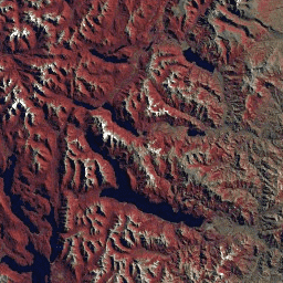
Zbiór danych GLS2005 to kolekcja 9500 ortorektyfikowanych zdjęć satelitarnych o średniej rozdzielczości, wykonanych w okresie od 2004 r. do 2007 r., przedstawiających obszary lądowe Ziemi. GLS2005 korzysta głównie z danych Landsat 5 i uzupełnionych danych Landsat 7, a także z danych EO-1 ALI i Terra ASTER, które wypełniają wszelkie luki w danych.
Ta kolekcja zawiera tylko podzbiór obrazów GLS2005 z sensora L7 ETM+.
Pasma
Pasma
Rozmiar piksela: zależy od modelu
| Nazwa | Rozmiar piksela | Długość fali | Opis |
|---|---|---|---|
10 |
30 metrów | 0,45–0,52 μm | Niebieski |
20 |
30 metrów | 0,52–0,60 μm | Zielony |
30 |
30 metrów | 0,63–0,69 μm | Czerwony |
40 |
30 metrów | 0,76–0,90 μm | Bliska podczerwień |
50 |
30 metrów | 1,55–1,75 μm | Podczerwień krótkofalowa 1 |
60 |
60 metrów | 10,40–12,50 μm | Termowizja w podczerwieni 1. Przeskalowano z 60 minut do 30 minut. |
70 |
30 metrów | 2,08–2,35 μm | Podczerwień krótkofalowa 2 |
Warunki korzystania z usługi
Warunki korzystania z usługi
Zbiory danych Landsat są tworzone przez instytucje federalne, dlatego należą do domeny publicznej i można ich używać, przenosić i reprodukować bez ograniczeń wynikających z praw autorskich.
Należy podać informację o źródle danych USGS, dodając wiersz z cytatem, np. jak w przykładzie poniżej.
(Nazwa produktu, obrazu, zdjęcia lub zbioru danych) dzięki uprzejmości U.S. Geological Survey
Przykład: zdjęcie Landsat-7 udostępnione przez U.S. Geological Survey
Więcej informacji o prawidłowym cytowaniu i uznawaniu produktów USGS znajdziesz w wytycznych dotyczących systemu tożsamości wizualnej USGS.
Odkrywaj za pomocą Earth Engine
Edytor kodu (JavaScript)
var dataset = ee.ImageCollection('LANDSAT/GLS2005_L7');
var trueColor321 = dataset.select(['30', '20', '10']);
Map.setCenter(6.746, 46.529, 6);
Map.addLayer(trueColor321, {}, 'True Color (321)');