- 数据集可用时间
- 1984-03-16T16:20:00Z–2012-05-05T17:54:06Z
- 数据集生产者
- USGS
- 标签
说明
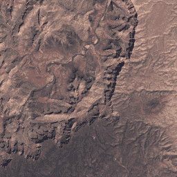
此数据集是来自 Landsat 5 ETM 传感器的经过大气校正的地表反射率。这些影像包含 4 个可见光和近红外 (VNIR) 波段以及 2 个短波红外 (SWIR) 波段(已处理为正射校正的地表反射率),以及 1 个热红外 (TIR) 波段(已处理为正射校正的亮度温度)。VNIR 和 SWIR 波段的分辨率为 30 米 / 像素。 TIR 波段最初以 120 米 / 像素的分辨率(Landsat 7 为 60 米 / 像素)收集,但已使用立方卷积重新采样为 30 米。
这些数据已使用 LEDAPS 进行大气校正,并包含使用 CFMASK 生成的云、阴影、水和雪掩码,以及每个像素的饱和度掩码。
收集的数据条带会打包成重叠的“场景”,这些场景使用标准化参考网格覆盖大约 170 公里 x 183 公里的区域。
请注意,自 2017 年以来,Landsat 7 的轨道一直在漂移,导致采集时间提前。
另请参阅 USGS 上有关 SR QA 波段的页面。
只有处理到 L1TP 级别的 Landsat 资产才能生成 SR
数据提供方备注:
- 对于太阳天顶角大于 76° 的场景,系统不会运行 SR。
- 建议用户避免对在高纬度(> 65°)获取的数据使用 SR。
- 全色波段(ETM+ 波段 7、OLI 波段 8)未处理为地表反射率。
- 在受不利条件影响的大气校正区域,SR 校正的有效性可能会降低:
- 极度干旱或积雪覆盖的地区
- 低太阳角度条件
- 陆地面积相对于邻近水域较小的沿海地区
- 云污染严重的区域
此产品由 Google 使用 USGS 提供的 Docker 映像生成。
频段
分辨率
30 米
波段
| 名称 | 单位 | 缩放 | 波长 | 说明 | |||||||||||||||||||||||||||||||||||||||||||||||||||||||||||||||||||||||||||||||||||||||||||||||
|---|---|---|---|---|---|---|---|---|---|---|---|---|---|---|---|---|---|---|---|---|---|---|---|---|---|---|---|---|---|---|---|---|---|---|---|---|---|---|---|---|---|---|---|---|---|---|---|---|---|---|---|---|---|---|---|---|---|---|---|---|---|---|---|---|---|---|---|---|---|---|---|---|---|---|---|---|---|---|---|---|---|---|---|---|---|---|---|---|---|---|---|---|---|---|---|---|---|---|---|
B1 |
0.0001 | 0.45-0.52 μm | 频段 1(蓝色)表面反射率 |
||||||||||||||||||||||||||||||||||||||||||||||||||||||||||||||||||||||||||||||||||||||||||||||||
B2 |
0.0001 | 0.52-0.60 μm | 波段 2(绿色)表面反射率 |
||||||||||||||||||||||||||||||||||||||||||||||||||||||||||||||||||||||||||||||||||||||||||||||||
B3 |
0.0001 | 0.63-0.69 μm | 波段 3(红色)表面反射率 |
||||||||||||||||||||||||||||||||||||||||||||||||||||||||||||||||||||||||||||||||||||||||||||||||
B4 |
0.0001 | 0.77-0.90 μm | 波段 4(近红外)地表反射率 |
||||||||||||||||||||||||||||||||||||||||||||||||||||||||||||||||||||||||||||||||||||||||||||||||
B5 |
0.0001 | 1.55-1.75 μm | 波段 5(短波红外 1)地表反射率 |
||||||||||||||||||||||||||||||||||||||||||||||||||||||||||||||||||||||||||||||||||||||||||||||||
B6 |
K | 0.1 | 10.40-12.50 μm | 频段 6 亮度温度。虽然最初以 120 米 / 像素(Landsat 7 为 60 米 / 像素)的分辨率收集,但此波段已使用立方卷积重新采样为 30 米。 |
|||||||||||||||||||||||||||||||||||||||||||||||||||||||||||||||||||||||||||||||||||||||||||||||
B7 |
0.0001 | 2.08-2.35 μm | 波段 7(短波红外 2)地表反射率 |
||||||||||||||||||||||||||||||||||||||||||||||||||||||||||||||||||||||||||||||||||||||||||||||||
sr_atmos_opacity |
0.001 | 大气不透明度;< 0.1 = 清澈;0.1 - 0.3 = 一般;> 0.3 = 朦胧 |
|||||||||||||||||||||||||||||||||||||||||||||||||||||||||||||||||||||||||||||||||||||||||||||||||
sr_cloud_qa |
云质量属性。注意:对于云掩码,pixel_qa 可能会比 sr_cloud_qa 提供更准确的结果。请参阅 LEDAPS 产品指南中的第 14 页。 |
||||||||||||||||||||||||||||||||||||||||||||||||||||||||||||||||||||||||||||||||||||||||||||||||||
pixel_qa |
根据 CFMASK 算法生成的像素质量属性。 |
||||||||||||||||||||||||||||||||||||||||||||||||||||||||||||||||||||||||||||||||||||||||||||||||||
radsat_qa |
辐射饱和度质量检查 |
||||||||||||||||||||||||||||||||||||||||||||||||||||||||||||||||||||||||||||||||||||||||||||||||||
图片属性
图像属性
| 名称 | 类型 | 说明 |
|---|---|---|
| CLOUD_COVER | 双精度 | 云覆盖百分比 (0-100),-1 = 未计算。 (从原始 Landsat 元数据中获取) |
| CLOUD_COVER_LAND | 双精度 | 陆地上空的云覆盖百分比 (0-100),-1 = 未计算。 (从原始 Landsat 元数据中获取) |
| EARTH_SUN_DISTANCE | 双精度 | 日地距离(天文单位) |
| ESPA_VERSION | STRING | 用于计算 SR 的内部 ESPA 映像版本 |
| GEOMETRIC_RMSE_MODEL | 双精度 | 横向和纵向几何残差(以米为单位)的组合 RMSE(均方根误差)。(从原始 Landsat 元数据中获取) |
| GEOMETRIC_RMSE_MODEL_X | 双精度 | 在沿轨道方向上用于几何精度校正的地面控制点 (GCP) 上测量的几何残差(以米为单位)的 RMSE(均方根误差)。 (从原始 Landsat 元数据中获取) |
| GEOMETRIC_RMSE_MODEL_Y | 双精度 | 在几何精度校正中,沿轨道方向上使用的地面控制点 (GCP) 上测得的几何残差(以米为单位)的 RMSE(均方根误差)。 (从原始 Landsat 元数据中获取) |
| IMAGE_QUALITY | INT | 图片质量,0 = 最差,9 = 最佳,-1 = 未计算质量。 (从原始 Landsat 元数据中获取) |
| LANDSAT_ID | STRING | Landsat 产品标识符(集合 1) |
| LEVEL1_PRODUCTION_DATE | INT | 原始 Level 1 数据的生成日期(以自纪元以来的毫秒数表示) |
| PIXEL_QA_VERSION | STRING | 用于生成“pixel_qa”波段的软件的版本 |
| 卫星 | STRING | 卫星名称 |
| SENSING_TIME | STRING | 观测时间,采用 ISO 8601 字符串格式。 (从原始 Landsat 元数据中获取) |
| SOLAR_AZIMUTH_ANGLE | 双精度 | 太阳方位角 |
| SR_APP_VERSION | STRING | 用于处理地表反射率的 LEDAPS 版本 |
| WRS_PATH | INT | 场景的 WRS 路径编号 |
| WRS_ROW | INT | 场景的 WRS 行号 |
使用条款
使用条款
Landsat 数据集属联邦政府创建数据,属于公共领域,可不受版权限制地使用、转让或复制。
必须通过包含如下示例的文字引用方式,标明美国地质调查局 (USGS) 作为数据来源。
(产品、图像、影像或数据集名称)由美国地质调查局提供
示例:Landsat-7 图像由美国地质调查局提供
有关正确引用和鸣谢美国地质调查局产品的详细要求,请参阅 美国地质调查局视觉识别系统指南。