- 数据集可用性
- 2000-02-24T00:00:00Z–2024-06-01T00:00:00Z
- 数据集提供商
- 美国地质调查局 (USGS) EROS 中心 NASA LP DAAC
- 频率
- 1 天
- 标签
说明
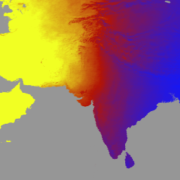
MCD18A1 版本 6.1 是一种中等分辨率成像光谱辐射计 (MODIS) Terra 和 Aqua 组合的向下短波辐射 (DSR) 网格化 3 级产品,每天以 1 公里像素分辨率生成,并每 3 小时估计一次 DSR。DSR 是指陆地表面在短波谱(300-4,000 纳米)范围内的入射太阳辐射,是陆地表面模型中的一个重要变量,可用于解决各种科学和应用问题。MCD18 产品基于一种原型算法,该算法使用 MODIS 数据的多时相签名来推导地表反射率,然后使用查找表 (LUT) 方法计算入射 DSR。LUT 考虑了不同类型的气溶胶和云负载,以及各种照明/观测几何形状。全球 DSR 产品由 MODIS 和地球静止卫星数据生成。如需详细了解用于创建这些数据的方法,请参阅算法理论基础文档。
频段
Pixel 大小
500 米
频段
| 名称 | 单位 | 最小值 | 最大值 | 像素尺寸 | 说明 | ||||||||||||||||||||||||||||||||||||||||||||||||||||||||||||||||||||||||||||||||||||||||||||||
|---|---|---|---|---|---|---|---|---|---|---|---|---|---|---|---|---|---|---|---|---|---|---|---|---|---|---|---|---|---|---|---|---|---|---|---|---|---|---|---|---|---|---|---|---|---|---|---|---|---|---|---|---|---|---|---|---|---|---|---|---|---|---|---|---|---|---|---|---|---|---|---|---|---|---|---|---|---|---|---|---|---|---|---|---|---|---|---|---|---|---|---|---|---|---|---|---|---|---|---|
DSR |
瓦/平方米 | 0 | 1400 | 米 | MODIS 过境时的瞬时总 DSR |
||||||||||||||||||||||||||||||||||||||||||||||||||||||||||||||||||||||||||||||||||||||||||||||
Direct |
瓦/平方米 | 0 | 1400 | 米 | MODIS 过境时的瞬时直接 DSR |
||||||||||||||||||||||||||||||||||||||||||||||||||||||||||||||||||||||||||||||||||||||||||||||
Diffuse |
瓦/平方米 | 0 | 1400 | 米 | MODIS 过境时的瞬时漫射 DSR |
||||||||||||||||||||||||||||||||||||||||||||||||||||||||||||||||||||||||||||||||||||||||||||||
GMT_0000_DSR |
瓦/平方米 | 0 | 1400 | 米 | GMT 00:00 时的总 DSR |
||||||||||||||||||||||||||||||||||||||||||||||||||||||||||||||||||||||||||||||||||||||||||||||
GMT_0300_DSR |
瓦/平方米 | 0 | 1400 | 米 | GMT 03:00 的总 DSR |
||||||||||||||||||||||||||||||||||||||||||||||||||||||||||||||||||||||||||||||||||||||||||||||
GMT_0600_DSR |
瓦/平方米 | 0 | 1400 | 米 | GMT 06:00 的总 DSR |
||||||||||||||||||||||||||||||||||||||||||||||||||||||||||||||||||||||||||||||||||||||||||||||
GMT_0900_DSR |
瓦/平方米 | 0 | 1400 | 米 | GMT 09:00 的总 DSR |
||||||||||||||||||||||||||||||||||||||||||||||||||||||||||||||||||||||||||||||||||||||||||||||
GMT_1200_DSR |
瓦/平方米 | 0 | 1400 | 米 | GMT 12:00 的总 DSR |
||||||||||||||||||||||||||||||||||||||||||||||||||||||||||||||||||||||||||||||||||||||||||||||
GMT_1500_DSR |
瓦/平方米 | 0 | 1400 | 米 | GMT 15:00 的总 DSR |
||||||||||||||||||||||||||||||||||||||||||||||||||||||||||||||||||||||||||||||||||||||||||||||
GMT_1800_DSR |
瓦/平方米 | 0 | 1400 | 米 | GMT 18:00 的总 DSR |
||||||||||||||||||||||||||||||||||||||||||||||||||||||||||||||||||||||||||||||||||||||||||||||
GMT_2100_DSR |
瓦/平方米 | 0 | 1400 | 米 | GMT 21:00 的总 DSR |
||||||||||||||||||||||||||||||||||||||||||||||||||||||||||||||||||||||||||||||||||||||||||||||
DSR_Quality |
米 | 质量标志 |
|||||||||||||||||||||||||||||||||||||||||||||||||||||||||||||||||||||||||||||||||||||||||||||||||
使用条款
使用条款
通过 LP DAAC 获取的 MODIS 数据和产品在后续使用、销售或重新分发方面没有任何限制。
引用
引用:
如需了解如何引用 LP DAAC 数据集,请访问 LP DAAC 的“引用我们的数据”页面。
DOI
使用 Earth Engine 探索
代码编辑器 (JavaScript)
var dataset = ee.ImageCollection('MODIS/061/MCD18A1')
                  .filter(ee.Filter.date('2000-01-01', '2001-01-01'));
var gmt_1200_dsr = dataset.select('GMT_1200_DSR');
var gmt_1200_dsr_vis = {
  min: 0,
  max: 350,
  palette: ['0f17ff', 'b11406', 'f1ff23'],
};
Map.setCenter(6.746, 46.529, 2);
Map.addLayer(
    gmt_1200_dsr, gmt_1200_dsr_vis,
    'Total dsr at GMT 12:00');