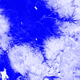
Normalleştirilmiş Fark Kar İndeksi, spektrumun görünür kısmında orta kızılötesine kıyasla karakteristik olarak daha yüksek yansıtma özelliğine sahip olması nedeniyle karı tanımlamak için kullanılır. NDSI, yeşil ve orta kızılötesi bantlar kullanılarak hesaplanır ve -1,0 ile 1,0 arasında bir aralığa sahiptir. Ayrıntılar için
Riggs ve diğerleri (1994)
kaynağına bakın. Bu ürün, MODIS/006/MCD43A4 yüzey yansıtma kompozitlerinden oluşturulmuştur.
Bantlar
Bantlar
Ad
Piksel Boyutu
Açıklama
NDSI
463.313 metre
Normalleştirilmiş Fark Kar İndeksi
Kullanım Şartları
Kullanım Şartları
LP DAAC aracılığıyla edinilen MODIS verileri ve ürünleri, sonraki kullanım, satış veya yeniden dağıtım açısından herhangi bir kısıtlamaya tabi değildir.
Normalleştirilmiş Fark Kar İndeksi, spektrumun görünür kısmında orta kızılötesine kıyasla karakteristik olarak daha yüksek yansıtma özelliğine sahip olması nedeniyle karı tanımlamak için kullanılır. NDSI, yeşil ve orta kızılötesi bantlar kullanılarak hesaplanır ve -1,0 ile 1,0 arasında bir aralığa sahiptir. … için Riggs ve diğerleri (1994) çalışmasına bakın.
[null,null,[],[[["\u003cp\u003eThe MODIS/MCD43A4_006_NDSI dataset provides daily, global Normalized Difference Snow Index (NDSI) values, derived from MODIS surface reflectance data.\u003c/p\u003e\n"],["\u003cp\u003eNDSI helps identify snow cover by comparing reflectance in the visible and mid-infrared spectrum, ranging from -1.0 to 1.0.\u003c/p\u003e\n"],["\u003cp\u003eThis dataset is freely available for use, sale, and redistribution with no restrictions.\u003c/p\u003e\n"],["\u003cp\u003eThe data is provided by Google Earth Engine and covers the period from February 24, 2000, to February 10, 2023.\u003c/p\u003e\n"],["\u003cp\u003eUsers can explore and analyze the dataset using Earth Engine's platform, which is free for research, education, and non-profit purposes.\u003c/p\u003e\n"]]],[],null,["# MODIS Combined 16-Day NDSI\n\nDataset Availability\n: 2000-02-24T00:00:00Z--2023-02-10T00:00:00Z\n\nDataset Provider\n:\n\n\n [Google](https://earthengine.google.com/)\n\nCadence\n: 1 Day\n\nTags\n:\n albedo \n brdf \n daily \n global \n mcd43a4 \n modis \n nasa \n ndsi \n reflectance \n usgs \nvegetation-indices \n\n#### Description\n\nThe Normalized Difference Snow Index is used to\nidentify snow, based on its characteristically higher reflectance in\nthe visible portion of the spectrum compared to the mid-IR. NDSI is\ncomputed using the Green and Mid-IR bands, and has a range of -1.0 to\n1.0. See\n[Riggs et al. (1994)](https://doi.org/10.1109/IGARSS.1994.399618)\nfor details. This product is generated from the MODIS/006/MCD43A4 surface reflectance composites.\n\n### Bands\n\n**Bands**\n\n| Name | Pixel Size | Description |\n|--------|----------------|----------------------------------|\n| `NDSI` | 463.313 meters | Normalized Difference Snow Index |\n\n### Terms of Use\n\n**Terms of Use**\n\nMODIS data and products acquired through the LP DAAC have no restrictions on subsequent use, sale, or redistribution.\n\n### Explore with Earth Engine\n\n| **Important:** Earth Engine is a platform for petabyte-scale scientific analysis and visualization of geospatial datasets, both for public benefit and for business and government users. Earth Engine is free to use for research, education, and nonprofit use. To get started, please [register for Earth Engine access.](https://console.cloud.google.com/earth-engine)\n\n### Code Editor (JavaScript)\n\n```javascript\nvar dataset = ee.ImageCollection('MODIS/MCD43A4_006_NDSI')\n .filter(ee.Filter.date('2018-04-01', '2018-06-01'));\nvar colorized = dataset.select('NDSI');\nvar colorizedVis = {\n palette: ['000088', '0000ff', '8888ff', 'ffffff'],\n};\nMap.setCenter(-7.03125, 31.0529339857, 2);\nMap.addLayer(colorized, colorizedVis, 'Colorized');\n```\n[Open in Code Editor](https://code.earthengine.google.com/?scriptPath=Examples:Datasets/MODIS/MODIS_MCD43A4_006_NDSI) \n[MODIS Combined 16-Day NDSI](/earth-engine/datasets/catalog/MODIS_MCD43A4_006_NDSI) \nThe Normalized Difference Snow Index is used to identify snow, based on its characteristically higher reflectance in the visible portion of the spectrum compared to the mid-IR. NDSI is computed using the Green and Mid-IR bands, and has a range of -1.0 to 1.0. See Riggs et al. (1994) for ... \nMODIS/MCD43A4_006_NDSI, albedo,brdf,daily,global,mcd43a4,modis,nasa,ndsi,reflectance,usgs,vegetation-indices \n2000-02-24T00:00:00Z/2023-02-10T00:00:00Z \n-90 -180 90 180 \nGoogle Earth Engine \nhttps://developers.google.com/earth-engine/datasets\n\n- [](https://doi.org/https://earthengine.google.com/)\n- [](https://doi.org/https://developers.google.com/earth-engine/datasets/catalog/MODIS_MCD43A4_006_NDSI)"]]