- Disponibilità set di dati
- 2002-07-04T00:00:00Z–2023-02-25T00:00:00Z
- Produttore del set di dati
- Cadenza
- 1 giorno
- Tag
Descrizione
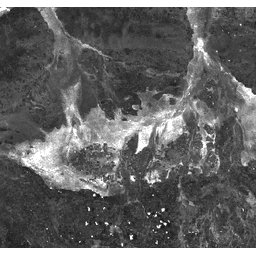
L'indice dell'area bruciata (BAI) viene generato dalle bande del rosso e del vicino infrarosso e misura la distanza spettrale di ogni pixel da un punto spettrale di riferimento (la riflettanza misurata del carbone). Questo indice ha lo scopo di enfatizzare il segnale di carbone nelle immagini post-incendio. Per maggiori dettagli, consulta Chuvieco et al. (2002). Questo prodotto è generato dai compositi di riflettanza di superficie MODIS/006/MYD09GA.
Bande
Bande
Dimensioni pixel: 463,313 metri (tutte le bande)
| Nome | Dimensioni dei pixel | Descrizione |
|---|---|---|
BAI |
463.313 metri | Burn Area Index |
Termini e condizioni d'uso
Termini e condizioni d'uso
I dati e i prodotti MODIS acquisiti tramite l'LP DAAC non sono soggetti a restrizioni per quanto riguarda l'uso, la vendita o la ridistribuzione successivi.
Esplora con Earth Engine
Editor di codice (JavaScript)
var dataset = ee.ImageCollection('MODIS/MYD09GA_006_BAI')
                  .filter(ee.Filter.date('2018-04-01', '2018-06-01'));
var scaled = dataset.select('BAI');
var scaledVis = {
  min: 0.0,
  max: 100.0,
};
Map.setCenter(-7.03125, 31.0529339857, 2);
Map.addLayer(scaled, scaledVis, 'Scaled');