Projekt EMIT jest częścią programu Earth Venture-Instrument (EV-I), którym kieruje dyrektor programu w Oddziale Nauk o Ziemi NASA (ESD).
EMIT to spektrometr obrazujący VSWIR Infrared Dyson przystosowany do instalacji na Międzynarodowej Stacji Kosmicznej (ISS). EMIT mierzy promieniowanie w zakresie od 380 do 2500 nanometrów z przepustowością około 7 nm.
Dane są zbierane na pasie o szerokości około 75 km na równiku, a odległość próbkowania na ziemi wynosi około 60 m. Więcej informacji znajdziesz w omówieniu misji EMIT NASA.
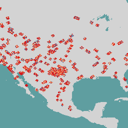
EMIT to szczególnie przydatne narzędzie do mapowania gazów cieplarnianych, w tym metanu, dwutlenku węgla i pary wodnej. Jest to zgodne z wcześniejszymi wynikami uzyskanymi na podstawie danych lotniczych, ale globalny charakter, częstotliwość ponownych wizyt i szeroki pas pomiarowy EMIT dały bezprecedensową możliwość zbadania pobierania danych o gazach cieplarnianych.
Produkt danych EMIT Level 2B Methane Enhancement Data (EMITL2BCH4ENH) w wersji 1 to szacunkowa wartość wzmocnienia całkowitej kolumny pionowej metanu w częściach na milion metrów (ppm m) na podstawie adaptacyjnego dopasowanego filtra.
EMITL2BCH4ENH zawiera dane o wzmocnieniu metanu na piksel, które służą do identyfikowania kompleksów pióropuszy metanu. Pierwsza wersja produktu danych EMITL2BCH4ENH będzie zawierać tylko granule, w których zidentyfikowano kompleksy pióropuszy metanu.
Pasma
Rozmiar piksela 72000 m
Pasma
Nazwa
Jednostki
Rozmiar piksela
Opis
vertical_column_enhancement
ppm m
metry
Szacunkowa łączna poprawa kolumny pionowej metanu
Właściwości obrazu
Właściwości obrazu
Nazwa
Typ
Opis
orbit_identification_number
CIĄG ZNAKÓW
Unikalny numer identyfikacyjny orbity
scene_identification_number
CIĄG ZNAKÓW
Unikalny numer identyfikacyjny sceny
Warunki korzystania z usługi
Dane i produkty NASA EMIT uzyskane za pośrednictwem LP DAAC
nie podlegają ograniczeniom w zakresie dalszego wykorzystania, sprzedaży ani redystrybucji.
Cytaty
Cytowania:
Green, R., Thorpe, A., Brodrick, P., Chadwick, D., Elder, C.,
Villanueva-Weeks, C., Fahlen, J., Coleman, R., Jensen, D., Olsen-Duvall, W.,
Lundeen, S., Lopez, A., Thompson, D. (2023). EMIT L2B Methane Enhancement
Data 60 m V001 [Zbiór danych]. NASA EOSDIS Land Processes Distributed Active
Archive Center. Dostęp: 26 lutego 2024 r. https://doi.org/10.5067/EMIT/EMITL2BCH4ENH.001
Projekt EMIT jest częścią programu Earth Venture-Instrument (EV-I), którym kieruje dyrektor programu w Oddziale Nauk o Ziemi NASA (ESD). EMIT to spektrometr obrazujący VSWIR Infrared Dyson przystosowany do instalacji na Międzynarodowej Stacji Kosmicznej (ISS). EMIT mierzy promieniowanie w zakresie od 380 do 2500 nanometrów…
[null,null,[],[[["\u003cp\u003eThe NASA EMIT Level 2B Methane Enhancement dataset provides total vertical column enhancement estimates of methane, useful for identifying methane plume complexes.\u003c/p\u003e\n"],["\u003cp\u003eData is collected by the EMIT imaging spectrometer on the International Space Station, offering global coverage with a 60m ground sampling distance and a 75km swath width.\u003c/p\u003e\n"],["\u003cp\u003eThis dataset is particularly valuable for investigating greenhouse gas retrievals, especially for methane, due to its global nature, revisit frequency, and wide swath.\u003c/p\u003e\n"],["\u003cp\u003eEMITL2BCH4ENH data is freely available for use, sale, and redistribution without restrictions.\u003c/p\u003e\n"],["\u003cp\u003eThe initial release of EMITL2BCH4ENH data focuses on granules containing identified methane plume complexes.\u003c/p\u003e\n"]]],["The NASA EMIT project provides daily methane enhancement data (EMITL2BCH4ENH) from a VSWIR imaging spectrometer on the ISS, covering August 2022 to November 2024. This data, measured in ppm m, identifies methane plume complexes using an adaptive matched filter. The dataset, accessible through Earth Engine, includes a `vertical_column_enhancement` band with a 60m pixel size, allowing for global greenhouse gas investigation. Data acquired have no restrictions on use, sale, or redistribution.\n"],null,["# Earth Surface Mineral Dust Source Investigation- Methane Enhancement\n\nDataset Availability\n: 2022-08-10T00:00:00Z--2024-11-30T19:38:00Z\n\nDataset Provider\n:\n\n\n [NASA Jet Propulsion Laboratory](https://earth.jpl.nasa.gov/emit/data/data-products/)\n\nCadence\n: 1 Day\n\nTags\n:\n[atmosphere](/earth-engine/datasets/tags/atmosphere) [daily](/earth-engine/datasets/tags/daily) [emit](/earth-engine/datasets/tags/emit) [methane](/earth-engine/datasets/tags/methane) [nasa](/earth-engine/datasets/tags/nasa) \n\n#### Description\n\nThe EMIT Project is part of the Earth Venture-Instrument (EV-I) Program\ndirected by the Program Director of the NASA Earth Science Division (ESD).\nEMIT is comprised of a VSWIR Infrared Dyson imaging spectrometer adapted for\ninstallation on the International Space Station (ISS). EMIT measures\nradiance between 380 and 2500 nanometers, with an approximate 7 nm bandpass.\nData are collected in a swath that is approximately 75 km wide at the\nequator, with an approximate ground sampling distance of 60 m. See the\nprovider's [NASA EMIT Overview](https://lpdaac.usgs.gov/documents/1695/EMIT_L2B_GHG_User_Guide_V1.pdf)\nfor more details.\n\nEMIT was a particularly useful tool for mapping out greenhouse gases,\nincluding methane, carbon dioxide, and water vapor. This is consistent with\nprevious findings from airborne data, but global nature, revisit frequency\nand wide swath of EMIT provided an unprecedented opportunity to investigate\ngreenhouse gas retrievals.\n\nThe EMIT Level 2B Methane Enhancement Data (EMITL2BCH4ENH) Version 1 data\nproduct is a total vertical column enhancement estimate of methane in parts\nper million meter (ppm m) based on an adaptive matched filter approach.\nEMITL2BCH4ENH provides per-pixel methane enhancement data used to identify\nmethane plume complexes. The initial release of the EMITL2BCH4ENH data\nproduct will only include granules where methane plume complexes have been\nidentified.\n\n### Bands\n\n\n**Pixel Size**\n\n72000 meters\n\n**Bands**\n\n| Name | Units | Pixel Size | Description |\n|-------------------------------|-------|------------|-------------------------------------------------------|\n| `vertical_column_enhancement` | ppm m | meters | Total vertical column enhancement estimate of methane |\n\n### Image Properties\n\n**Image Properties**\n\n| Name | Type | Description |\n|-----------------------------|--------|------------------------------------|\n| orbit_identification_number | STRING | Unique Orbit Identification Number |\n| scene_identification_number | STRING | Unique scene identification nuber |\n\n### Terms of Use\n\n**Terms of Use**\n\nNASA EMIT data and products acquired through the LP DAAC\nhave no restrictions on subsequent use, sale, or redistribution.\n\n### Citations\n\nCitations:\n\n- Green, R., Thorpe, A., Brodrick, P., Chadwick, D., Elder, C.,\n Villanueva-Weeks, C., Fahlen, J., Coleman, R., Jensen, D., Olsen-Duvall, W.,\n Lundeen, S., Lopez, A., Thompson, D. (2023). EMIT L2B Methane Enhancement\n Data 60 m V001 \\[Data set\\]. NASA EOSDIS Land Processes Distributed Active\n Archive Center. Accessed 2024-02-26 from\n \u003chttps://doi.org/10.5067/EMIT/EMITL2BCH4ENH.001\u003e\n\n### DOIs\n\n- \u003chttps://doi.org/10.5067/EMIT/EMITL2BCH4ENH.001\u003e\n\n### Explore with Earth Engine\n\n| **Important:** Earth Engine is a platform for petabyte-scale scientific analysis and visualization of geospatial datasets, both for public benefit and for business and government users. Earth Engine is free to use for research, education, and nonprofit use. To get started, please [register for Earth Engine access.](https://console.cloud.google.com/earth-engine)\n\n### Code Editor (JavaScript)\n\n```javascript\nvar dataset = ee.ImageCollection('NASA/EMIT/L2B/CH4ENH');\nvar emitEnhancement = dataset.select('vertical_column_enhancement');\nvar emitEnhancementVis = {\n min: 0,\n max: 100.0,\n palette: ['d7191c', 'fdae61', 'ffffbf', 'abd9e9', '2c7bb6'],\n};\nMap.setCenter(-100.24, 32.04, 5);\nMap.addLayer(\n emitEnhancement, emitEnhancementVis,\n 'Emit Enhancement');\n```\n[Open in Code Editor](https://code.earthengine.google.com/?scriptPath=Examples:Datasets/NASA/NASA_EMIT_L2B_CH4ENH) \n[Earth Surface Mineral Dust Source Investigation- Methane Enhancement](/earth-engine/datasets/catalog/NASA_EMIT_L2B_CH4ENH) \nThe EMIT Project is part of the Earth Venture-Instrument (EV-I) Program directed by the Program Director of the NASA Earth Science Division (ESD). EMIT is comprised of a VSWIR Infrared Dyson imaging spectrometer adapted for installation on the International Space Station (ISS). EMIT measures radiance between 380 and 2500 nanometers, ... \nNASA/EMIT/L2B/CH4ENH, atmosphere,daily,emit,methane,nasa \n2022-08-10T00:00:00Z/2024-11-30T19:38:00Z \n-90 -180 90 180 \nGoogle Earth Engine \nhttps://developers.google.com/earth-engine/datasets\n\n- [https://doi.org/10.5067/EMIT/EMITL2BCH4ENH.001](https://doi.org/https://earth.jpl.nasa.gov/emit/data/data-products/)\n- [https://doi.org/10.5067/EMIT/EMITL2BCH4ENH.001](https://doi.org/https://developers.google.com/earth-engine/datasets/catalog/NASA_EMIT_L2B_CH4ENH)"]]