Проект EMIT является частью программы Earth Venture-Instrument (EV-I), реализуемой под руководством директора программы Отделения наук о Земле НАСА (ESD). EMIT представляет собой инфракрасный спектрометр Дайсона VSWIR, адаптированный для установки на Международной космической станции (МКС). EMIT измеряет излучение в диапазоне длин волн от 380 до 2500 нм с полосой пропускания приблизительно 7 нм. Данные собираются в полосе шириной около 75 км на экваторе с приблизительным расстоянием между точками измерения на поверхности Земли 60 м. Подробнее см. в обзоре NASA EMIT, предоставленном поставщиком.
EMIT оказался особенно полезным инструментом для картирования парниковых газов, включая метан, углекислый газ и водяной пар. Это согласуется с предыдущими результатами, полученными с помощью аэрокосмических данных, но глобальный характер, частота повторных измерений и широкая зона охвата EMIT предоставили беспрецедентную возможность для изучения процессов сбора парниковых газов.
Данные EMIT Level 2B Methane Enhancement Data (EMITL2BCH4ENH) версии 1 представляют собой оценку общего вертикального столба метана в частях на миллион метров (ppm³·м), основанную на подходе с адаптивным согласованным фильтром. EMITL2BCH4ENH предоставляет данные попиксельного усиления метана, используемые для идентификации комплексов метановых шлейфов. Первоначальный выпуск продукта EMITL2BCH4ENH будет включать только гранулы, в которых были идентифицированы комплексы метановых шлейфов.
Группы
Размер пикселя 72000 метров
Группы
Имя
Единицы
Размер пикселя
Описание
vertical_column_enhancement
ppm м
метров
Оценка общего вертикального столба метана
Свойства изображения
Имя
Тип
Описание
номер_идентификации_орбиты
НИТЬ
Уникальный идентификационный номер орбиты
номер_идентификации_сцены
НИТЬ
Уникальный идентификационный номер сцены
Условия эксплуатации
Данные и продукты NASA EMIT, приобретенные через LP DAAC, не имеют ограничений на последующее использование, продажу или распространение.
Цитаты
Цитаты:
Грин, Р., Торп, А., Бродрик, П., Чедвик, Д., Элдер, К., Виллануева-Уикс, К., Фален, Дж., Коулман, Р., Дженсен, Д., Олсен-Дюваль, У., Ландин, С., Лопес, А., Томпсон, Д. (2023). Данные об увеличении концентрации метана EMIT L2B на высоте 60 м V001 [Набор данных]. Распределённый активный архивный центр NASA EOSDIS Land Processes. Дата обращения: 26 февраля 2024 г., https://doi.org/10.5067/EMIT/EMITL2BCH4ENH.001
Проект EMIT является частью программы Earth Venture-Instrument (EV-I), реализуемой под руководством директора программы Отделения наук о Земле НАСА (ESD). EMIT состоит из инфракрасного спектрометра Дайсона VSWIR, адаптированного для установки на Международной космической станции (МКС). EMIT измеряет интенсивность излучения в диапазоне длин волн от 380 до 2500 нанометров, …
[null,null,[],[[["\u003cp\u003eThe NASA EMIT Level 2B Methane Enhancement dataset provides total vertical column enhancement estimates of methane, useful for identifying methane plume complexes.\u003c/p\u003e\n"],["\u003cp\u003eData is collected by the EMIT imaging spectrometer on the International Space Station, offering global coverage with a 60m ground sampling distance and a 75km swath width.\u003c/p\u003e\n"],["\u003cp\u003eThis dataset is particularly valuable for investigating greenhouse gas retrievals, especially for methane, due to its global nature, revisit frequency, and wide swath.\u003c/p\u003e\n"],["\u003cp\u003eEMITL2BCH4ENH data is freely available for use, sale, and redistribution without restrictions.\u003c/p\u003e\n"],["\u003cp\u003eThe initial release of EMITL2BCH4ENH data focuses on granules containing identified methane plume complexes.\u003c/p\u003e\n"]]],["The NASA EMIT project provides daily methane enhancement data (EMITL2BCH4ENH) from a VSWIR imaging spectrometer on the ISS, covering August 2022 to November 2024. This data, measured in ppm m, identifies methane plume complexes using an adaptive matched filter. The dataset, accessible through Earth Engine, includes a `vertical_column_enhancement` band with a 60m pixel size, allowing for global greenhouse gas investigation. Data acquired have no restrictions on use, sale, or redistribution.\n"],null,["# Earth Surface Mineral Dust Source Investigation- Methane Enhancement\n\nDataset Availability\n: 2022-08-10T00:00:00Z--2024-11-30T19:38:00Z\n\nDataset Provider\n:\n\n\n [NASA Jet Propulsion Laboratory](https://earth.jpl.nasa.gov/emit/data/data-products/)\n\nCadence\n: 1 Day\n\nTags\n:\n[atmosphere](/earth-engine/datasets/tags/atmosphere) [daily](/earth-engine/datasets/tags/daily) [emit](/earth-engine/datasets/tags/emit) [methane](/earth-engine/datasets/tags/methane) [nasa](/earth-engine/datasets/tags/nasa) \n\n#### Description\n\nThe EMIT Project is part of the Earth Venture-Instrument (EV-I) Program\ndirected by the Program Director of the NASA Earth Science Division (ESD).\nEMIT is comprised of a VSWIR Infrared Dyson imaging spectrometer adapted for\ninstallation on the International Space Station (ISS). EMIT measures\nradiance between 380 and 2500 nanometers, with an approximate 7 nm bandpass.\nData are collected in a swath that is approximately 75 km wide at the\nequator, with an approximate ground sampling distance of 60 m. See the\nprovider's [NASA EMIT Overview](https://lpdaac.usgs.gov/documents/1695/EMIT_L2B_GHG_User_Guide_V1.pdf)\nfor more details.\n\nEMIT was a particularly useful tool for mapping out greenhouse gases,\nincluding methane, carbon dioxide, and water vapor. This is consistent with\nprevious findings from airborne data, but global nature, revisit frequency\nand wide swath of EMIT provided an unprecedented opportunity to investigate\ngreenhouse gas retrievals.\n\nThe EMIT Level 2B Methane Enhancement Data (EMITL2BCH4ENH) Version 1 data\nproduct is a total vertical column enhancement estimate of methane in parts\nper million meter (ppm m) based on an adaptive matched filter approach.\nEMITL2BCH4ENH provides per-pixel methane enhancement data used to identify\nmethane plume complexes. The initial release of the EMITL2BCH4ENH data\nproduct will only include granules where methane plume complexes have been\nidentified.\n\n### Bands\n\n\n**Pixel Size**\n\n72000 meters\n\n**Bands**\n\n| Name | Units | Pixel Size | Description |\n|-------------------------------|-------|------------|-------------------------------------------------------|\n| `vertical_column_enhancement` | ppm m | meters | Total vertical column enhancement estimate of methane |\n\n### Image Properties\n\n**Image Properties**\n\n| Name | Type | Description |\n|-----------------------------|--------|------------------------------------|\n| orbit_identification_number | STRING | Unique Orbit Identification Number |\n| scene_identification_number | STRING | Unique scene identification nuber |\n\n### Terms of Use\n\n**Terms of Use**\n\nNASA EMIT data and products acquired through the LP DAAC\nhave no restrictions on subsequent use, sale, or redistribution.\n\n### Citations\n\nCitations:\n\n- Green, R., Thorpe, A., Brodrick, P., Chadwick, D., Elder, C.,\n Villanueva-Weeks, C., Fahlen, J., Coleman, R., Jensen, D., Olsen-Duvall, W.,\n Lundeen, S., Lopez, A., Thompson, D. (2023). EMIT L2B Methane Enhancement\n Data 60 m V001 \\[Data set\\]. NASA EOSDIS Land Processes Distributed Active\n Archive Center. Accessed 2024-02-26 from\n \u003chttps://doi.org/10.5067/EMIT/EMITL2BCH4ENH.001\u003e\n\n### DOIs\n\n- \u003chttps://doi.org/10.5067/EMIT/EMITL2BCH4ENH.001\u003e\n\n### Explore with Earth Engine\n\n| **Important:** Earth Engine is a platform for petabyte-scale scientific analysis and visualization of geospatial datasets, both for public benefit and for business and government users. Earth Engine is free to use for research, education, and nonprofit use. To get started, please [register for Earth Engine access.](https://console.cloud.google.com/earth-engine)\n\n### Code Editor (JavaScript)\n\n```javascript\n
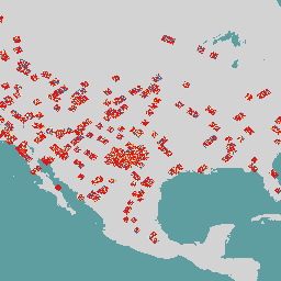
var dataset = ee.ImageCollection('NASA/EMIT/L2B/CH4ENH');\nvar emitEnhancement = dataset.select('vertical_column_enhancement');\nvar emitEnhancementVis = {\n min: 0,\n max: 100.0,\n palette: ['d7191c', 'fdae61', 'ffffbf', 'abd9e9', '2c7bb6'],\n};\nMap.setCenter(-100.24, 32.04, 5);\nMap.addLayer(\n emitEnhancement, emitEnhancementVis,\n 'Emit Enhancement');\n```\n[Open in Code Editor](https://code.earthengine.google.com/?scriptPath=Examples:Datasets/NASA/NASA_EMIT_L2B_CH4ENH) \n[Earth Surface Mineral Dust Source Investigation- Methane Enhancement](/earth-engine/datasets/catalog/NASA_EMIT_L2B_CH4ENH) \nThe EMIT Project is part of the Earth Venture-Instrument (EV-I) Program directed by the Program Director of the NASA Earth Science Division (ESD). EMIT is comprised of a VSWIR Infrared Dyson imaging spectrometer adapted for installation on the International Space Station (ISS). EMIT measures radiance between 380 and 2500 nanometers, ... \nNASA/EMIT/L2B/CH4ENH, atmosphere,daily,emit,methane,nasa \n2022-08-10T00:00:00Z/2024-11-30T19:38:00Z \n-90 -180 90 180 \nGoogle Earth Engine \nhttps://developers.google.com/earth-engine/datasets\n\n- [https://doi.org/10.5067/EMIT/EMITL2BCH4ENH.001](https://doi.org/https://earth.jpl.nasa.gov/emit/data/data-products/)\n- [https://doi.org/10.5067/EMIT/EMITL2BCH4ENH.001](https://doi.org/https://developers.google.com/earth-engine/datasets/catalog/NASA_EMIT_L2B_CH4ENH)"]]