Projekt EMIT jest częścią programu Earth Venture-Instrument (EV-I), którym kieruje dyrektor programu w Oddziale Nauk o Ziemi NASA (ESD).
EMIT to spektrometr obrazujący VSWIR Infrared Dyson przystosowany do instalacji na Międzynarodowej Stacji Kosmicznej (ISS). EMIT mierzy promieniowanie w zakresie od 380 do 2500 nanometrów z przepustowością około 7 nm.
Dane są zbierane na pasie o szerokości około 75 km na równiku, a odległość próbkowania na ziemi wynosi około 60 m. Więcej informacji znajdziesz w omówieniu misji EMIT NASA.
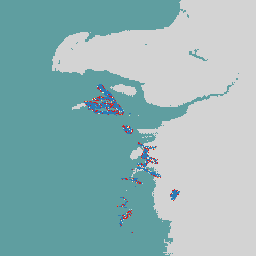
EMIT to szczególnie przydatne narzędzie do mapowania gazów cieplarnianych, w tym metanu, dwutlenku węgla i pary wodnej. Jest to zgodne z wcześniejszymi wynikami uzyskanymi na podstawie danych lotniczych, ale globalny charakter, częstotliwość ponownych wizyt i szeroki pas pomiarowy EMIT dały bezprecedensową możliwość zbadania pobierania danych o gazach cieplarnianych.
Produkt danych EMIT Level 2B Estimated Methane Plume Complexes (EMITL2BCH4PLM) w wersji 1 zawiera szacunkowe kompleksy pióropuszy metanu w jednostkach ppm m (części na milion na metr) wraz z danymi o niepewności. Produkt danych EMITL2BCH4PLM będzie generowany tylko w przypadku wykrycia kompleksów pióropuszy metanu.
Pasma
Rozmiar piksela 72000 m
Pasma
Nazwa
Jednostki
Rozmiar piksela
Opis
methane_plume_complex
ppm m
metry
Szacowany kompleks pióropusza metanu.
Właściwości obrazu
Właściwości obrazu
Nazwa
Typ
Opis
global_plume_identifier
CIĄG ZNAKÓW
Globalny numer identyfikacyjny smugi
Concentration_Uncertainty
LICZBA ZMIENNOPRZECINKOWA O PODWÓJNEJ PRECYZJI
Niepewność stężenia
DAAC_Scene_Names
STRING_LIST
Nazwy scen DAAC
DAAC_Scene_Numbers
STRING_LIST
Numery scen DAAC
DCID
CIĄG ZNAKÓW
Identyfikator zbierania danych
Latitude_of_max_concentration
LICZBA ZMIENNOPRZECINKOWA O PODWÓJNEJ PRECYZJI
Szerokość geograficzna z maksymalnym stężeniem
Longitude_of_max_concentration
LICZBA ZMIENNOPRZECINKOWA O PODWÓJNEJ PRECYZJI
Długość geograficzna z maksymalnym stężeniem
Max_Plume_Concentration
LICZBA ZMIENNOPRZECINKOWA O PODWÓJNEJ PRECYZJI
Maksymalne stężenie pióropusza
Orbita
CIĄG ZNAKÓW
Unikalny numer orbity
Plume_ID
CIĄG ZNAKÓW
Unikalny numer identyfikacyjny pióra
Scene_FIDs
STRING_LIST
Identyfikatory FID sceny
Warunki korzystania z usługi
Dane i produkty NASA EMIT uzyskane za pośrednictwem LP DAAC
nie podlegają ograniczeniom w zakresie dalszego wykorzystania, sprzedaży ani redystrybucji.
Cytaty
Cytowania:
Green, R., Thorpe, A., Brodrick, P., Chadwick, D., Elder, C.,
Villanueva-Weeks, C., Fahlen, J., Coleman, R., Jensen, D., Olsen-Duvall, W.,
Lundeen, S., Lopez, A., Thompson, D. (2023). EMIT L2B Estimated Methane
Plume Complexes 60 m V001 [Zbiór danych]. NASA EOSDIS Land Processes Distributed
Active Archive Center. Dostęp uzyskano 6 marca 2024 r. ze strony https://doi.org/10.5067/EMIT/EMITL2BCH4PLM.001
Projekt EMIT jest częścią programu Earth Venture-Instrument (EV-I), którym kieruje dyrektor programu w Oddziale Nauk o Ziemi NASA (ESD). EMIT to spektrometr obrazujący VSWIR Infrared Dyson przystosowany do instalacji na Międzynarodowej Stacji Kosmicznej (ISS). EMIT mierzy promieniowanie w zakresie od 380 do 2500 nanometrów…
[null,null,[],[[["\u003cp\u003eThe NASA EMIT L2B Estimated Methane Plume Complexes dataset provides estimated methane plume complexes and uncertainty data in parts per million meter (ppm m).\u003c/p\u003e\n"],["\u003cp\u003eData is collected globally by the EMIT instrument on the International Space Station with a ground sampling distance of 60m and a swath width of ~75km.\u003c/p\u003e\n"],["\u003cp\u003eThis dataset is useful for identifying and quantifying methane plumes, supporting greenhouse gas research and environmental monitoring efforts.\u003c/p\u003e\n"],["\u003cp\u003eEMIT data is freely available for use, sale, and redistribution without restrictions.\u003c/p\u003e\n"],["\u003cp\u003eThe dataset can be accessed and analyzed through Google Earth Engine using the provided code snippet.\u003c/p\u003e\n"]]],[],null,["# Earth Surface Mineral Dust Source Investigation- Methane Plume Complexes\n\nDataset Availability\n: 2022-08-10T00:00:00Z--2024-10-26T17:21:33Z\n\nDataset Provider\n:\n\n\n [NASA Jet Propulsion Laboratory](https://earth.jpl.nasa.gov/emit/data/data-products/)\n\nCadence\n: 1 Day\n\nTags\n:\n[atmosphere](/earth-engine/datasets/tags/atmosphere) [daily](/earth-engine/datasets/tags/daily) [emit](/earth-engine/datasets/tags/emit) [methane](/earth-engine/datasets/tags/methane) [nasa](/earth-engine/datasets/tags/nasa) \n\n#### Description\n\nThe EMIT Project is part of the Earth Venture-Instrument (EV-I) Program\ndirected by the Program Director of the NASA Earth Science Division (ESD).\nEMIT is comprised of a VSWIR Infrared Dyson imaging spectrometer adapted for\ninstallation on the International Space Station (ISS). EMIT measures\nradiance between 380 and 2500 nanometers, with an approximate 7 nm bandpass.\nData are collected in a swath that is approximately 75 km wide at the\nequator, with an approximate ground sampling distance of 60 m. See the\nprovider's [NASA EMIT Overview](https://lpdaac.usgs.gov/documents/1695/EMIT_L2B_GHG_User_Guide_V1.pdf)\nfor more details.\n\nEMIT was a particularly useful tool for mapping out greenhouse gases,\nincluding methane, carbon dioxide, and water vapor. This is consistent with\nprevious findings from airborne data, but global nature, revisit frequency\nand wide swath of EMIT provided an unprecedented opportunity to investigate\ngreenhouse gas retrievals.\n\nThe EMIT Level 2B Estimated Methane Plume Complexes (EMITL2BCH4PLM) Version\n1 data product provides estimated methane plume complexes in parts per\nmillion meter (ppm m) along with uncertainty data. The EMITL2BCH4PLM data\nproduct will only be generated where methane plume complexes have been\nidentified.\n\n### Bands\n\n\n**Pixel Size**\n\n72000 meters\n\n**Bands**\n\n| Name | Units | Pixel Size | Description |\n|-------------------------|-------|------------|----------------------------------|\n| `methane_plume_complex` | ppm m | meters | Estimated Methane plume complex. |\n\n### Image Properties\n\n**Image Properties**\n\n| Name | Type | Description |\n|--------------------------------|-------------|--------------------------------------|\n| global_plume_identifier | STRING | Global Plume Identification Number |\n| Concentration_Uncertainty | DOUBLE | Uncertainity in Concentration |\n| DAAC_Scene_Names | STRING_LIST | DAAC Scene Names |\n| DAAC_Scene_Numbers | STRING_LIST | DAAC Scene Numbers |\n| DCID | STRING | Data Collection Identifier |\n| Latitude_of_max_concentration | DOUBLE | Latitute with maximum concentration |\n| Longitude_of_max_concentration | DOUBLE | Longitude with maximum concentration |\n| Max_Plume_Concentration | DOUBLE | Maximum Plume Concentration |\n| Orbit | STRING | Unique orbit number |\n| Plume_ID | STRING | Unique Plume Identification number |\n| Scene_FIDs | STRING_LIST | Scene FIDs |\n\n### Terms of Use\n\n**Terms of Use**\n\nNASA EMIT data and products acquired through the LP DAAC\nhave no restrictions on subsequent use, sale, or redistribution.\n\n### Citations\n\nCitations:\n\n- Green, R., Thorpe, A., Brodrick, P., Chadwick, D., Elder, C.,\n Villanueva-Weeks, C., Fahlen, J., Coleman, R., Jensen, D., Olsen-Duvall, W.,\n Lundeen, S., Lopez, A., Thompson, D. (2023). EMIT L2B Estimated Methane\n Plume Complexes 60 m V001 \\[Data set\\]. NASA EOSDIS Land Processes Distributed\n Active Archive Center. Accessed 2024-03-06 from\n \u003chttps://doi.org/10.5067/EMIT/EMITL2BCH4PLM.001\u003e\n\n### DOIs\n\n- \u003chttps://doi.org/10.5067/EMIT/EMITL2BCH4PLM.001\u003e\n\n### Explore with Earth Engine\n\n| **Important:** Earth Engine is a platform for petabyte-scale scientific analysis and visualization of geospatial datasets, both for public benefit and for business and government users. Earth Engine is free to use for research, education, and nonprofit use. To get started, please [register for Earth Engine access.](https://console.cloud.google.com/earth-engine)\n\n### Code Editor (JavaScript)\n\n```javascript\nvar dataset = ee.ImageCollection('NASA/EMIT/L2B/CH4PLM');\nvar emitEnhancement = dataset.select('methane_plume_complex');\nvar emitEnhancementVis = {\n min: 0,\n max: 100.0,\n palette: ['d7191c', 'fdae61', 'ffffbf', 'abd9e9', '2c7bb6'],\n};\nMap.setCenter(53.99, 39.11, 8);\nMap.addLayer(\n emitEnhancement, emitEnhancementVis,\n 'Emit Enhancement');\n```\n[Open in Code Editor](https://code.earthengine.google.com/?scriptPath=Examples:Datasets/NASA/NASA_EMIT_L2B_CH4PLM) \n[Earth Surface Mineral Dust Source Investigation- Methane Plume Complexes](/earth-engine/datasets/catalog/NASA_EMIT_L2B_CH4PLM) \nThe EMIT Project is part of the Earth Venture-Instrument (EV-I) Program directed by the Program Director of the NASA Earth Science Division (ESD). EMIT is comprised of a VSWIR Infrared Dyson imaging spectrometer adapted for installation on the International Space Station (ISS). EMIT measures radiance between 380 and 2500 nanometers, ... \nNASA/EMIT/L2B/CH4PLM, atmosphere,daily,emit,methane,nasa \n2022-08-10T00:00:00Z/2024-10-26T17:21:33Z \n-90 -180 90 180 \nGoogle Earth Engine \nhttps://developers.google.com/earth-engine/datasets\n\n- [https://doi.org/10.5067/EMIT/EMITL2BCH4PLM.001](https://doi.org/https://earth.jpl.nasa.gov/emit/data/data-products/)\n- [https://doi.org/10.5067/EMIT/EMITL2BCH4PLM.001](https://doi.org/https://developers.google.com/earth-engine/datasets/catalog/NASA_EMIT_L2B_CH4PLM)"]]