- Disponibilidade de conjuntos de dados
- 2000-06-01T00:00:00Z–2025-05-01T00:00:00Z
- Provedor de conjunto de dados
- NASA GES DISC no NASA Goddard Space Flight Center
- Cadência
- 1 mês
- Tags
Descrição
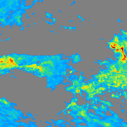
A Medição Global de Precipitação (GPM, na sigla em inglês) é uma missão internacional de satélite que fornece observações de última geração de chuva e neve no mundo todo a cada três horas. O Integrated Multi-satellitE Retrievals for GPM (IMERG) é o algoritmo unificado que fornece estimativas de precipitação combinando dados de todos os instrumentos de micro-ondas passivos na Constelação GPM.
O algoritmo foi criado para intercalibrar, mesclar e interpolar todas as estimativas de precipitação por micro-ondas de satélite, além de estimativas de satélite infravermelho (IR) calibradas por micro-ondas, análises de pluviômetros e outros estimadores de precipitação em escalas de tempo e espaço refinadas para as eras TRMM e GPM em todo o mundo. O sistema é executado várias vezes para cada período de observação, primeiro fornecendo uma estimativa rápida e, em seguida, estimativas melhores à medida que mais dados chegam. A etapa final usa dados mensais de medidor para criar produtos no nível da pesquisa. Consulte a documentação técnica do IMERG para mais detalhes sobre o algoritmo.
Documentação:
Essa coleção contém dados de GPM_3IMERGM_07
Bandas
Tamanho do pixel
11132 metros
Bandas
| Nome | Unidades | Tamanho do pixel | Descrição |
|---|---|---|---|
gaugeRelativeWeighting |
% | metros | Ponderação da precipitação pluviométrica em relação à precipitação multissatélite |
precipitation |
mm/h | metros | Estimativa de precipitação combinada de satélite e pluviômetro |
precipitationQualityIndex |
Medidores equivalentes por caixa de 2,5 graus | metros | Índice de qualidade para o campo de precipitação |
probabilityLiquidPrecipitation |
% | metros | Probabilidade ponderada por acumulação da fase de precipitação líquida |
randomError |
mm/h | metros | Erro aleatório para precipitação combinada de satélite e pluviômetro |
Termos de Uso
Termos de Uso
Todos os dados produzidos pela NASA na missão GPM são disponibilizados sem custo financeiro para uso público.
Citações
Huffman, G.J., E.F. Stocker, D.T. Bolvin, E.J. Nelkin, Jackson Tan (2019), GPM IMERG Final Precipitation L3 1 month 0.1 degree x 0.1 degree V07, Greenbelt, MD, Goddard Earth Sciences Data and Information Services Center (GES DISC), Acesso: [Data Access Date], 10.5067/GPM/IMERG/3B-MONTH/07
DOIs
Explorar com o Earth Engine
Editor de código (JavaScript)
var dataset = ee.ImageCollection('NASA/GPM_L3/IMERG_MONTHLY_V07')
    .filterDate('2022-01-01', '2023-01-01');

// Select the max precipitation and mask out low precipitation values.
var precipitation = dataset.select('precipitation').max();
var mask = precipitation.gt(0.25);
var precipitation = precipitation.updateMask(mask);

var palette = [
  '000096','0064ff', '00b4ff', '33db80', '9beb4a',
  'ffeb00', 'ffb300', 'ff6400', 'eb1e00', 'af0000'
];
var precipitationVis = {min: 0.0, max: 1.5, palette: palette};
Map.addLayer(precipitation, precipitationVis, 'Precipitation (mm/hr)');
Map.setCenter(-76, 33, 3);